




Pinned Tweet
Dad and Wren enjoying the snow. Mom behind the camera yelling at me for throwing her this high 😂

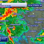
9 First Warning: Strong T-storms with wind gusts to 45-50mph are moving across the Tri-State right now. Some of these storms could produce small hail. Moving east at 45mph. #wcpo
218
9 First Warning: Severe T-Storm Warning for Franklin, Ripley & Dearborn Counties until 8:45pm. Winds to 60 mph, small hail, and lightning. Moving E 50 mph #wcpo

2
253

I would like to give a shoutout to my day 1… @Applebees. In a world filled with pointless political texts.. I can always count on them to send me a USEFUL text 🙌🏼

5
450
Welp. The Colts season is officially over. Been a lot of embarrassing seasons the last 10 years, this is probably the worst. Fire everyone. Burn it to the ground. #GoBengals
2
6
462
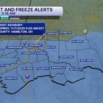
9 FIRST WARNING: A Freeze Warning has been issued from 1-9 am Sunday. Temperatures will drop into the low and mid 30s across the Tri-State, allowing some spots to see the first frost or light freeze of the season. Bring in or protect any sensitive plants you'd like to keep alive.

185
9 FIRST WARNING: A Freeze Watch will be in effect Sunday morning across the Tri-State. Rural areas have the best chance to see their first light freeze of the season. Protect or bring in cold-sensitive plants before heading to bed Saturday night.

1
231
The amount of people that are so up in arms about this woman being the most invested owner in HER team, in all of sports is insane. (Btw, this was pre-game, not during the game 😑)

1
6
655
9 First Warning: Flash Flood Warning until 12:15am for Eastern Portion of Warren & Western Portion of Clinton.Between 1.5 and 2 inches of rain have fallen. Additional rainfall amounts of 0.5 to 1" are possible. Flash flooding is ongoing or expected to begin shortly.

206
9 First Warning: Light green polygons are Flood Advisories out for the next hour through 11pm These advisories are from the tornado & severe storm warnings. A Flood Watch (dark green) continues thru 8am Monday. Check the maps for your timing. Be careful #wcpo


190
9 First Warning: Severe T-Storm Warnings out right now until 9pm & 9:15pm across Warren and Clinton Counties. These are very strong storms that produced a Tornado Warning about an hour ago. Winds to 60mph+, hail, frequent lightning, and torrential rain #wcpo


257
9 First Warning: Severe T-Storm Warning until 9pm for Warren & Clinton Counties Wind gusts to 60mph+, hail, frequent lightning, and torrential rain Stay #weatheraware as these storms produced a Tornado Warning a short time ago #wcpo

9 First Warning: Severe T-Storm Warning until 8pm for a NW portion of Butler County. Winds to 60mph, frequent lightning, large hail and torrential rain. This is a very powerful storm #wcpo

262
9 First Warning: Severe T-Storm Warning until 7:30pm for Union County. Fayette continues their Severe T-Storm Warning as well. Wind gusts to 60mph, frequent lightning, large hail and torrential rain with this storm. #wcpo

169
9 First Warning: Severe T-Storm Warning until 6:45pm for Fayette County. Winds to 60mph, Frequent Lightning, Torrential rain, small hail. These storms are likely to hold together and affect other counties. #wcpo

205
And the countdown to Opening Day starts now! Beautiful day to wrap up the 2026 season. #Reds


2
10
582
9 First Warning: Severe T-Storm Warning for Adams county until 4:30pm Winds to 60mph, heavy rain, small hail and lightning Moving E/SE 17mph

9 First Warning: Flood Watch is out for most of the Tri-State through Monday 8am. Showers and thunderstorms producing heavy rain will impact the area overnight. Rainfall totals of 1 to 3 inches are expected with locally higher amounts.

159
9 First Warning: Flood Watch is out for Warren, Clinton & Highland counties until Sunday at noon. Rounds of thunderstorms overnight into Sunday morning will produce locally heavy rainfall. Rainfall amounts of 1"-3" with locally higher amounts possible. #wcpo
