Really enjoying this graphical representation of presidential ages. Well done @hannahdormido and @PostGraphics!
Alethea Steingisser retweeted
Our July newsletter is out! Read about student awards and successes, Oregon-shaped cutting boards, and a trip to Jackson Lake to meet with ungulate migration experts from around the world with
@migratinghooves !
@wyo_migrations @uocas @ianfreeman0
tinyurl.com/igNewsJuly2023
Alethea Steingisser retweeted
Our May newsletter is out! Read about the
@atlasynp awards, InfoGraphics Fellows program, fantasy maps, and more! tinyurl.com/igNewsMay2023
Congratulations to these incredible student cartographers!! Very appropriate for the @InfoGraphicsLab first tweet.
Bill Loy founded the InfoGraphics Lab with @Jim_Meacham in 1988, and his legacy continues to inspire!
So many beautiful maps!!
Congratulations to the 50th Annual CaGIS Map Design Competition Winners! cartogis.org/docs/map_compet…
So very honored that @atlasYNP won two highly competitive awards from @cartographyGIS! 🌎
cas.uoregon.edu/uo-atlas-win…
@uocas @ucpress
Great opportunity at @NatGeo!
This Post is from an account that no longer exists. Learn more
Window seat to Colorado was a perfect primer for my first ICA Mountain Cartography workshop! Very excited to learn from this group!
Excellent internship opportunity at Nat Geo!
This Post is from an account that no longer exists. Learn more
HUGE welcome to Erik Steiner as the new InfoGraphics Lab director! 🎉🎉 I am excited about the creative thinking and experience he brings to our team to lead us into our mappy future!
Erik Steiner worked as a cartographer in the UO InfoGraphics Lab from 2002-2010. Starting in October, Erik began his time as new director of the lab. Here, he shares what what it’s like to be back directing the lab as a former employee. Welcome back, Erik! 🗺 @uogeog
Poignant, powerful, devastating. Thank you, @DevinMLea for creating this heartfelt piece for the #30DayMapChallenge .
#30DayMapChallenge
Day 22: NULL
A map and haiku for Club Q:
Colorado Springs
We mourn for friends, family, lovers
Now null from our lives

ALT The map shows the city boundaries of Colorado Springs. The fill of the city contains the pattern of the progress pride flag. Within the fill color, the names of the five victims who lost their lives in the Club Q shooting are spelled in white: Daniel Aston, Ashley Paugh, Kelly Loving, Raymond Green Vance, Derrick Rump. In the top right the haiku reads: Colorado Springs, we mourn for friends, family, lovers, now null from our lives. A note on the bottom right reads: I invoke null here in the data sense of missing, that we still keep the memories and knowledge of our community even when we physically are no longer together
I haven't had time to make any maps for the #30DayMapChallenge, but I already have a certificate in #badmaps from intentionally breaking all the rules I learned in my first cartography class. The map was destroyed for safety purposes. My favorite and most cherished award.
This is going to be a great event!!
Join us at @uoregon for a #GISDay Open House!
Wed Nov 16, 10- 3 in @uolibraries DREAM Lab
See infographics.uoregon.edu/eve…
First map made with @EduardShading of the Greater Yellowstone region, of course! Super intuitive interface, exports play well with @Esri, and the results are quick and beautiful. I'm still swooning 😍
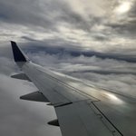
Not many landscape views on my way home from #NACIS2022, but I'll take clouds any day. Also, embarrassingly, my first use of @flyovergeo and I love it! I always need more information about what I'm seeing and where I'm at. #windowseatforever
Just home from #NACIS2022, inspired and catching up on posting a few photos of @uoregon Ducks in action! @uogeog 🦆
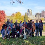
Fun and informative walking tour #NACIS2022 workshop with ICA Art and Cartography commission @icawebsite learning about the land, the people, and intersections of the two.
I just decided that I'll be using a Mac so I can make gorgeous #shadedrelief and save a million hours by using @EduardShading 😍 #NACIS2022