

Chief Meteorologist ABC7 Amarillo- KVII. Weather runs my life | CBM #933 | I post weather & sometimes news information. Tweets are my own.
Amarillo, TX
Joined December 2014
- Tweets18.3K
- Following556
- Followers2.5K
- Likes17.3K





Nice thunderstorm rolling through Amarillo. Solid lightning display, loud inversion thunder. Haven’t had much luck shooting video, I’ll post something if I get a good bolt.

Watching the next round take shape across Eastern New Mexico. There is currently a Tornado Warning on the Southern part of the line. Not overly surprising, there is a lot of wind shear in place, especially in Eastern NM. We could see a few more attempts through this evening.


A band of thunderstorms is forming over New Mexico but is moving slowly. It probably won't reach Eastern NM until Saturday morning. Periodic showers & storms will persist through Monday. Most of the heavier rainfall will favor Eastern NM & the Western Panhandles.


A Severe Thunderstorm Watch is in effect just outside our area. Some severe storms have occurred but haven't lasted long. Storm environment-wise, best energy & wind shear is in New Mexico. Spotty storms are possible in Eastern NM & possibly the Western Panhandle later tonight.


Monitoring moisture moving east. Showers & thunderstorms may develop late tomorrow in Eastern NM/Western Panhandle. Strong to severe storms may occur Friday/Saturday, with the best rain chance on Sunday.

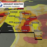
It's Drought Monitor Thursday! Incredible news: drought has been fully eliminated in the SW Panhandle! While there are still areas facing EXTREME Drought, overall improvements are significant. Fortunately, rain chances are on the rise. Let's hope for some much-needed rain!


Rain chances are expected to increase this weekend as a Low pressure system moves eastward from Southern California. There's still considerable uncertainty, so we'll monitor the situation closely. I'll post more as the event nears.

It was a pleasant day in the Panhandle. If you like it warm...you'll love tomorrow with highs in the upper 70s & lower 80s. As the weekend nears, expect cooler temperatures. Late October lows usually drop to the lower 40s, but we’ll stay mild, mainly in the 50s.


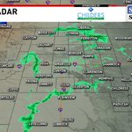
Showers are visible on radar, but little is reaching the ground. Dealing with a lot of virga out there due to large dew point depressions. A large temperature-dew point gap indicates we're far from saturation. If the showers get heavier, they MAY overcome the dry air.


Freeze Warning overnight into Saturday AM. A first freeze is expected in the Northern zones. Amarillo will get close to freezing but maybe not quite grab the first freeze. Stay warm, friends!


Cool day in the Panhandle! Friday Night Football is here, & it will feel chilly by game’s end with wind chill values in the 30s and 40s. Stay warm, friends!


It’s Global Cat Day which means it’s Hailey time! Hailey is not a fan of the cold, gonna have to break out the heavier blankets tonight!


It's Drought Monitor Thursday! Significant improvements since last month! More progress is expected in the SE Panhandle next update. You know what they say...Drought ends in floods.


Excessive rainfall has occurred in the SE Panhandle, with radar estimates showing 4-8 inches over the past 2 days. While you missed the remnants of Polo, this event brought significant rain. Spotty showers will continue in the SE Panhandle through this evening.


Fog is setting up across the Panhandles, prompting a Dense Fog Advisory until Thursday morning. Visibility is near zero in many areas, including Amarillo. Check out the Skycam in Follett for some spooky season vibes!


Potent line of storms clipping through the SE Panhandle mainly Cottle County. Lots more rain on the way for the SE zones tonight. Some storms could be strong to severe, mainly IF supercells develop. More so, it looks like a heavy rain/flooding event.


I mentioned that the far SE Panhandle had a chance of severe storms. Well, we got a messy supercell with embedded rotation. Heads up, Southern/SE Cottle County. Watching closely.

The SE Panhandle experienced heavy rain last night. Currently, a cold front is moving in, causing significant cloud cover. This will limit high temperatures & could reduce chances of severe weather later in the day.


Spotty storms will continue in the SE Panhandle, with possible flash flooding. Rain is expected overnight into Wednesday morning. IF we see sufficient clearing after the morning wave, strong to severe storms may develop by late day. I'll post more tomorrow.


