Geographer with a computer. @WorldPopProject, #rstats
Joined July 2019
- Tweets23
- Following379
- Followers159
- Likes270
Chris Jochem retweeted
🥳The Breheny Prize for the most innovative @envplanb article published in 2021 has been awarded to @ChrisJochem , Douglas Leasure, Oliver Pannell, @HeatherCh100 , Patricia Jones, @AndyTatem from the @WorldPopProject Congratulations to all👏Find out more: doi.org/10.1177/239980832211…
Thank you @evnplanb and congratulations to my co-authors!
🥳The Breheny Prize for the most innovative @envplanb article published in 2021 has been awarded to @ChrisJochem , Douglas Leasure, Oliver Pannell, @HeatherCh100 , Patricia Jones, @AndyTatem from the @WorldPopProject Congratulations to all👏Find out more: doi.org/10.1177/239980832211…
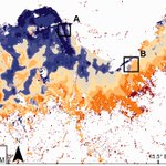
Our paper looks at a way to classify and map potential settlement types from the spatial patterns of building footprints using Gaussian mixture models.
This work was supported by @WorldPopProject, @grid3global.
Read more here: doi.org/10.1177/239980832092…
Chris Jochem retweeted
New random forest informed population modelling package in R (CRAN.R-project.org/package=p… ). Vignette/tutorial can be found (for now) at (dx.doi.org/10.13140/RG.2.2.2…)
@geodatascience @WorldPopProject #Population #rspatial
Chris Jochem retweeted
Got excited and took it out for a spin, all looking great! Here's how you can read/write geospatial data between R and Python like it's the XXIst Century (also, in the same notebook thanks to the darribas.org/gds_env). Notebook at:
gist.github.com/darribas/95b…
My first #rstats 📦on CRAN! {sfarrow} Reading/writing spatial objects with coordinate reference system info from/to Parquet files and partitioned datasets #rspatial
cran.r-project.org/package=s…
Experimental #rstats 📦 {sfarrow} for reading/writing `sf` objects from/to Parquet files with {arrow}. Using consistent geo metadata to work with @GeoPandas. Currently quite simple; feedback and ideas welcome #rspatial
github.com/wcjochem/sfarrow
Chris Jochem retweeted
Excited that there will be not one but TWO Bayesian demography sessions at #PAA2021 on Wed 5 May!
- 10:45PM CT: @AdrianRaftery1 @DrEmmaZang @mr_wheldon @jonathanbearak discussant @NCahill_Stat
- 2:30PM CT: @caseyfbreen @sinafala @ChrisJochem @jonwakeblue discussant @CSchmert
New paper now out with @AndyTatem @WorldPopProject. We introduce our #rstats 📦foot for calculating gridded morphology measures of building footprints doi.org/10.1371/journal.pone…
The paper also presents an example of generating a gridded classification of settlements for England, Scotland, and Wales using only patterns in buildings and unsupervised clustering
The package has flexibility to calculate morphology metrics on grids, in polygon zones, and using focal windows. Check out the code/docs here:
wpgp.github.io/foot/
All the data and settlement classification from our paper are available!
dx.doi.org/10.5258/SOTON/D16…
Chris Jochem retweeted
Developing methods for classifying residential status of urban buildings: mdpi.com/2072-4292/12/23/384…
Experimental #rstats 📦 {sfarrow} for reading/writing `sf` objects from/to Parquet files with {arrow}. Using consistent geo metadata to work with @GeoPandas. Currently quite simple; feedback and ideas welcome #rspatial
github.com/wcjochem/sfarrow
Chris Jochem retweeted
New WorldPop paper in @PNASNews as part of @grid3global - National population mapping from sparse survey data: pnas.org/content/early/2020/… - explore outputs at: apps.worldpop.org/woprVision…
Chris Jochem retweeted
Explore our new Bayesian population estimate datasets produced as part of the @grid3global program through the woprVision app: apps.worldpop.org/woprVision…
Chris Jochem retweeted
New @WorldPopProject paper led by @ChrisJochem - Classifying settlement types from multi-scale spatial patterns of building footprints, with @Need4GIS @AndyTatem Doug Leasure, Pat Jones @geogsouthampton @grid3global #openaccess #geospatial #urbananalytics journals.sagepub.com/doi/10.…
Chris Jochem retweeted
Learn more about how we map settlements. Our first webinar, Mapping Settlements, is out now: bit.ly/mapsettlements #datascience #datadriven
At what time on New Year's had most of the world's people started the year 2020? A little trivia, and a fun use for @WorldPopProject data.
github.com/wcjochem/newyear_…
Happy (belated) New Year to all!
Chris Jochem retweeted
Finishing up the last day at @efgs2019 with a session on Future #geospatial thinking. @ChrisJochem from @WorldPopProject @geogsouthampton presented on settlement classification from multi-scale spatial patterns of building footprints using a machine learning approach #efgs2019