

Meteorologist/Manager at the Canadian Hurricane Centre @ECCC_CHC | Tropical cyclone (hurricane) and many weather related topics | postings are own not employer
Dartmouth, NS, Canada
Joined January 2024
- Tweets1.5K
- Following151
- Followers644
- Likes585







Clear this afternoon - high-resolution Sentinel satellite view over Parrsboro NS with blueberry fields showing up in shades of maroon and crimson. #nswx

Chris Fogarty, PhD retweeted

TC Info Statement from CHC on Subtropical Storm Josephine: weather.gc.ca/hurricane/stat….
Mainly a marine hazard, with hurricane-force winds likely on its backside as it transitions to post-tropical. Will also help fuel a feed of moisture and gusty conditions into parts of Nfld. #nlwx


Chris Fogarty, PhD retweeted

🌀Hurricane Isaias Damage Analysis (1/4)
NWS Mobile continues to investigate an extreme corridor of damaging winds WEST of Isaias' center. This radar/velocity loop shows intense winds, with deeper blues/greens indicating higher wind speeds, possibly associated with a "sting jet"
Chris Fogarty, PhD retweeted

We really don't often get to see the inner dynamics of pinhole eyes on radar, especially in the Western Pacific basin, so it's remarkable to watch the eye pass just to the south of #Guam and see the various eyewall mesovortices and other features.
On this date...25 years ago our second Canadian research flight into Tropical Storm Karen (first was Michael in 2000) as it approached western Nova Scotia. Here is the report from the storm and flight data. novaweather.net/Hurricane_Ka… report and data: novaweather.net/Hurricane_Ka… #nswx


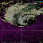
The sting jet from Hurricane Isaias showed up in striking detail as seen by Sentinel SAR instruments: #Isaias

Chris Fogarty, PhD retweeted

Here's a preliminary look at peak wind gusts observed in association with the landfall of Hurricane #Isaias on Friday night. Multiple gusts topping 100 mph were recorded from Santa Rosa Island through the Pensacola area and northward.
You might note that the strongest winds were on the west side of the track -- not what we typically expect. This appears to be associated with the formation of something meteorologists refer to as a 'sting jet.' Isaias was in the process of transitioning from a tropical low to an extratropical low at landfall, and these sting jets are often associated with extratropical systems.
If you rode the storm out in the Panhandle and have any updates and/or pictures, please share them here. Wishing the best for everyone over there as the recovery process gets underway. @WAFB

Chris Fogarty, PhD retweeted

16 hours and counting of continuous coverage of Hurricane Isaias from hurricane hunters.
4 flights (2 NOAA, 2 US Air Force) provided frequent data on the storm’s structure to help forecasters predict the expected hazards tonight & tomorrow.

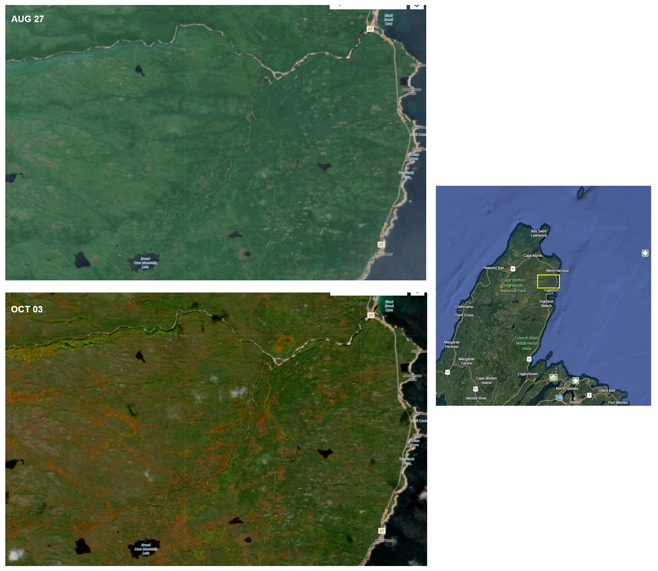
Foliage change from high-resolution Sentinel satellite over northern Cape Breton comparing Aug 27 to today Oct 3. #nswx novaweather.net/Photos/folia…

Chris Fogarty, PhD retweeted

Starting to see the signal for Gulf development wane a little bit. Down to 30% on Google DeepMind (was 40% a day or so ago). If shear proves to be too much for this system, I think that probably closes the book on the 2026 Atlantic hurricane season (that never really got started to be honest).

3-month review of daily max temperatures in Halifax. August was generally warmer than normal but September has been cooler than normal. Normal daytime max temp is ~23C Sept 1 and ~17C by the 30th. #nswx


Satellite snapshot showing the large low off NJ with what looks like an eye but it's really just a cleared area of shallow cloud near the center. A true eye (as in a hurricane) has heavy rain immediately encircling it. In this case the rain is WELL removed from the center.

It's technically not a tropical storm (and has no formal name) but it will be a mess especially along the heavily-populated coastline from MA to NJ to DE.


September 25-27 nor'easter will be a waterlogged one. After all, most nor'easters form deeper into the autumn; less than 5% form in September, meaning this one has some leftover summer to work with, especially since the ocean waters offshore are so warm.
We think the system may slow/stall somewhere east of Delmarva and south of Long Island this weekend, prolonging impacts at the coast. A long-duration onshore flow will lead to pockets of moderate beach erosion and coastal flooding. A few gusts of 55-60 mph are possible at the immediate coastline in the red, though that's nothing this region hasn't seen many, many times.
It's worth noting, however, that most of our strong coastal winds happen in the winter, whereas right now the trees are still fully-leafed. That means it'll be easier for a few branches/limbs to fall, leading to widely-scattered power outages.
Otherwise, the slow-moving storm is pinwheeling a LOT of moisture northwestward. Rainfall totals of 3 to 6 inches are expected in the red, with lesser inland. Greater rainfall totals will be found on the right (north) side of the system, meaning lesser totals in Delmarva.
We're still not entirely sure how far west the clouds/precipitation get. These types of systems tend to have a sharp western cutoff. Our gut is that Washington D.C., for example, will be cloudy both days with some drizzle, but it won't be a washout. Closer to Philadelphia, however, plan for a damp weekend.
