

Advocating for, and educating ALX residents on major infrastructure issues that are being rapidly exacerbated by climate change. | RT ≠ Endorsements
Alexandria, VA
Joined March 2021
- Tweets3.9K
- Following471
- Followers1.2K
- Likes2.8K





DrainALX retweeted

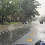
@DrainALX High Water between 1400 - 1700 blocks of Duke St.
We made Washington Weather Geeks!

12:30AM: Multiple water rescues ongoing across the warned area, with emergency management reporting several vehicles stalled in high water around Commonwealth Road, Glebe Road, and Wilson Avenue!
Please use caution! Avoid driving into flooded roadways! #vawx


DrainALX retweeted

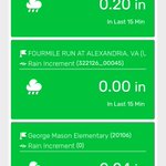
Rain Rate Alert: Rain Rate at DelrayVA Weather, Alexandria - Alexandria, Virginia USA is 0.5 at May 21, 2026 at 01:46AM. Chance of Urban Flooding.
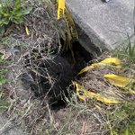
Hey @AlexandriaVAGov @AlexandriaVAGov @AlexandriaVA311 There’s a hole on Hume Ave that is deeper than my three year old is tall and looks like it is continuing well under the sidewalk. Directly beside Stracci Pizza, beside a power poll.

Truth.

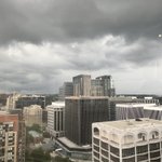
Seeing a lot on here about today being a "bust".
How could something that was not 100% guaranteed be a bust? Numerous credible meteorologists did extremely well communicating several days ago that there was POTENTIAL for a big severe weather day today. That potential was not realized. And? That's a good thing. No funerals planned for next week. No insurance companies to deal with. No regrets in my book. You owe the Internet and Social Media nothing. You did your jobs; people were aware.
Next play.
DrainALX retweeted
Rain Rate Alert: Rain Rate at DelrayVA Weather, Alexandria - Alexandria, Virginia USA is 0.47 at March 16, 2026 at 09:18PM. Chance of Urban Flooding.

DrainALX retweeted

Add Baltimore city, Anne Arundel, and the rest of Prince George's County to the warning zone until 9:45pm.
DCA gusted to 54mph, Dulles to 66mph with this line.

DrainALX retweeted
Temps are absolutely tumbling with this front.
60s in DC, lower 40s in Gaithersburg, 30s already along the I-81 corridor with mix being reported.
Another powerful March cold front!
DrainALX retweeted

10:36AM: TORNADO WARNING for Rappahannock, Fauquier, and Culpeper counties until 11:00AM.
TAKE COVER NOW! Move to a basement or the most interior room on the lowest floor of a sturdy building. #vawx


DrainALX retweeted

First tornado warning of the day... for eastern Rappahannock, northwest Culpeper and northwest Fauquier counties until 11 a.m. Radar indication.
* This dangerous storm will be near...
Hume around 1040 AM EDT.
The Plains and Delaplane around 1050 AM EDT.

Tornado Warning including Marshall VA and The Plains VA until 11:00 AM EDT

ALT This graphic displays a tornado warning plotted on a map. The warning is in effect until 11:00 AM EDT. The warning includes Marshall VA and The Plains VA. This warning is for Eastern Rappahannock County in northwestern Virginia, Northwestern Fauquier County in northern Virginia and Northwestern Culpeper County in northern Virginia. The threats associated with this warning are a radar indicated tornado and pea sized hail. There are 15,946 people in the warning along with 3 schools and 0 hospitals.
DrainALX retweeted

JUST IN: ACPS to release students early due to severe storm outlook alxnow.com/2026/03/16/just-i…

DrainALX retweeted
🚨⛈️ SEVERE WEATHER OUTBREAK EXPECTED TODAY ACROSS THE DMV:
A potentially significant severe weather day is expected today with several rounds of showers and storms. The DC Meteo Area remains under a rare Level 4 out of 5 Risk for severe storms.
Two rounds of storms are expected, with the first occurring between 10AM-3PM as isolated showers, and storms develop ahead of the main line. These will be capable of producing isolated tornadoes, large hail, and damaging winds. Not everyone will see a storm.
Following the first round, a line of strong to severe storms is expected from west to east between 3PM-8PM. This line has the potential to produce widespread damaging to destructive winds, along with several tornadoes, some of which could be strong (EF-2+). This will be the worst of the weather for the DMV.
Widespread downed trees and power lines are possible today, along with several power outages. Roadways may be blocked and impassable due to debris.
Make sure devices are charged and that there are several ways to receive severe weather alerts. Use caution this afternoon and evening. #vawx #mdwx #dcwx #wvwx
