Geomatics World (@GeomaticsWorld) header
Geomatics World (@GeomaticsWorld) profile picture

Geomatics World is the leading journal for professional and techically qualified surveyors.

United Kingdom
Joined October 2016
Photo by Geomatics World (@GeomaticsWorld)Photo by Geomatics World (@GeomaticsWorld)Photo by Geomatics World (@GeomaticsWorld)Photo by Geomatics World (@GeomaticsWorld)Photo by Geomatics World (@GeomaticsWorld)Photo by Geomatics World (@GeomaticsWorld)Photo by Geomatics World (@GeomaticsWorld)Photo by Geomatics World (@GeomaticsWorld)Photo by Geomatics World (@GeomaticsWorld)Photo by Geomatics World (@GeomaticsWorld)
The May/June issue is available now! Get up-to-date on the latest Geomatics articles, news and more! https://teapawt.org/t.co/fmL3PE2REj Why not sign up for a free subscription https://teapawt.org/t.co/N5KLg3rYfh
Borough of Poole Makes a Splash with MapThat. The new technology has improved information access for Council employees and the public alike, while simultaneously reducing costs and enhancing efficiency. Read more: geomatics-world.co.uk/conten…
New technology and software have made a great difference to the well-established procedures for mapping cultural features and together with a rising interest in the preservation and recording of our heritage has reinvigorated this sector of geomatics. geomatics-world.co.uk/conten…
5G Wireless Mapping Puts Geospatial Business on Inc. 5000 List of Fastest Growing Companies ow.ly/XrZS50vKDAc
2
3
senseFly Brings Expanded Portfolio of Fixed-wing Drone Innovations to Intergeo ow.ly/YFdF50vKDzj
1
lassifying Urban Poor Areas with Satellite Imagery geomatics-world.co.uk/conten…
1
Terra Drone Eyes Middle East Market with UAV Solutions https://teapawt.org/t.co/iy5MHHYdvf
Airbus to Develop CO3D Earth Observation Programme for CNES https://teapawt.org/t.co/xF6bmInn2t
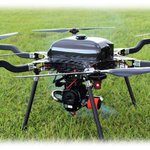
LiDARUSA Announces Long Endurance Multicopter Lidar Solution https://teapawt.org/t.co/BERYm1dR33
ATLAS Bolsters Global Ground Network for Two Satellites https://teapawt.org/t.co/fO9PJsYh6R
Impossible Aerospace US-1 Drone Responds to California Fire https://teapawt.org/t.co/5sWmzXkLDU
Viametris Launches Second-generation vMS3D Scanner https://teapawt.org/t.co/Gj8kq2PhI4
GeoCue Introduces Drone Lidar Imagery Fusion Sensor True View https://teapawt.org/t.co/IG3tbqGyzR
Students Invited to Get Creative with Design a Drone Competition https://teapawt.org/t.co/tpLGtOZMK4
Teledyne Lidar Enables Visual Effects on Game of Thrones https://teapawt.org/t.co/DcPiukCvmD
Innovusion Announces High-resolution Lidar System Cheetah https://teapawt.org/t.co/n1joaEtp1b
1
Terra Drone Europe Wins UAV Mapping Contract with Ordnance Survey geomatics-world.co.uk/conten…
2
3
Association to Promote Aerial Surveying in Europe Announced https://teapawt.org/t.co/TtKHYkbSrA
1
Carlson Launches Lightweight GNSS Receiver NR3 https://teapawt.org/t.co/My50XD9JCo