

Meteorologist, Photographer, Award Winning Home Designer/Builder, & Storm Chaser living in Western North Carolina. Graduated from @msstate
Asheville, NC
Joined June 2011
- Tweets2.6K
- Following183
- Followers3.4K
- Likes4K




Pinned Tweet
Tropical Moisture is currently moving through WNC and some areas along the Blue Ridge Escarpment will see 4"+ of rainfall. Some models yesterday started showing some extreme solutions, but those look to be outliers at this time. Downsloping will keep rainfall totals around closer to an inch in the Asheville, but areas around Lake Lure could see over 5". This could cause some minor flash flooding in those areas. Here is my latest forecast to get you ready for this storm!

What a fun evening at the @AshevilleHBA Parade of Homes Gala. The Ward Team took home several trophies including a Gold Craftsmanship & Silver Craftsmanship award! Come check it out this weekend.

AshevilleWX retweeted

Clay County, NC - One of the brightest rainbows I’ve ever seen. It’s been visible on and off for well over an hour. We’ve had light on-and-off showers all morning and holding at a balmy 50°F @TimBuckleyWX @wxbrad @SCweather_wx @ryanhallyall @weathernerdga @ncwxauthority @Hvward


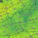
Models are showing a significant cool down this week around WNC with a hard frost possible for many locations both Saturday morning and Sunday morning. Temperatures will dip into the mid 30's (12z GFS Saturday 8AM below) both mornings, but by the afternoon hours we will push well into the 60's with blue skies! Perfect weather to come out and tour the New Homes & Renovations on the @AshevilleHBA 2026 Parade of Homes happening this weekend and next weekend. Come check out the @BuildWithWard Historic renovation in the Montford Neighborhood. I look forward to seeing you!

Hurricane Isaias will bring heavy rain for WNC at times on Saturday, with 1"-2" falling around the Asheville area. Locations along the Blue Ridge Escarpment could see higher totals of 3"-4"+, but overall I think the flooding threat is relatively low. Here is my latest forecast on what to expect for your weather across WNC this weekend!
The Fall Feel will finally arrive around WNC late next week as temperatures dip into the 50's and even 40's for higher elevation locations! We have been roasting here lately, but it does appear as though the area will finally cool off through next weekend (6z Euro Thursday AM temps below). Temperatures on Saturday and Sunday AM look even cooler, so get ready to enjoy that coffee on the porch!
Watch for storms each day Sunday(Today)-Wednesday, until the cold front moves through. Some of these storms could bring heavy rainfall of 1"-2" per hour.
All and all next week will start out very hot with plenty of pop up storms, but by Thursday morning it will feel wonderful. Watch for severe storms on Wednesday, but make plans for next weekend as temperatures look great and models are showing limited if any precipitation!


Wow, what a day for rainfall here around WNC! Many places saw 2-3" of much needed precipitation and we have another round on tap tomorrow. Check out the radar projected totals below from just today. Some minor flash flooding has occurred and will continue to occur as the night progresses, but I am not anticipating significant rain overnight. Most models have rain dying down around midnight and then the possibility of storms popping up tomorrow afternoon. Another 1"-2" could be fall in isolated locations, but I generally think rainfall will be less widespread tomorrow.
Looking forward towards the weekend, pop up showers can't be ruled out, but I do think we see a good bit of sunshine as well. Get out and enjoy it!

Heavy rainfall looks to be in store for most of WNC later tonight and into the early hours of tomorrow morning as some tropical moisture moves through the area. Some locations in Henderson, Jackson, Macon, Transylvania, & Swain Counties could see over 2" of rain from this and minor flash flooding is a concern.
Timing on this will depend on where you are located, but I only see scattered showers until around 6pm in the Asheville area. Then as the night progresses, a large swath of moisture will inundate the whole area. Locations along the Blue Ridge Escarpment(NC/SC line) will see the highest rainfall totals, while areas along the NC/TN line North of Asheville could only see a half inch of rainfall. Below you can see the most recent RRFS model run that shows the precipitation potential through early Friday morning. Please be mindful of this as you travel around later this evening!
Isolated strong storms are possible before the main precipitation. Some models show pop up storms between noon and 3pm, but these do not appear to be widespread. Some strong winds/isolated hail could occur with these cells that pop up before the main line. Overall though I think this will be a nice and much needed rainfall for the area with minimal issues.


AshevilleWX retweeted
THE CUP IS COMING BACK TO RALEIGH!!!

ALT Graphic promoting the Carolina Hurricanes as the 2025-26 Stanley Cup Champions


AshevilleWX retweeted

postseason hornets basketball coming 🔜
#HiveMentality

Short range models continue to show a very dicey commute home this evening around WNC. Rain will switch to heavy snow between 3-5pm for most around the area with locations farther west seeing that switchover occurring sooner. A quick 1"-3" is certainly possible from this as the burst moves through, then as the evening progresses we will switch to Northwest Flow Snow.
Below you can see the projected radar around 4pm for WNC per the NAM 3km. I have also included a cursor that indicates the projected snowfall rate per hour. You can see that this line could potentially have rates of 2"+ per hour. This is very heavy snowfall. Please be mindful that heavy rates like this could accumulate on the roads, even though soil temps are high. It would be wise to be heading home around 2-3pm today.
Winds will really ramp up as the afternoon progresses and we will likely see gust over 35mph even in the Asheville area. Blowing snow and high winds will create difficult driving conditions, especially north of I-40. It would be best to stay in this evening if possible.
Power outages can't be ruled out with snowfall and high winds. Please be prepared to go a day or so without power as crews work to restore in temps below 20 degrees.
Low temperatures tomorrow morning look to fall close to 20 degrees or below. Wind chills will be below zero and all around it looks to be a very nasty day as well. My best advice for this storm is to be in by 3pm today, the weather is going to turn unfavorable after that and there could be some road closures if snow falls heavy enough. Check Ashevillewx.com for live views as the snow falls!

