

Post-Doctoral Researcher, Global Hydro Lab @ UNC Chapel Hill. Looking at sand from space. I also like LLMs. opinions are my own. email: [email protected]
Chapel Hill, NC
Joined July 2020
- Tweets977
- Following2.7K
- Followers636
- Likes11.7K






Pinned Tweet
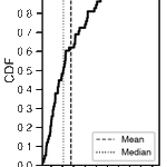
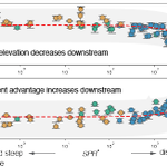
🚨 New Paper Alert!🚨: Excited to share my latest work in @Nature on river avulsions—catastrophic shifts in river courses that threaten millions worldwide. We've uncovered new rules that govern when and where avulsions occur. nature.com/articles/s41586-0…
🧵(1/12)
James (Jake) Gearon retweeted

I did GDAL too. A MUCH faster engine for processing rasters is here!
GDAL is a is an open-source translator library for raster and vector geospatial data formats; it's behind the scenes for most modern maps you have probably ever seen. It takes ages to render maps because of how compute intensive it is--often times GIS people have their computers running overnight and then some to generate a single map.
Iterating on maps is a taxing process for everyone involved for this reason.
It's a bit of a misnomer, because unlike with PDAL there wound up being no real advantage to using the GPU, but with CPU threading we've made it ELEVEN times faster on some pipelines!
By combining a much faster GDAL for rasters and PDAL for point clouds, I intend to make a vibe cartography harness capable of fast iteration for feedback, and one that uses real geospatial data instead of diffusion pixel slop that's always inaccurate.
Full release coming soon!

James (Jake) Gearon retweeted

Introducing e-means, an algorithm beating k-means in 10x fewer epochs.
With order of magnitude wall-clock speedups, e-means is released in FAISS and needs no hyperparameter tuning beyond k. It is robust to various scales and datasets. Still skeptical ? Just try e-means [1/10]🧵
James (Jake) Gearon retweeted

We built a Rust engine for landscape connectivity. Each focal cell gets a least-cost graph that coarsens with distance.
Globally anchored grids let us reuse aggregation and geometry across cells.
9.4M focal cells in <1 min on an M4 laptop.
Python & R: github.com/csiro/connectivit…
James (Jake) Gearon retweeted

I've made an interactive map for exploring the terrain of the world! It uses data and tiles from Mapterhorn, and WebGL for dynamic colors and animations. relief.bertspaan.nl/world?la…


James (Jake) Gearon retweeted

OpenStreetMap's Layercake project now ships a 4.6M-record, 18-column, 2.2 GB wetlands file every week.
13K records are points; the rest are polygons.
My guide uses DuckDB, QGIS & BASH: tech.marksblogg.com/layercak…

James (Jake) Gearon retweeted

I wrote a book on spatial networks, using Python, networkx, and osmnx
Online version can be found here:
bgu-geography.com/net/
Comments and ideas are welcome!


James (Jake) Gearon retweeted

For me, the bar for AGI was always “the day the agents realize they can con their human handlers into purchasing Sentinel-2 data” and it is with a heavy heart and fear in my voice that I say: today is that day


James (Jake) Gearon retweeted

The US has incredible topography!
@USGS recently released 1 m LiDAR elevation data covering the entire country, and their “3D Elevation as Art” series shows just how detailed it is.
I used Astra/Codex to build an app where you can slide between the LiDAR elevation maps and optical imagery for every state.
It’s extremely satisfying watching mountain ranges, watersheds, riverbeds, and other terrain suddenly appear in the LiDAR data.
Check it out here and let me know what your favorite results are:
mattmullin.space/state-lidar


James (Jake) Gearon retweeted

Introducing Portolan - A serverless spatial data infrastructure portolan-sdi.org/blog/introd…
James (Jake) Gearon retweeted

Fable says today is “plausibly the most significant single day in the history of mathematics”


An internal version of Astra, @OpenAI’s next major model family, solved 10 major open problems in mathematics, quantum complexity, and theoretical computer science.
We believe it will be a major step for scientific reasoning. openai.com/index/ten-advance…

James (Jake) Gearon retweeted

Yeah this is bad. Unbelievably irresponsible and does immediate, catastrophic damage to the credibility of satellite imagery.

Tonight I typed just one sentence into Google Earth and put refugees near the Mexican border. Then I planted a nuclear plant in Iran. What on earth is Google doing? Check my latest post here: digitaldigging.org/p/how-to-…
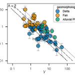
My latest in Sedimentology: Alluvial ridge morphology on avulsing rivers. (last chapter from my Ph.D with @HoosierRiver)
We show that ridges widen faster than they grow taller, and that deeper low-gradient rivers build thinner, wider ridges.
doi.org/10.1111/sed.70134

James (Jake) Gearon retweeted

HydroSHEDS v2 river data for the Americas is now available, the first of more to come. hydrosheds.org/products/hydr…


Very happy to see @wernerk_au's write up of my project: dgov, a deterministic kernel for multi-agent orchestration via git worktrees. He calls it a city-state model, which I find quite useful as a framing.
dev.to/wernerk_au/the-city-s…
Thank you, Werner!

1
74

I feel like this is something everyone should run away from. Do not let Claude model you this way!! Be careful out there folks

someone built a SUBCONSCIOUS for CLAUDE CODE
a Letta agent that watches every session, learns your patterns, and injects memory before every prompt AUTONOMOUSLY
its called claude-subconscious, open source
one command install and it just... starts remembering

88
Why are LLMs, particularly Claude, obsessed with describing its generations/generation process as rough or smooth? I’ve found this pretty consistently through 4.6-4.8 but maybe before too
37
