

17 || Weather Enthusiast | Forecaster | Graphic Designer | Aspiring Meteorologist | Christian ✝️| #RingTheBell | #Throwtheballup | #FlyEaglesFly
South Jersey (Philly Suburbs)
Joined January 2022
- Tweets18.6K
- Following3.1K
- Followers1.9K
- Likes28.8K






Pinned Tweet
A defined look at the broadly rotating wall cloud that moved over Philadelphia earlier this afternoon. Quite the catch. 🔥
#NJwx #PAwx #wxtwitter – at Paulsboro, NJ


Manny Man ☈ The Weatherman retweeted

🚨Aguacero 6.13 is live
🇨🇦 Radar from across Canada
🇲🇽 Mexico's radars
🇭🇺 Hungary radar coverage
🇨🇾 Cyprus and the eastern Mediterranean
🇫🇷 Six more radars in France
🇮🇸 A mobile radar in South Iceland
🏝️ Guadeloupe, Martinique, Réunion and New Caledonia
📡 Custom radar polling now accepts mobile radar .gis files
🖥️ Open the app: aguacerowx.com/app
Manny Man ☈ The Weatherman retweeted

Fun fact: Our daylight length and sun angle are now back to what it was around the time of the February blizzard.
Manny Man ☈ The Weatherman retweeted

The past 24 hours over the Desert Southwest have been concerning from an NWS warning issuance standpoint.
We’ve had:
• warnings issued based on contaminated data
• a TOR for a left split (spinning the “wrong” way)
• several delayed/missed events (both tornadoes and giant hail)
• polygons that miss the actual circulation
• ongoing debris signatures that are missed
I’m pro-expertise and pro-NWS — when they win, we all win. But critiquing poor performance scientifically is, at times, important.
It’s tough to justify keeping 122 offices staffed for warning operations when consistency and quality are obvious problems. The case for centralized warning operations is getting stronger, which is both good and bad.
I’m working on a longer piece and am not going to prematurely release it before I make sure every detail is presented fairly and completely — but there is a deeper conversation that needs to be had.
If anyone has any specific examples (both from this event or otherwise) that you feel I should look into, DM me.

Manny Man ☈ The Weatherman retweeted

Unwarned significant tornado ongoing with a debris ball near San Mateo, New Mexico.


Manny Man ☈ The Weatherman retweeted

It’s been in development a long time, but finally, “threats-in-motion” likely to come in 2028 as new software is implemented across the National Weather Service. Severe storm warnings will move with the storm. @nwas
Manny Man ☈ The Weatherman retweeted

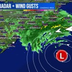
NHC will initiate advisories on Subtropical Storm Josephine (formerly AL93), located offshore of the U.S. East Coast, at 500 PM EDT (2100 UTC).
Manny Man ☈ The Weatherman retweeted

Here it is…my yearly picture of the same tree taken on October 20th 🍃🍁🍂 2020-2026
📸 Taken in Metuchen, New Jersey

Manny Man ☈ The Weatherman retweeted

12:55pm CDT #SPC Day2 Outlook Enhanced Risk: across portions of Arizona spc.noaa.gov/products/outloo…


Manny Man ☈ The Weatherman retweeted
A severe thunderstorm watch has been issued for parts of Connecticut, Delaware, Maryland, New Jersey and New York until 10 PM EDT

ALT This graphic displays Severe Thunderstorm watch number 687 plotted on a map. The watch is in effect until 10:00 PM EDT. The watch includes parts of Connecticut, Delaware, Maryland, New Jersey and New York. The threats associated with this watch are no tornadoes expected, isolated hail up to half inch size possible and scattered gusts up to 70 mph possible. There are 24,688,816 people in the watch along with 6026 schools and 296 hospitals.