

Weather simplified, locally explained 🌧️🌬️☀️- Private Weather Blogger to update Daily Weather Updates. #TNRains #ChennaiRains #Kerala #AP #Telangana #KA
Chennai,Tamilnadu
Joined April 2011
- Tweets31.5K
- Following387
- Followers16.4K
- Likes36.9K


Pinned Tweet
🛰️ Free live radar rain alerts for Tamil Nadu, Chennai, Kerala, Karnataka & Andhra — hourly + instant heavy-rain alerts in Tamil & English. Follow on WhatsApp 👉 whatsapp.com/channel/0029VbE…
#RainAlert #ChennaiRains #TNWeather

How do weather models work? And why do we place such great trust in ensemble models? I hope you will now be able to understand the forecast charts that are shared daily.
வானிலை படிமங்கள் எவ்வாறு செயல்படுகின்றன ? Ensemble மாதிரிகளை ஏன் நங்கள் பெரிதும் நம்புகிறோம் ...தினமும் பகிரப்படும் படம் Forecast Chart உங்களுக்கு இப்பொழுது புரியும் என்று நம்புகிறேன்.
facebook.com/share/v/1djt7m1…
4
992
🌦️ **Daily Weather Inference – 18.11.2026 | 🌀Cyclone Akvan is Stationary Due to Ridges and Wind Shear impacts its shape |Presently Maintaining 34kts with 1001MB Central Pressure at 13.36N 87.16E |Caught with Mid Latitude trough as well it may move NW towards Andhra coast | Further consolidation in Realtime and models expectations to be monitored| as of now it may weaken further and move NW towards AP |This Akvan totally Disturbed our Easterly winds and Peak Monsoon Rains |Trough Embedded Easterly winds influenced Monsoon Rains will Return to Tamilnadu from November 22nd onwards.
⛈️ Isolated Moderate Rains likely in #Kanyakumari #Tenkasi #Nellai #Virudhunagar #dindigul #Valparai.Remaining District will be Dry. Isolated Rains in #Kerala Coastal #Karnatka #Konkan #MH as well.
⚠️ This is not an official forecast. For official updates, please follow the respective official agencies.
📡 For Radar Nowcast Alerts and Updates, follow our WhatsApp Channel.
📊 **District-wise & State-wise Weather Charts**
Tamil Nadu • Kerala • Karnataka • Telangana • Andhra Pradesh
📱 **Follow our WhatsApp Channel:**
tinyurl.com/masrainman
📲 **Talk to MasRainMan:**
masrainman.blogspot.com
🌐 **For Nowcast Alerts, Follow Us:**
Facebook • Instagram • YouTube • WhatsApp Channel
facebook.com/MASrainman | instagram.com/masrainman/ | tinyurl.com/WhatsappMasrainm…
#MasRainMan #DailyWeatherInference #CycloneMurasu #NortheastMonsoon2026 #NEM2026 #TamilNaduRains #ChennaiRains #SouthIndiaWeather #RainAlert #RadarNowcast #MasRainman #BayOfBengal #CycloneTracking #WeatherScience #EnsembleForecast #ChennaiWeather #WeatherUpdate


Welcome to the MasRainman Live Cyclone & Atmospheric Lab. Track active tropical cyclones and invests across the Bay of Bengal and global basins in real time—featuring live CIMSS satellite intensity estimates (ADT, AiDT-V2, SATCON), cloud-top IR imagery, and interactive ECMWF IFS steering, vertical wind shear, and upper-level ridge maps with meteorological wind barbs. Use the basin buttons and forecast slider below to see how steering currents and wind shear are shaping the system's path and strength over the next 48 hours. masrainman.blogspot.com/p/cu…

MasRainman retweeted

Every sky has a story, even if we'll never know what it means to someone else.
which frame would you keep forever?
#skyphotography #skylovers #cloudscape #skylover #naturephotography
#CycloneAkvan | ECMWF ensemble members are now showing better track consensus. The Indo-Pacific Ridge is emerging as the dominant steering mechanism, potentially guiding the system towards Central AP, around the Machilipatnam–Kakinada belt. Easterly winds are expected to return from November 23rd. Monitoring the steering pattern and ensemble trends closely. Further updates to follow about #CycloneAkvaan Present Analysis till Landfall. #APRains #TNRains

Analysis of the Images
The two satellite-derived graphics from MasRainman (using UW-CIMSS ADT 9.1, AIDT V2, and SATCON data) provide an intensity and location update on Cyclone Akvan (05B) in the Bay of Bengal as of Tue, 17 Nov 2026 at 05:00 AM IST (16 Nov 23:30 UTC):
Current Intensity & Classification: The system is classified as a Cyclonic Storm. AI-enhanced Dvorak (AIDT) estimates current maximum 1-minute sustained winds at 37 knots (69 km/h). Classic ADT and SATCON consensus estimates place winds slightly higher at 39 knots, with a minimum central pressure between 999 hPa and 1002 hPa (Dvorak CI number 2.7).
Short-Term Forecast: The AIDT forecast curve indicates steady strengthening over the next 12 hours, expecting winds to reach approximately 47 knots (~87 km/h) by 5:00 PM IST on Nov 17, keeping it in the upper Cyclonic Storm category (just below Severe Cyclonic Storm threshold).
Location & Wind Field: The storm is centered over the central/southwest Bay of Bengal at 11.5°N, 86.9°E (east-southeast of the Tamil Nadu/Andhra Pradesh coast and west of the Andaman & Nicobar Islands). Gale-force winds (34 kt+)
Cyclone Akvan (05B) is active over the Bay of Bengal at 11.5°N, 86.9°E as a Cyclonic Storm 🌀
📍 Current winds: 37 kt (69 km/h) | Pressure: ~999–1002 hPa 📈 Forecast: Expected to strengthen to ~47 kt over the next 12 hrs 💨 Gale-force winds extend up to 111 km
#CycloneAkvan #BayOfBengal #WeatherUpdate
Note: It’s my own forecast : For official Forecast follow IMD


🌦️ **Daily Weather Inference – 17.11.2026 | 🌀Cyclone Akvan is Stationary and locked between the two ridges at 11.3N 86.7E & 1001.5mb/ 39.0kt| Ensembles & Determistic models expecting the system to move further west close to NTN Coast and then moving close to South AP | A Very Complex System to Track as Ridges are Expected to Push the System as it is stalled now | Hope for some good news as Some Consensus seen in Ensemble Members in Latest Run & From Now Realtime Tracking will give us a clear Picture | Stay Tune for Further updates.
Note: Why One Model Track Isn't Enough During a Cyclone 🌀📉
Because the atmosphere is chaotic, tiny errors in initial weather data can cause a single forecast run to miss a sudden turn or landfall shift. Running dozens of slightly tweaked simulations together as an ensemble maps out the full cone of uncertainty—showing both the most likely path and worst-case coastal risks.
Always watch the cluster, never just a single line! 👀🌧️
⛈️ Isolated Moderate/Heavy Rains likely in #Kanyakumari #Tenkasi #Nellai #Ramnathapuram #Thoothukudi #Virudhunagar #Madurai #Sivagangai #dindigul #Valparai #Kovai & #Nilgiris.Remaining District will be Dry. South #Kerala isolated light rains as well.
⚠️ This is not an official forecast. For official updates, please follow the respective official agencies.
📡 For Radar Nowcast Alerts and Updates, follow our WhatsApp Channel.
📊 **District-wise & State-wise Weather Charts**
Tamil Nadu • Kerala • Karnataka • Telangana • Andhra Pradesh
📱 **Follow our WhatsApp Channel:**
tinyurl.com/masrainman
📲 **Talk to MasRainMan:**
masrainman.blogspot.com
🌐 **For Nowcast Alerts, Follow Us:**
Facebook • Instagram • YouTube • WhatsApp Channel
facebook.com/MASrainman | instagram.com/masrainman/ | tinyurl.com/WhatsappMasrainm…
#MasRainMan #DailyWeatherInference #CycloneMurasu #NortheastMonsoon2026 #NEM2026 #TamilNaduRains #ChennaiRains #SouthIndiaWeather #RainAlert #RadarNowcast #MasRainman #BayOfBengal #CycloneTracking #WeatherScience #EnsembleForecast #ChennaiWeather #WeatherUpdate


INVEST 92B : Deep Convective Burst: Cloud-top brightness temperatures have cooled sharply to -81°C (Band 13) and -88.3°C (Band 14) near 12°N–13°N, 85°E–86°E, indicating vigorous deep convection and strong upper-level divergence.
Intensity & Pressure: JTWC currently pegs the system at 30 knots (55 km/h) with a minimum central pressure dropping to 1004 hPa. The Wind/Pressure diagnostic plot clearly captures a classic inverse inflection—pressure dipping from 1009 hPa down to 1004 hPa as maximum sustained winds step up from 25 kt to 30 kt.
Vortex & Moisture Structure: The Water Vapor channel (6.3µm / 6.9µm) shows a broad, consolidated moisture envelope and curved banding wrapping around the circulation center, with WMG (Warmest Eye/Center) Count at 0, typical of a developing Depression-stage system building its inner core.
#MasRainman #BayOfBengal #Invest92B #NEM2026 #ChennaiRains #TamilNaduWeather #AndhraWeather #TropicalWeather #SatelliteMeteorology
DC.Dapiya.cn ..Note: Its not an official Forecast. For official Forecast Follow IMD and Official Sources.

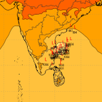
Still Some Divergence seen in Ensemble Members⚠️ Spread
Members are split into two groups: one off Nellore–Ongole, and a second close to the Chennai–Puducherry coast. A few outliers sit as far north as Kakinada. The landfall zone is still wide open between north Tamil Nadu and south Andhra. Further Runs will give a clear Picture about Landfall. Keep hopes low as it depends on further Run and about the Ridges alignment as explained in last post.
Model guidance only, not an official forecast. Follow Official Agency for forecasts and warnings.
#ChennaiRains #BayOfBengal #NEM2026 #TamilNaduWeather #AndhraWeather #CycloneAkvan

தற்போதைய வானிலை மாதிரிகளின்படி, 'அக்வான்' (Akvan) புயல் ஆந்திரப் பிரதேச கடற்கரையை நோக்கி, குறிப்பாக ஒங்கோல் மற்றும் விசாகப்பட்டினம் (Vizag) இடையிலான பகுதியை நோக்கி நகர்வதைக் காண முடிகிறது. ஆனால், இந்த மாதிரிகள் ஏன் இந்த குறிப்பிட்ட திசையைக் காட்டுகின்றன என்று நீங்கள் எப்போதாவது யோசித்திருக்கிறீர்களா? Watch this video...
facebook.com/share/v/1E6joSM…
Weather models are currently showing Cyclone Akvan moving towards the Andhra Pradesh coast, particularly the stretch between Ongole and Visakhapatnam (Vizag). But have you ever wondered why the models are indicating this particular direction? The main reason behind this projected movement is the Steering Ridges, which play a crucial role in determining the direction and movement of a cyclone. The animated video shared here will give you a much clearer understanding of this atmospheric mechanism. Instead of simply watching weather charts and following model predictions, this animation will help you understand how to decode the charts, identify steering patterns and interpret future weather model forecasts on your own. Consider this not just a cyclone update, but also a valuable weather lesson to help you learn the science behind forecasting!
#CycloneAkvan #AndhraPradesh #WeatherModels #SteeringRidge #CycloneTracking #WeatherLearning #Meteorology #RainmanStudio #TNRains #APRains
🌦️ **Daily Weather Inference – 16.11.2026 | 🌀Deep Depression over Bay at 10.4°N 86.3°E|30Kts with 1006MB Central Pressure |Further it will intensify in to #CycloneAkvan within next 18/24hrs|Mostly it will be Heading into South AP or Central AP Coast| Unless Ridge Position Favours it will head to AP | Rain Prospect Depends how close it moves towards West of North TN | Ensembles also hints mostly close to Ongole/Machilipatinal Landfall as of now| will update further if there is a Change.
⛈️ Isolated Light/Moderate Rains likely in Kanyakumari Tenkasi Nellai Ramnathapuram Thoothukudi Virudhunagar.Remaining District will be Dry.North and South Kerala South Coastal Karnataka isolated light rains as well.
⚠️ This is not an official forecast. For official updates, please follow the respective official agencies.
📡 For Radar Nowcast Alerts and Updates, follow our WhatsApp Channel.
📊 **District-wise & State-wise Weather Charts**
Tamil Nadu • Kerala • Karnataka • Telangana • Andhra Pradesh
📱 **Follow our WhatsApp Channel:**
tinyurl.com/masrainman
📲 **Talk to MasRainMan:**
masrainman.blogspot.com
🌐 **For Nowcast Alerts, Follow Us:**
Facebook • Instagram • YouTube • WhatsApp Channel
facebook.com/MASrainman | instagram.com/masrainman/ | tinyurl.com/WhatsappMasrainm…
#MasRainMan #DailyWeatherInference #CycloneMurasu #NortheastMonsoon2026 #NEM2026 #TamilNaduRains #ChennaiRains #SouthIndiaWeather #RainAlert #RadarNowcast


