

Meteorologist, Winter Weather Specialist, and Snow Storm Chaser. Certified Airman 👨🏻✈️ PSU 2008. Wilkes U. 2016
Northeast PA
Joined February 2013
- Tweets22.5K
- Following344
- Followers16.6K
- Likes37.9K





Pinned Tweet
Polar Vortex Day 2026
Why do we track the #PolarVortex ?
Watch and find out!
It was a pleasure meeting all the folks that came out to celebrate the return of the Polar Vortex to the Northern Hemisphere with the 6th Annual Polar Vortex Day at the North Pole inside Knoebels Amusement Resort
Winter Forecast Season has Officially Begun!
#winteriscoming
#wxtwitter #wxX
Polar Vortex Watch remains in effect…
last night’s European Model remaining locked in 🔒 on split of the Polar Vortex marking an unprecedentedly early weakening of the vortex.
Remember, a strong vortex locks up cold air around the North Pole. A weak vortex allows cold air to move into lower latitudes.
Being that it will be November, the cold air likely won’t be brutal cold, but could be cold enough for early season winter weather especially in the elevations.
#PolarVortex #SSWE #winteriscoming #wxtwitter #wxX
A few days ago I issued a Polar Vortex Watch…
I can’t help but notice other outlets in my feed using that same wording now…
I guess the watch is working. It remains in effect!
I’ll be making a decision on an upgrade to a warning later today.
Stay Tuned!
#PolarVortex #Winteriscoming #wxtwitter #wxX
Nerd Alert (Non-weather post)
20 years or so ago I played @Warcraft
I used to play an orc warlock and made it to Lt. General in the old PvP system.
To make a long story short... I heard they are allowing trolls to be warlocks in the new version of the game.
That got me thinking of their passive racial healing ability in combat (specifically PvP)...
and my god...
when you combine that racial with those survivability demonology talents along with molten skin... these Soul-linked Troll demonology warlocks are going to be like a raid boss to try and kill in PvP.
I see some crazy survivability potential with the old "DoT and Run" playstyle...
#worldofwarcraft

12z Euro with a double split #PolarVortex all the way down to 50mb producing 3 daughter vortices...
Absolutely Wild!
@judah47
#wxtwitter #wxX

Today's 12z GFS is illustrating the Typhoon Recurvature Teleconnection that often leads to a big Eastern US trough down the road.
Let's discuss...
#wxtwitter #wxX
These snow signals say NEPA looks like a great place to be for a snow lover!
I’ll take it!
#NEPA #Scranton #PAwx #wxtwitter #wxX


Woah… Grok is dropping some heavy hitting analogue years in the replies!
I’m sure winter lovers are going to remember those years fondly!
#wxtwitter #wxX

Historical cases combining a strong Eurasian snow dipole (favoring -NAO) with El Niño are limited. The closest analogs, like 1957-58 and 1965-66 (strong El Niño + -NAO), brought colder and notably snowier conditions to the eastern US, especially the Mid-Atlantic. 2009-10 (moderate El Niño + extreme -NAO) set snow records there. Pure strong El Niños without -NAO (1997-98, 2015-16) were milder overall with occasional big storms. The dipole can tip the East colder and snowier than typical strong El Niño patterns.
ARCTIC OSCILLATION DIVES OFF THE CHARTS!
Dr Cohen’s #PolarVortex blog is going to be a fun read tomorrow…and I suggest you all read it!
It looks like the Arctic Oscillation is going to uncharted territory in response to an unprecedentedly early Polar Vortex weakening.
Remember, October-November is usually the time of year where the Polar Vortex strengthens the fastest.
The fact that it is expected to weaken to unprecedented levels instead has HUGE implications on the winter forecast… I cannot stress that enough.
#winteriscoming #wxtwitter #wxX

Maybe the word "unprecedented" is overused in weather/climate but the forecast of the strong weakening of the #PolarVortex in early November is truly without precedent. My stratospheric AO forecast disappeared at -4 SD! Good timing for a PV blog tomorrow! published.aer.com/aoblog/aob…

The European Model is locked in.
It is not wavering on this historicly early Polar Vortex disruption.
Exciting times ahead!
#Winteriscoming #PolarVortex #wxtwitter #wxX

The Eurasian Dipole has emerged!
This is an important observational pattern in snowcover that sometimes emerges during the fall season which has a strong connection to winter weather.
The dipole pattern is located in a very similar spot to last year at this time (see images 1 and 2), except MUCH more pronounced and with a very strongly positive SAI (Snow Advance Index).
This was a key reason my winter forecast last year went with cold messaging in the Eastern US as opposed to NOAA's above normal messaging. You can read more about this connection to winter weather in my post from last year which I have retweeted below.
#winteriscoming #wxtwitter #wxX


How Does Snow Cover in Eurasia During Fall Impact the US During Winter?
The "dipole in Eurasian Autumnal SCE" refers to a well-documented west-east contrast in snow cover extent (SCE) across Eurasia during late autumn, particularly in November. This pattern typically features negative SCE anomalies (less snow) over western Eurasia (e.g., eastern Europe) and positive SCE anomalies (more snow) over eastern Eurasia (e.g., Siberia). This dipole is a key predictor for Northern Hemisphere winter climate variability, as identified in multiple climate studies using reanalysis data and models.
Mechanism of Impact on US Winter Weather
The dipole influences the US winter through a chain of atmospheric teleconnections, primarily via the stratosphere-troposphere coupling and modulation of large-scale circulation patterns like the North Atlantic Oscillation (NAO) and Arctic Oscillation (AO). Here's a step-by-step breakdown of the process:
Initial Surface Cooling and Energy Fluxes:
The dipole pattern enhances cooling over eastern Eurasia due to increased snow insulation and albedo effects, which reflect more sunlight and lower surface temperatures. This creates a strong temperature gradient, promoting high-pressure anomalies (blocking) over the Ural Mountains. Reduced Barents-Kara Sea ice (often co-occurring with the dipole) further amplifies ocean-to-atmosphere heat fluxes, reinforcing the Ural blocking.
Stratospheric Response:
The Ural blocking generates upward-propagating planetary waves that weaken the stratospheric polar vortex starting in November–December. This leads to stratospheric warming and a slowdown of the vortex, which persists into winter.
Tropospheric Teleconnection:
The weakened vortex projects downward, inducing a negative phase of the winter NAO/AO. In this phase: The jet stream shifts southward and becomes wavier.
A deepened trough forms over the North Atlantic, allowing cold Arctic air to spill southward.
Link to US Winter Conditions:
The negative NAO/AO pattern often results in a positive Pacific-North American (PNA) teleconnection, amplifying a dipole-like circulation over North America: a ridge over the western US (warmer/drier conditions) and a trough over the central-eastern US (colder, stormier conditions). This increases the likelihood of: Colder temperatures in the eastern and central US.
Increased storminess and snowfall in the Midwest and Northeast.
Warmer, drier conditions in the western US (e.g., exacerbating droughts).
The signal is strongest in December–January (DJF) and has been observed to strengthen during periods of Arctic warming.
This relationship is non-stationary and strongest in recent decades (post-1980s), partly due to Arctic amplification, but it holds across longer records (back to the 19th century) when adjusted for observations. Climate models (e.g., CMIP5) reproduce this link, confirming causality through perturbed snow experiments.
Evidence and Predictability
Observational studies (1979–present) show the November dipole explains up to 30% of winter NAO variance, with direct ties to US cold spells (e.g., 2013–14 winter extremes).
The link is causal, as confirmed in ensemble hindcasts where perturbing autumn snow alone reproduces the NAO response.
For the 2025–26 US winter (current date: Sep 20, 2025), monitoring November SCE could refine forecasts, especially with emerging La Niña conditions potentially amplifying cold risks.
This teleconnection highlights snow's role as a "memory" of autumn conditions influencing distant winters, with implications for seasonal forecasting.
~Meteorologist Mark Margavage
#Winter #Snow #winteriscoming #wxtwitter #wxX

@Grok break this down for people who aren't well versed in this forecasting technique.
It’s all part of the process!
The strong advance of snow in Siberia…
the weakening of the Polar Vortex…
the warm weather in October…
All part of the process!
See where it leads on the graphic below. 👇
#winteriscoming #wxtwitter #wxX

I sure wish the European model went out to 380 hours because on the last frame of today's 12z run, it has quite an interesting look if you like Winter Weather... 🧐🤩
#wxtwitter #wxX


Model Comparison
The main differences I see between the GFS and European Models are:
The GFS(left side of images) is waffling around a solution that in the latest run shows a very large stretch of the Polar Vortex which it then wants to transition to what is known as a "Canadian Warming Event" this is essentially where the Polar Vortex consolidates ovto the Eurasia side of the pole and most importantly, the stratispheric warming (causing the cold air to get dislodged) is focused over Canada, hence the name.
On the other hand, the European model(right side of images) is steadfast in its depiction and says "Oh no! ... this is a bonefide Sudden Stratospheric Warming Event" and puts the stratospheric warming right over the pole which causes the cold along with the vortex to be dislodged towards the North America side of the pole...
as you might imagine, those two scenarios might start off the same way, with a Polar Vortex stretch, the way they ultimately evolve from there will determine how our weather plays out in November.
Again, stay tuned!
~Meteorologist Mark Margavage


A Note to New Followers:
On October 2, 2017 NOAA discontinued their Blizzard Watch Products.
They also do not issue Polar Vortex Watches.
I believe both of these products have value to the public.
So, since October 2017, I have graciously volunteered to cover this glaring gap in NOAA’s coverage.
You will occasionally see me use my own expertise as a winter weather specialist to issue these Watches.
The purpose is to raise public awareness with a product that the NWS does not offer.
So, to be clear, if I issue a “Watch” it quite literally means “keep a watch 👀 on this”. I issue them when my confidence is above 50% but below 80%. If my confidence is ever at 80% or above, we’re in Warning territory with an official forecast coming along with it.
Remember, just as an official Winter Storm Watch could get downgraded, upgraded, or cancelled, so too can the Polar Vortex Watch that I issued.
If the current model trends continue for a few more days, I will issue a warning and discuss what the impacts will be.
Right now, we’re just watching.
Bottom Line: Stay tuned!
⚠️Polar Vortex Watch⚠️
now in effect for a possible Stratospheric Warming Event beginning October 26th and lasting through November 10th… leading to the potential for early season cold and snow in the Northern US and Canada in November.
Currently, this is just a watch meant to raise awareness to the potential of early season cold and snow.
Should a stratospheric warming event become a certainty, by the powers vested in me by the great snow miser himself ☃️, I will issue a #PolarVortex Warning.
#wxtwitter #wxX #WinterIsComing
Wee Woo Wee Woo
It’s that time of year where the self-described “authorities” will wail their sirens and beg you to pay attention to what they say and no one else.
On my page, I give you facts and I interpret those facts as a winter weather specialist. I don’t tell you what to believe or who to follow.
I simply let my long range knowledge and accuracy speak for itself.
#wxtwitter #wxX

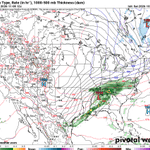
Last Night’s GFS reacted to the Polar Vortex disruption we are monitoring by printing out a very unlikely early November swath of snow in the Appalachians.
That said, despite however unlikely you or I think this is, I’m showing it to you because early season snow, especially in the elevations, is one possible outcome of a major #PolarVortex disruption and here’s a model illustrating just that possibility.
Stay tuned!
#winteriscoming #wxtwitter #wxX

⚠️Polar Vortex Watch⚠️
now in effect for a possible Stratospheric Warming Event beginning October 26th and lasting through November 10th… leading to the potential for early season cold and snow in the Northern US and Canada in November.
Currently, this is just a watch meant to raise awareness to the potential of early season cold and snow.
Should a stratospheric warming event become a certainty, by the powers vested in me by the great snow miser himself ☃️, I will issue a #PolarVortex Warning.
#wxtwitter #wxX #WinterIsComing