Official X account for the National Weather Service Boise. Details: https://xitter.cf/t.co/kwtncnlnle

Boise, Idaho
Joined October 2012
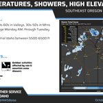
A Pacific storm system will bring seasonable temperatures and the chance for precipitation Monday and Tuesday.
2
13
1,464
A Pacific trough will bring active weather to eastern Oregon and southwest Idaho beginning Monday.
1
28
1,455
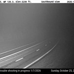
🌫️Areas of fog have developed this morning, impacting highway 55 north of Banks Lowman Road. Localized visibilities of a quarter mile have been observed. Fog will begin to lift after sunrise... but in the meantime exercise extra caution if traveling.
1
17
1,283
Check out some rainfall totals from Wednesday Night (10/22) through Friday (10/24) across eastern Oregon and southwest Idaho. How much did you see? weather.gov/wrh/TextProduct?…
10
1,642
Temperatures will approach freezing across the Treasure and western Magic Valleys on Saturday morning. Patchy frost is possible. Emmett, Payette, and Boise have yet to hit their first freeze this fall, and are already past due.
1
5
33
1,985
3:50 AM MDT: A cold front is moving through the region this morning, bringing gusty west/north winds and increasing showers once again. Windy, chilly, & showery conditions will persist into the afternoon. Image: Radar + Wind Gusts (mph)
1
16
1,407
Friday will be windy and much colder in the wake of a strong cold front. Widespread rain and high mountain snow will continue through mid-day, before tapering off from west to east in the afternoon and evening.
19
1,446
9:45 PM MDT Radar Update: scattered rain showers are continuing over most areas. A strong cold front will pass across the area late tonight, bringing widespread showers 🌧️and gusty northwest winds🍃 overnight through most of Friday. #idwx #orwx
1
13
1,603
A special weather statement has been issued for Fairfield ID and Featherville ID until 5:15 PM MDT
1
6
1,195
A special weather statement has been issued for Jerome ID, Gooding ID and Wendell ID until 4:30 PM MDT
3
1,280
⛈️3:42 PM MDT Radar Update: clusters of thunderstorms producing moderate to heavy rainfall and observed gusts of 30-40 mph are continuing mainly over southwest ID this afternoon. Scattered showers and isolated thunderstorms will continue this evening through tonight.
2
26
1,625
A special weather statement has been issued for Mountain Home ID, Gooding ID and Wendell ID until 4:00 PM MDT
5
1,071
A special weather statement has been issued for Mountain Home ID, Mountain Home Air Force Base ID and Glenns Ferry ID until 3:15 PM MDT
3
1,101
⛈️Thunderstorms will roll across SW Idaho this afternoon and evening bringing locally gusty winds up to 60 mph, brief heavy rain and small hail. The chance of thunderstorms continues through tonight with the potential for brief heavy rain impacting burn scars.
1
4
48
3,189
🌧️ A cluster of showers and thunderstorms moving south to north late Thursday into Friday could produce strong outflow winds up to 50-60 mph, brief heavy rain, and small hail. Heavy rainfall will bring a flash flood threat over the Crooked and Wapiti burn scars.
1
10
2,592
🌧️A low pressure system moving into the area will bring widespread rain, with isolated thunderstorms⛈️capable of gusty outflows and heavy showers, Thursday through early Friday. Cooler temperatures and gusty winds expected Friday through the weekend following the cold front.
1
1
21
2,952
ICYMI: Temperatures will remain warm through mid week, but shower and thunderstorm chances will begin to increase Tuesday and Wednesday. Rain and high mountain snow, along with windy conditions and cool temperatures, are anticipated toward the end of this week.
1
1
19
1,528
Temperatures will remain warm through mid week, but shower and thunderstorm chances will begin to increase Tuesday and Wednesday. Rain and high mountain snow, along with windy conditions and cool temperatures, are anticipated toward the end of this week.
17
1,779
🥶 A frost advisory is in effect for the Treasure Valley tonight and a freeze warning is in effect for the Magic Valley! Check out the forecast temperatures through this Sunday with a steady warming and drying trend thanks to building high pressure.
2
27
2,644
Frost is likely to develop Tues and Wed mornings across the lower valleys. Temperatures could reach the mid 30s Tuesday morning. Could see similar temps again for the Treasure Valley on Wednesday morning with freezing temps possible east of Mountain Home through the Magic Valley.
1
35
2,276