

Official Twitter account for the National Weather Service Grand Forks. Details: https://xitter.cf/t.co/JM63NmxS5I
- Tweets30.8K
- Following191
- Followers16.3K
- Likes7.3K
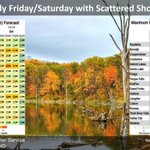
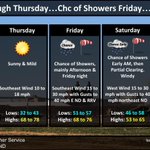


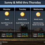


ALT An official National Weather Service (Grand Forks) hazard graphic detailing every 6 hours of Friday and Saturday for the wind gusts and precipitation chances.

ALT 5-day outlook graphic featuring wind gust thresholds and temperature details through Sunday. Shows Friday southeast wind gusts up to 40 mph in eastern ND/RRV, Saturday west wind gusts up to 40 mph in northeast ND, and a cold front bringing Sunday highs down to 42–52°F with overnight lows from 28 to 38°F.

ALT Forecast Graphic today through Saturday: Mostly sunny skies prevail today through Thursday, along with highs in the 60s and 70s. South to southeast winds bring moisture into the area ahead of a system that will bring rain and gusty winds to the area Friday and Saturday.

ALT Warm temperatures and sunny skies prevail through Thursday with rain chances returning on Friday. Afternoon highs this week range from the 60s in northeast North Dakota to the low 70s in the southern Red River Valley.

ALT Sunny, dry and mild conditions through Thursday. Daily highs mostly in the 60s, with some 70s. Overnight lows in the 30s and 40s. Next rain chance arrives Friday and Saturday.

ALT Sunny, dry and mild conditions this weekend into early next week. Highs in the 60s and lows in the 30s and 40s.

ALT An official National Weather Service (Grand Forks) hazard graphic detailing a Freeze Warning in effect tonight for west central Minnesota. The map highlights affected counties in purple (including areas around Elbow Lake and Wadena). The right panel features a stylized drooping flower icon representing damage or death to sensitive outdoor vegetation.

ALT Areas of clouds giving way to sunshine today as high pressure builds in. North winds will diminish through the day becoming light by late in the day. Highs today in the upper 40s. Clear tonight, with light wind in the early evening becoming south 10-20 mph overnight. Lows 30-36. Sunny this weekend into early next week.


ALT Fast moving area of low pressure will drop southeast thru Manitoba and into northern Minnesota today into tonight. As it does look for winds to turn northwest this afternoon and increase in speeds over central North Dakota and the Devils Lake basin, then tonight turn northerly over the Red River valley. Wind gusts 45 to 50 mph are possible. Expect a few rain showers as well with this system late afternoon and tonight. Early morning rain showers in far southeast ND into Minnesota lakes country will move out after daybreak.


ALT Fast moving area of low pressure will drop southeast thru Manitoba and into northern Minnesota today into tonight. As it does look for winds to turn northwest this afternoon and increase in speeds over central North Dakota and the Devils Lake basin, then tonight turn northerly over the Red River valley. Wind gusts 45 to 50 mph are possible. Expect a few rain showers as well with this system late afternoon and tonight. Early morning rain showers in far southeast ND into Minnesota lakes country will move out after daybreak.

ALT 4-day weather outlook graphic: Wednesday: Highs 50–55°F, light and variable wind under 10 mph. Thursday: Highs 50–58°F, lows 34–40°F, NW winds 15–30 mph with gusts up to 45 mph in eastern ND. Friday: Gradual clearing, highs 48–55°F, lows 30–37°F, NW winds 10–20 mph. Saturday: Sunny, highs 62–69°F, lows 28–35°F, south winds 10–25 mph.

ALT National Weather Service Grand Forks forecast graphic titled 'Much Cooler This Week'. Today: Mostly cloudy, NW winds 10 to 20 mph, highs 48 to 56. Wednesday: Mostly sunny, light and variable winds, lows 28 to 36, highs 54 to 58. Thursday: Mostly sunny south and partly sunny north, NW winds 15 to 25 mph with gusts to 35 mph, lows 30 to 36, highs 52 to 62. Friday: Mostly sunny, NW winds 10 to 20 mph, lows 28 to 35, highs 50 to 55.

ALT NWS Grand Forks 4-day forecast graphic titled "Much Cooler This Week". Today: Rain showers, breezy northerly wind, highs 43 NW to 68 SE. Tuesday: Mostly cloudy, NW winds 10 to 20 mph, lows 32 to 44, highs 48 to 56. Wednesday: Mostly sunny, light and variable wind, lows 28 to 38, highs 55 to 60. Thursday: Slight chance of showers, strong NW wind, lows 32 to 38, highs 52 to 62.

ALT Much cooler airmass spreads in today into Monday. Coolest readings found in northern North Dakota with highs in the 40s and this is where rain chances are highest into Monday. Farther south into far southeast North Dakota and west central Minnesota, cooler than on Saturday but overall remaining mild with scattered showers possible Monday.

ALT North Dakota Ag Weather Network high temperatures. Low 90s in southeast ND and west central MN.

ALT Side-by-side temperature forecast graphic for today and Sunday. Today: Highs in the upper 70s to upper 80s across eastern ND and NW MN. Sunday: Much cooler behind a cold front, with highs dropping into the upper 40s to low 60s in eastern ND and mid-60s to mid-70s in NW MN, along with a chance for showers in northeast ND.

ALT A change in the pattern arrives Sunday & Monday as temperatures cool off significantly and there is a chance for showers. Until then today and Saturday will be partly to mostly sunny sunshine and gusty south winds. Warmest day Saturday ahead of a cold front which moves thru Saturday night & Sunday.
