

Official Twitter account for the National Weather Service Pendleton. Details: https://xitter.cf/t.co/LCpPXzpjtc
- Tweets14K
- Following249
- Followers10.4K
- Likes3.5K



ALT Image highlighting snowy travel conditions for Cascade mountain passes.

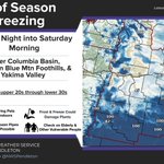
ALT Chance of Season Ending Freeze Friday into Saturday Morning Lower Columbia Basin, Northern Blue Mtn Foothills, & Yakima Valley Lows in the upper 20s through lower 30s Graphic shows the percent probability of temperatures less than or equal to 32 degrees Friday night through Saturday morning.

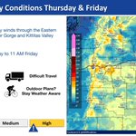
ALT The graphic shows a map of forecast maximum wind gusts (mph) Thursday through Friday. Breezy to windy westerly to northwesterly winds are expected (80% confidence) through the Eastern Columbia River Gorge and Kittitas Valley Thursday evening through Friday morning. A Wind Advisory is in effect, valid 7 PM Thursday to 11 AM Friday.

ALT The graphic shows a map of the probability (%) of wind gusts of 40 mph or greater Thursday evening through Friday morning. Breezy to windy westerly to northwesterly winds are expected (80% confidence) through the Eastern Columbia River Gorge and Kittitas Valley Thursday evening through Friday morning. A Wind Advisory is in effect, valid 7 PM Thursday to 11 AM Friday.

ALT Table of forecasted Temps. Image of sunset

ALT Alt Text: A graphic depicting a red flag warning for the Grande Ronde Valley until 7pm Friday, October 16th. The graphic says that fires may exhibit rapid growth with dry and breezy winds and to pay close attention to local news sources and abide by law enforcement if evacuations are necessary.

ALT Image showing a map highlighting the peak wind gust for friday. Forecast confidence is high. bulleted text reads as follows"Hazards 30+ Wind gusts in the Grande Ronde Valley Timing 5 am Friday - 5 am Saturday Actions Light Objects Blown Around Difficult Travel Unsecured Tents Blown Around Outdoor Plans? Stay Weather Aware "

ALT Pendleton meteorologists taking safety precautions to prepare for earthquakes if they should occur.

ALT Graphic displaying the Great ShakeOut drill happening today at 10:15am; It also details how a person can protect themselves during an earthquake

ALT Graphic shows upcoming ShakeOut drill in 2 hours

ALT Graphic displays upcoming ShakeOut tomorrow at 10:15am

ALT 2 maps showing probabilities for 30 mph or greater wind gusts. bulleted text reads Increasing chances for breezy conditions Friday.

ALT Radar showing rain over the Yakima Valley

ALT Graphic showing ShakeOut drill this Thursday at 10:15am

ALT two maps showing temperatures at 7am. temperature trend timeline with a red arrow showing warming trend. Warm and dry trend throughout the week Pattern changes next week

ALT Graphic showing upcoming ShakeOut drill this Thursday at 10:15am

ALT The graphic shows the chance of low temperatures dropping to freezing or below Monday night into Tuesday morning. Clearing skies and light winds will allow near- or sub-freezing temperatures to develop across the majority of the lower elevations of eastern Oregon and eastern Washington Monday night into Tuesday morning.

ALT Map showing probability of less than 32F temperatures Saturday morning. Hazards Sub-Freezing Temperatures Timing Saturday night into Sunday Morning Actions Check on Elderly & Other Vulnerable People Bring Pets Indoors Forecast Confidence High Stay updated on forecast! Dress for the weather. Find safety resources at weather.gov/safety/cold.

ALT Breezy winds and dry conditions will lead travel impacts in the form of blowing dust, potentially reducing visibilities.

ALT A map showing a freeze watch for Madras, Union, La Grande, Prineville, Elgin, Bend, Cove, Joseph, Wallowa,Enterprise and Redmond temps Lows: 28° to 32° actions: Bring Pets Indoors Frost and freeze conditions could kill crops Frozen Pipes Possible Check on Elderly & Other Vulnerable People