NWS Tulsa (@NWStulsa) header
NWS Tulsa (@NWStulsa) profile picture

Official Twitter account for the National Weather Service Tulsa, Oklahoma. Details: https://teapawt.org/t.co/Afr013XkGT

Tulsa, Oklahoma
Joined June 2011
Photo by NWS Tulsa (@NWStulsa)Photo by NWS Tulsa (@NWStulsa)Photo by NWS Tulsa (@NWStulsa)Photo by NWS Tulsa (@NWStulsa)Photo by NWS Tulsa (@NWStulsa)Photo by NWS Tulsa (@NWStulsa)Photo by NWS Tulsa (@NWStulsa)Photo by NWS Tulsa (@NWStulsa)Photo by NWS Tulsa (@NWStulsa)Photo by NWS Tulsa (@NWStulsa)
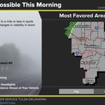
[5:23A - 11/17/26] Very patchy fog remains possible across portions of E OK and NW AR this morning and could impact the morning commute. The most favored regions for fog will be valleys and near lakes or rivers. Use caution while out and about this morning. #okwx #arwx
5
1,093
[11:46A - 11/16/26] Patchy fog could develop tonight into Tuesday morning across portions of E OK and NW AR. This fog could impact the Tuesday morning commute. #okwx #arwx
11
1,659
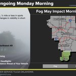
[5:10 AM 11/16/26] Patchy fog is ongoing this morning across the region w/ widely varying visibilities. Valleys and near area lakes have seen visibilities below one half mile at times. Morning commute may see slow downs. Temps warm into low 60s by afternoon.
9
1,589
[8:00 PM 11/15/26] - Areas of light to moderate rain continue across southeast OK and east-central OK. Rain should begin to wind down the next few hours with minimal additional accumulation. #okwx #arwx
13
2,007
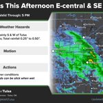
[2:35P - 11/15/26] An area of light rain persists across E-central and SE OK through the afternoon. Expect this rain to gradually wind down by this evening without much more progression to the east. Roads will be wet so use caution while driving in the affected areas. #okwx
1
1
6
2,017
[12:50P - 11/15/26] A band of light to moderate rain continues to shift slowly east this afternoon. Roads will be wet in the area, so use caution. #okwx
11
2,256
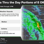
[10:32A - 11/15/26] A band of light to moderate rain continues to shift slowly east. Hourly rain rates up to a tenth of an inch have been observed to the S and W of Tulsa. Roads will be wet so exercise caution while driving. #okwx
2
1
16
2,117
[8:50A - 11/15/26] Coverage of light to moderate rain will expand over E OK through the day. Rain rates will be fairly light initially, then pick up a bit as the main band of rain moves in. Be aware that roadways will be wet if you are out and about this morning. #okwx
1
4
19
1,969
[6:20 AM 11/15/26] Areas of light rain will continue to slowly spread east through mid morning. Rainfall amounts will remain light through this time with any heavier rains focused along and west of the Highway 75 corridor through E OK.
3
10
1,931
[5:25 AM 11/15/26] Areas of light rain will continue through Sunday primarily across E OK. Temperatures will remain cool especially where rains persist. Any heavier rainfall totals will focus across SE OK.
2
13
1,698
[3 AM 11/15/26] Light showers will continue to slowly spread east through sunrise. Rainfall amounts will remain light through the remainder of the overnight hours. Rains will continue into the day on Sunday w/ higher chances remaining across E OK.
1
4
1,637
[12:30 AM 11/15/26] Areas of light rain will gradually spread eastward through the morning hours. The heavier rains will eventually focus across portions of SE OK. Rainfall totals through the early morning hours will be less than one quarter inch.
2
6
1,796
[9:25 PM 11/14/26] - Areas of light to moderate rainfall are moving into eastern Oklahoma. Accumulation will mostly be light. An isolated rumble of thunder cannot be ruled out. #okwx #arwx
2
13
2,424
[1:36P - 11/14/26] Rain chances ramp up tonight, and a rainy and cool Sunday is on tap for much of E OK. The heavier rains are expected to focus over E-central and SE OK. #okwx #arwx
1
16
2,583
[4:25 AM 11/14/26] Cold start Saturday morning with temps warming into mid 50s by afternoon. Rain spreads into the region Sat. night and becomes more widespread on Sunday. Cool & wet weather on Sunday w/ highs in the upper 40s to mid 50s.
3
20
2,579
[4:10 pm - 11/13/26] Widespread freezing conditions are expected tonight for much of the area, with frost conditions in southeast Oklahoma. A few of the coldest locations may see a hard freeze. #okwx #arwx
5
19
3,568
[2:50 pm - 11/12/26] A rainy Sunday is expected for at least a portion of the area, as an upper level low, currently off the California coast, moves through the region. If you have outdoor plans, keep tuned to the latest forecast, as uncertainty remains in the track. #okwx #arwx
15
2,350
[2:14 pm - 11/12/26] Wondering about the weather for your weekend? Check out our latest Weekend Weather Outlook video: youtu.be/lYPtSbuq8Qg #okwx #arwx
1
7
2,849
[12:02 pm - 11/12/26] Even colder temperatures appear likely Saturday morning, with medium to high chance of freezing temperatures everywhere except far southeast Oklahoma. Additional frost/freeze headlines will likely be necessary. Keep an eye on forecasts! #okwx #arwx
3
11
2,131