

Official Twitter account for the National Weather Service Tulsa, Oklahoma. Details: https://xitter.cf/t.co/Afr013XkGT
- Tweets46.2K
- Following252
- Followers53.6K
- Likes6.8K




ALT graphic depicts chances for rainfall on Tuesday...areas in the green shading...especially the darker shades...have rain chances

ALT graphic depicts the chances for precipitation on Halloween evening from a multi-model ensemble mean (average)...some describing text is also included on the right pane

ALT [2:30 PM 10/24/26] - Mostly quiet weather this week as well above normal temperatures continue. A few showers may occur Tuesday with a better chance of rain next weekend.

ALT the graphic shows two different maps from the CPC; the red on the left graphic means odds favor warmer than average temps; the greens on the right graphic mean that above average precip is favored

ALT Low impact weather, with warm and dry conditions, is expected to prevail across eastern Oklahoma and northwest Arkansas through the weekend. The left panel shows a map with the weather pattern for the southern United States through the weekend, showing upper level high pressure over the immediate area and a low pressure system in the southwest.

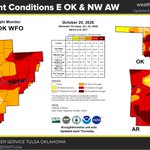
ALT Image shows drought conditions from abnormally dry (yellow areas) to exceptional drought (dark red areas) continue across parts of eastern OK and western AR as of Thursday October 22nd 2026.

ALT The latest Climate Prediction Center outlook for late October into early November continues to highlight a lean toward wetter-than-normal conditions across eastern Oklahoma and northwest Arkansas. Odds also favor above-normal temperatures, continuing the warmer-than-average trend the region has experienced since last January.

ALT The latest Climate Prediction Center outlook for late October into early November continues to highlight wetter-than-normal conditions across eastern Oklahoma and northwest Arkansas. Odds also favor above-normal temperatures, continuing the warmer-than-average trend the region has experienced since last January.


ALT Image shows scattered light rain moving eastward across northeast Oklahoma toward northwest Arkansas early Wednesday morning. A layer of drier low level air will limit the amount of rain reaching the ground. The chance of lightning with this activity was less than 10 percent.

ALT Image shows a low chance of light rain for parts of northeast Oklahoma Wednesday, with also a chance of a sprinkle in northeast Oklahoma and northwest Arkansas as a disturbance moves through the region. A layer of drier low level air will limit the amount of rain that reaches the ground. The greater potential for precipitation is through early afternoon Wednesday.

ALT Image shows light rain showers with embedded lightning moving into northeast Oklahoma early Wednesday morning. Drier air underneath the light rain was limiting the amount of rain reaching the ground. Lightning potential is forecast to weaken with eastern extent.

ALT Image shows a weak disturbance moving into the Plains Tuesday. At the same time, a deep layer of drier low level air over eastern Oklahoma and northwest Arkansas will keep most of any rain development from reaching the ground, other than a chance of a sprinkle.

ALT Three images are on the graphic (from left to right): 10/19/26 7 am Norman, OK sounding, MRMS base reflectivity image from 2 pm on 10/19/26 and 10/19/26 7 am Springfield, MO sounding. Both sounding images show a moist layer high in the atmosphere, where the cloud and precipitation are developing, along with a deep layer of dry air, where the precipitation is evaporating.

ALT The latest Climate Prediction Center outlook into late-October leans toward wetter-than-normal conditions across eastern Oklahoma and northwest Arkansas. Odds also favor above-normal temperatures, continuing the warmer-than-average trend the region has experienced since last January.

ALT Two images showing the latest Climate Prediction Center outlook into late-October. The precipitation graphic show odds leans toward wetter-than-normal conditions across eastern Oklahoma and northwest Arkansas while the temperature graphic favors above-normal temperatures, continuing the warmer-than-average trend the region has experienced since late last January.

ALT Map showing the parts of northern Oklahoma and southern Kansas in a Frost Advisory Saturday morning, shaded in light blue.