
Official X account for the National Weather Service Twin Cities, Minnesota. Details: https://xitter.cf/t.co/Ou56XBf7km
- Tweets55.4K
- Following473
- Followers12K
- Likes27.4K


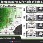




ALT Today: Widespread rain with highs in the 40s. Hourly forecast included on the graphic for various forecast points. Tuesday: Rain ends by daybreak for most locations. Highs in the 50s to lower 60s. Wednesday: Mild, with highs in the 60s to near 70. Chance of showers and thunderstorms. Thursday: Partly cloudy with highs in the 50s and 60s.

ALT On the left a table showing the rain chances for select cities. On the right a graphical forecast with highs around 50 on Monday warming to the 60s by Wednesday.


ALT Scattered showers will spread east from western MN this evening and linger into Sunday. Steadier rain will move in Sunday night into Monday night, with the heaviest totals (~1 inch) expected across western MN. Numerous chances for rain are in the forecast for the rest of next week.

ALT Today: Highs in the 70s with scattered rain showers Sunday: Cloudy and cooler with highs in the 50s. Monday: Rain likely with highs in the 40s. Tuesday: Scattered rain showers. Wednesday. Rain showers early then drying out.

ALT 3 day forecast with temperatures falling from 70s on saturday to 40s for highs by Monday, with lows falling just as much but remaining above freezing.

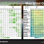
ALT 3 hourly forecast of precipitation and max wind gusts for Minnesota and Wisconsin cities.

ALT 4 day forecast with an image of a map with a chance for a tenth of an inch of rain on Friday, showcasing mainly western MN. Temperatures in the 60s and 70s tomorrow and Saturday, with 50s Sunday and Monday.

ALT Highs and lows for parts of central and southern Minnesota and western Wisconsin for the next five days.

ALT Graphic showing forecast highs, lows, and weather for southern Minnesota and west-central Wisconsin tonight through Saturday night. Also shown in the background is a photo of trees along a lake shore on a sunny Fall day.

ALT Highs and lows with rain chances and other weather conditions for southern and central Minnesota and western Wisconsin forecasts.

ALT Graphic showing forecast highs, lows, and weather for southern Minnesota and west-central Wisconsin tonight through Friday night. Also shown is a picture of fallen leaves on the ground.


ALT Weather forecast tonight through Wednesday for central and southern MN and western WI. Tonight, clear skies with calm winds. Lows in the lower 40s. Some patchy fog possible early. Tuesday, Sunny Highs in the upper 60s. Wednesday, partly cloudy. Highs in the lower 70s.


ALT A weather forecast graphic from the National Weather Service in Twin Cities, MN titled "More Mild Weather". The left side features a photograph of autumn trees with colorful red, orange, and gold leaves. The right side contains a day-by-day forecast grid: Tonight: Low 38 to 45°. Condition: Wind comes down. Sunday: High 62 to 68°, Low 36 to 42°. Condition: Sunny, less wind. Monday: High 60 to 65°, Low 38 to 44°. Condition: Sunny. Tuesday: High 64 to 68°, Low 44 to 50°. Condition: Sunny. Wednesday: High 66 to 72°, Low 46 to 52°. Condition: A few clouds.
