
Committed to promoting open data, data governance, and data-driven decision making in Lebanon.
Lebanon
Joined August 2020
- Tweets110
- Following50
- Followers335
- Likes143




Open Map Lebanon retweeted

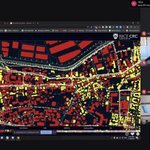
Our @UNDPAccLabs worked with @meldaSalhab @MathewNg to explore vulnerability in Beirut neighborhood post-blast through #spatial data processing techniques such as population analysis, urban morphology, & accessibility analysis.
👉 more on their approach: bit.ly/3jqbcGm

Open Map Lebanon retweeted

A startling 19 politically exposed people (PEPs) exist among the shareholders of #Lebanon's cement cartel: Sibline, Cimenterie Nationale, and Holcim.
Many more occupy seats in the companies' boards of directors. Read our latest paper "Mountain to Mortar"
thinktriangle.net/mountain-t…

THREAD 1/ Our latest investigation reveals the names of political elites who control #Lebanon's cement cartel.
SIBLINE:
- PM-designate Saad Hariri
- 3X Close family members of Saad Hariri
- 1X Former Economy Minister Nicolas Nahas
- 2X Indirect PEPs

Open Map Lebanon retweeted
Ever wondered who owns all of those illegal quarries in #Lebanon?
Yep, a quarter of them are politicians, their extended family and associates. You can find all the names and locations in my latest paper for @Think_Triangle:
thinktriangle.net/mountain-t…

Open Map Lebanon retweeted


Recent PhDs interested in historical and temporal aspects of Lebanese refugee policy - look no further! Excellent post doc opportunity @LebaneseStudies working with a fabulous team of scholars.
Open Map Lebanon retweeted

We're happy to share with you the video of the #COVID19 Webinar of 23Jan.
Thanks again to our wonderful guest speakers:
@DrHZaraket @GhinwaHayek @bs_maroun
👉New viral strain/variants
👉Data needs/limitations
👉Surveillance
👉Future paths
👉#ZeroCovid
youtube.com/watch?v=6JiAy0O_…

Open Map Lebanon retweeted

Using Mapillary images in ArcGIS Experience Builder.
beirutrecovery.org
#esri #arcgisonline #experiencebuilder #mapillary #beirut
Open Map Lebanon retweeted

The OSM Foundation Board wants to hear from you on our work in 2020 and priorities in 2021. Take the survey at osmf.limequery.org/281662 It's been translated into 17 languages! More details on the survey at blog.openstreetmap.org/2021/…
Open Map Lebanon retweeted

1.Updated and integrated view of #Lebanon's #Covid pandemic. This time with a feeble attempt to estimate the effective reproduction number (Re). The only good news is that #Facebook movement data show the largest ever reduction in users' movement - more than the first lockdown.

Open Map Lebanon retweeted

Today we are announcing the release of Vistas 2.0. Vistas is a street-level image dataset of 25,000 images that helps machines to understand street scenes.
In this release we double the amount of labelling categories. Researchers can download 2.0 now.
blog.mapillary.com/update/20…

Open Map Lebanon retweeted
And here's a composite plot showing (1) how people reduced their mobility in response to measures, (2) daily positive cases, (3) ICU occupancy, and (4) airport arrivals and testing. ICU capacity should be reached somewhere in February, but better numbers and models needed.

Open Map Lebanon retweeted
Animating a disaster. See how #COVID19 numbers evolved in @lebanon since the beginning of the pandemic. And how the different measures failed.
Special thanks to @ChangSara for compiling the official data in a useful format.
@mophleb @DRM_Lebanon @WHOLebanon @OpenMapLebanon
Open Map Lebanon retweeted

1. Catastrophic Jan & Feb have begun, as we had warned. @zerocovidlb
Wouldn't have happened if #Lebanon authorities had listened, since April 2020.👇
Our early success in the Spring did not mean we could sit back & just react to a virus faster than us.
What happens now?

Open Map Lebanon retweeted
On the International Day for Persons with Disabilities #IDPD2020 we are proud to be the best world map for accessibility. Read on to learn about applications for persons with disabilities, and ways to contribute to the map. blog.openstreetmap.org/2020/…

Open Map Lebanon retweeted
The global @openstreetmap and Mapillary communities have made a huge impact together--visualized here with a dot for every changeset on OpenStreetMap that tagged Mapillary as a source. From Greenland to Kamchatka, Yucatan to Estonia, Tasmania to Brazil--collaboration wins! #map

Open Map Lebanon retweeted

Very useful data on openmaplebanon.org These guys did an amazing work! Well done #Beirut #BeirutBlast @OpenMapLebanon It’s the largest mapping of building damage, repair and recovery of Beirut since the August 4th Port Explosion
Open Map Lebanon retweeted

1/2 On this, and drawing from @bs_maroun 's contribution in @OpenMapLebanon 's recent conference, we must really think about what we call a 'boundary'.
#Boundaries

#30daysmapchallenge day 23- Boundaries
An eternal question for us: on what basis should we draw boundaries between neighborhoods?
Compare neat administrative boundaries in #Beirut as defined by Electricité du Liban with food delivery drivers' accounts of lived neighborhoods


Open Map Lebanon retweeted
Now if you click on a thumbnail it will take you to the Mapillary Viewer where you can navigate, zoom in and out and also see 360 Views. By the way, there's a Gallery for theses images in the sidebar on the left of the map
Open Map Lebanon retweeted

#30daysmapchallenge day 21- water
How frequently do you get tap water when you live in #Beirut?
From a sample of 1167 buildings, we projected a honeycomb grid using an optimised hot spot analysis tool to map statistically significant high and low water supply locations


Open Map Lebanon retweeted

OpenStreetMap is now at the center of a truly incredible alliance of the biggest companies on earth, and I'm surprised by how little attention it's getting. So I wrote it up! joemorrison.medium.com/opens…

Open Map Lebanon retweeted
We're late to the #30daysmapchallenge party so here is at the same time a blue, a monochrome, and a map not made with GIS. More than 1950 landmarks mentioned by delivery drivers in #Beirut mapped by @monica_bsb (manually with incredible patience!) and Ahmad Gharbieh.
