

Professional meteorologist. MMet Meteorology @UniofReading & @ousom. Amateur photographer. Storm chaser @volatility_wx. Views are my own.
Berkhamsted, England
Joined November 2016
- Tweets440
- Following164
- Followers929
- Likes761


Pinned Tweet
One month ago, post-tropical storm #Ophelia made landfall in Ireland, bringing hurricane-force winds.
The lifecycle of this storm is beautiful and mesmerising, and is why I love the weather.
Here's my account of the storm:
stratusdeck.co.uk/convective…
Image credit: NOAA

I think the UK just experienced a Pacific NW-style heatwave.
I'm lost for words over what's happened today.
3
Hottest airmass ever recorded over the UK.
25.2C at 850hPa belongs over Saharan Africa, not the UK.

17Z Camborne sounding had a 850 hPa temperature of 25.2C which is the highest seen on record for the UK and beats the previous record in June 2019. #UKHeatwave

11
The intensity of the airmass and surface heat about to hit the UK is unlike anything meteorologists have seen before. It's shocking and terrifying.
All time max and min temps will be obliterated.
Take the warnings seriously. Heat kills.
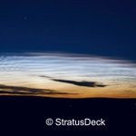
Incredibly bright noctilucent cloud display last night from the North York Moors.
Taken at 00:45 BST.


Some more thoughts on today's severe thunderstorm risk in Europe: stratusdeck.co.uk/blog/today…
1


Today's storms in the SE have developed in a low wind-shear environment with a convergence line to focus storm development and high PWAT to enhance precipitation efficiency.
Further details on flash flooding requirements can be found here: stratusdeck.co.uk/flash-floo…
3
Who likes noctilucent clouds?
Here's a short blog about the display I saw last week:
stratusdeck.co.uk/blog/nocti…

1
Beautiful noctilucent clouds on the evening of 14th July, 23:36 BST.
Looking north over Windermere towards the Cumbrian Fells.

2
A look at current and recent extreme heat across North America in my latest blog:
stratusdeck.co.uk/blog/going…
1
Unbelievable violent tornado damage from the Czech Republic today. Cars tossed, building totally destroyed, looks to be ground scouring too.
Thoughts go out to those affected.


Noctilucent clouds over Headingley Stadium, Leeds, at approx. 00:37 BST 13.06.2021.
A fantastic display enjoyed with @wx_radar.
