

This project will rebuild and widen approximately 14 miles of I-20, I-820 and US 287, relieving congestion in southeast Tarrant County
- Tweets473
- Following9
- Followers352
- Likes19

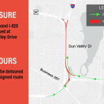




ALT Map illustrating a road closure and detour on I-820 at Sun Valley Drive. Northbound lanes are closed. Traffic is rerouted using Business 287 and Bowman Springs Road. Detour route is marked in green, and the closed section is marked in red. A legend is included in the image for reference.

ALT Map showing a closure and detours in Arlington, Texas. Southbound I-820 is closed at Sun Valley Drive. Detours: Southbound US 287 traffic should U-turn at Berry Street; Southbound I-820 traffic should U-turn at Village Creek Road.

ALT Map showing a detour for a northbound closure on I-820 at Sun Valley Drive. Red lines indicate the closed section, while green lines show the detour route via Business 287. A legend clarifies the route colors.

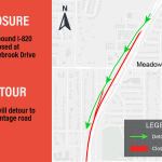
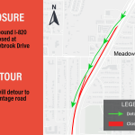
ALT Map showing a road closure on Southbound I-820 at Meadowbrook Drive. A detour route is marked with green arrows directing traffic to the frontage road. The closed section is highlighted in red. A legend indicates detour and closed routes.

ALT Map showing road closure on Southbound I-820 at Meadowbrook Drive. A detour is indicated using green arrows, guiding traffic to the frontage road. There's a legend highlighting the detour route in green and the closed section in red. An arrow at the top indicates north.

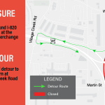
ALT A map shows a road closure and detour near the US 287 interchange. Southbound I-820 is closed, indicated in red, at the intersection with US 287. The detour route, shown in green, directs traffic to take a U-turn at Village Creek Road. The map includes labels for Wilbarger St, Martin St, and a compass for orientation.

ALT Traffic advisory map showing the closure of southbound I-820 at the US 287 interchange. The detour route is marked with green arrows, directing traffic to make a U-turn at Village Creek Road. The closure is marked with red. Surrounding streets like Wilbarger St and Martin St are visible. A legend explains the symbols for detour (green) and closed (red) routes.

ALT Map showing a closure and detour on Westbound I-20 at the US 287 interchange. Closure marked in red. Detour route in green, directing traffic to exit at Bowman Springs Road and Littel Road. Legend provided.

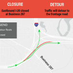
ALT This image is a map illustrating a traffic detour. Eastbound I-20 is closed at Business 287, indicated in red. The detour route is shown in green, directing traffic to the frontage road. An arrow points north to provide orientation. The map includes nearby roads I-820 and Anglin Drive.

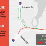
ALT Map illustration showing a traffic closure and detour in the area of the US 287 interchange. The eastbound I-20 is closed, with traffic rerouted to Little Road. The detour route is marked with green arrows, and the closed section is highlighted in red. The map includes roads like Sun Valley Dr, Bowman Springs Rd, and Business 287.


ALT Traffic detour map indicating closure of westbound I-20 at the I-820 interchange. Detour routes via Sun Valley Drive are marked in green arrows, indicating U-turns and directions. The closure is emphasized in red on the map.
ALT Traffic detour map indicating closure of westbound I-20 at the I-820 interchange. Detour routes via Sun Valley Drive are marked in green arrows, indicating U-turns and directions. The closure is emphasized in red on the map.


