An experimental wildfire smoke detector built by AI For Mankind. Use the infos strictly at your own risk. Donate to support us https://teapawt.org/t.co/JmQ10pRCYS
Joined June 2020
- Tweets3.8K
- Following89
- Followers1.4K
- Likes220



Smoke detected ! Camera: Otay Mountain South, (Camera Lat/Long: 32.60N 116.84W) hpwren.ucsd.edu/cameras at 2023-05-16 14:38:56 Pacific Time cc @CALFIRESANDIEGO #CAwx #CAfire

Smoke detected ! Camera: Los Pinos South, (Camera Lat/Long: 32.73N 116.58W) hpwren.ucsd.edu/cameras at 2023-04-25 09:46:59 Pacific Time #CAwx #CAfire

Smoke detected ! Camera: Mount Laguna Observatory South, (Camera Lat/Long: 32.84N 116.43W) hpwren.ucsd.edu/cameras at 2023-04-25 10:25:52 Pacific Time cc @CALFIRESANDIEGO #CAwx #CAfire

Smoke detected ! Camera: Mount Laguna Observatory West, (Camera Lat/Long: 32.84N 116.43W) hpwren.ucsd.edu/cameras at 2023-04-11 11:55:54 Pacific Time #CAwx #CAfire

Smoke detected ! Camera: Mt. Wilson Observatory West, (Camera Lat/Long: 34.22N 118.06W) hpwren.ucsd.edu/cameras at 2022-11-25 09:58:53 Pacific Time cc @vcfpd #CAwx #CAfire

Smoke detected Camera: Green Peak East, (Camera Lat/Long: 34.09N 118.57W) hpwren.ucsd.edu/cameras at 2022-11-20 13:45:32 Pacific Time #CAwx #CAfire

Smoke detected ! Camera: L.A.Co.F.D Helibase 69 Bravo East, (Camera Lat/Long: 34.07N 118.63W) hpwren.ucsd.edu/cameras at 2022-11-20 13:33:02 Pacific Time #CAwx #CAfire

Smoke detected Camera: Chino Hills West, (Camera Lat/Long: 33.91N 117.74W) hpwren.ucsd.edu/cameras at 2022-11-20 13:48:28 Pacific Time cc @vcfpd #CAwx #CAfire

Smoke detected Camera: Mt. Wilson Observatory South, (Camera Lat/Long: 34.22N 118.06W) hpwren.ucsd.edu/cameras at 2022-11-20 13:45:53 Pacific Time cc @vcfpd #CAwx #CAfire

Smoke detected Camera: Lyons Peak South, (Camera Lat/Long: 32.70N 116.76W) hpwren.ucsd.edu/cameras at 2022-11-20 13:16:40 Pacific Time cc @CALFIRESANDIEGO #CAwx #CAfire

Smoke detected ! Camera: Lyons Peak South, (Camera Lat/Long: 32.70N 116.76W) hpwren.ucsd.edu/cameras at 2022-11-20 13:03:38 Pacific Time cc @CALFIRESANDIEGO #CAwx #CAfire

Smoke detected ! Camera: Chino Hills West, (Camera Lat/Long: 33.91N 117.74W) hpwren.ucsd.edu/cameras at 2022-11-19 11:00:28 Pacific Time cc @vcfpd #CAwx #CAfire

Smoke detected Camera: Chino Hills West, (Camera Lat/Long: 33.91N 117.74W) hpwren.ucsd.edu/cameras at 2022-11-19 10:51:28 Pacific Time cc @vcfpd #CAwx #CAfire

Smoke detected ! Camera: L.A.Co.F.D Helibase 69 Bravo West, (Camera Lat/Long: 34.07N 118.63W) hpwren.ucsd.edu/cameras at 2022-11-14 12:42:04 Pacific Time cc @vcfpd #CAwx #CAfire


Smoke detected Camera: Lyons Peak South, (Camera Lat/Long: 32.70N 116.76W) hpwren.ucsd.edu/cameras at 2022-11-04 14:16:39 Pacific Time cc @CALFIRESANDIEGO #CAwx #CAfire

Smoke detected ! Camera: Otay Mountain West, (Camera Lat/Long: 32.60N 116.84W) hpwren.ucsd.edu/cameras at 2022-11-04 14:12:55 Pacific Time cc @CALFIRESANDIEGO #CAwx #CAfire

Smoke detected ! Camera: Los Pinos North, (Camera Lat/Long: 32.73N 116.58W) hpwren.ucsd.edu/cameras at 2022-11-01 11:48:57 Pacific Time #CAwx #CAfire

Smoke detected ! Camera: Los Pinos North, (Camera Lat/Long: 32.73N 116.58W) hpwren.ucsd.edu/cameras at 2022-11-01 10:37:57 Pacific Time cc @CALFIRESANDIEGO #CAwx #CAfire

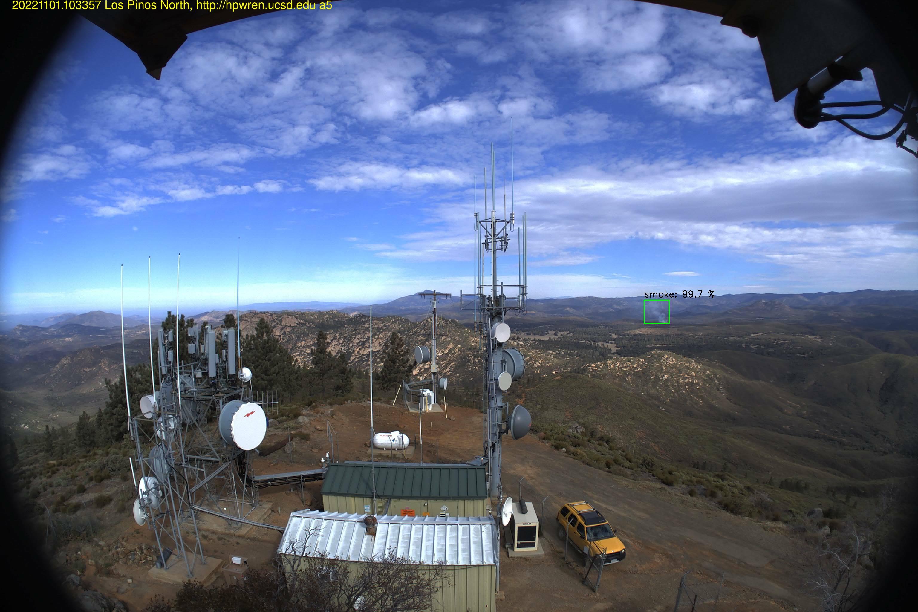
Smoke detected Camera: Los Pinos North, (Camera Lat/Long: 32.73N 116.58W) hpwren.ucsd.edu/cameras at 2022-11-01 10:33:57 Pacific Time cc @CALFIRESANDIEGO #CAwx #CAfire