
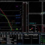




Nov17. GOES19 Al sur-oeste de Galapagos Islands presenta una region con desorganizada conveccion plana sobre mar calido y alta inestabilidad, puede inducir a la formacion de una perturbacion y formacion de racimos de nubosidad convectiva asociada c chubascos proximas 24 horas.


28
Nov13 ITCZ southern branch visualization w GOES19 Composite Overlaid RGB products and Askat sea winds data. To the West of Galapagos Islands with weak activity and to the EAST with expanded-enhanced electric activity.


Oct26 Mar del Ecuador: Confluencia de vientos marinos de componentes Norte y Sur con eje NO/SE apoyo la formacion de un masivo MCS muy activo desde la madrugada, muestra migracion al oeste y debilitamiento. Flujo del Oeste sobre SEGU y Tumbes favorecera lluvias noche/madrugada.


1
170
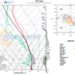
Perfiles d Lima & Trujillo muestran Elevated Mixed Layers en 400Hpa. Para desestabilizar EML estatica y favorecer lluvia, se requiere introducir un forzante dinamico que produzca ascenso. Como n esta zona no hay, solo la presencia d la MJO or KW atmosferica puede inducir lluvia.


Etapas diferentes entre SPIM y SPRU. Lima Td verde muestra proceso de humidificacion x alternancia de capas secas y humedas y vientos cambiantes. Trujillo Td capa MEDIA 95% saturada,avanza hacia atmosfera condicional inestable.Forma d CEBOLLA indica tiene estabilidad en capa baja


Oct16-20UTC Composite: Long-lived MCS formed at Maritime Frontier Colombia-Equator stays alive expanding to the west, it is not linked to the ITCZ, Model generated RADAR reflectivity shows High values of 65 + dBZ. the rain rate reaches 45mm/hr. 4cast trend I expect 10 more hours.


47
Oct16 Long-lived MCS 4casted w Modified-GDI still stays active. Enjoys very favorable environment over the ocean with SST 29C. 850 Hpa stream lines show a very convergent , Also Rain Rate chart depicts very high values, given it's current position I expect MCS will last past noon
32
Oct10 4casting exercise Sat into early Sun Peru-Ecuador border (Zapotillo/Marcara). Ingredient base methodology. Moist Saturated environment/PW 62mm , GDI index 35-45 Fav Convection w SCT RASH. Shallow LCL, Anticyclonic rotation under 700 Hpa, 3h RR 10 mm, some lighting Activity.

39
Oct09 WARF MODEL 7 hours B4 Hrrcne ISAIAS landfall at St, Rosa County Fl. extremely humid environment , very saturated column 2.38 in, strong easterly shear winds below 500 Hpa. Strong OMEGA lifting middle level, Expected Storm Surge > 9 feet, 6hours accumulated rainfall ~ 9 in.


24

