

0xB38F46851825dd9413687e62cE57A3f178d4Af84 Explore the connections between capital, resources, infrastructure and events through one shared globe.
- Tweets385
- Following18
- Followers113
- Likes518




ALT Conceptual overhead relief map of a mountainous coast and small city. A gold event pin connects to cyan clock and source-document icons; a hand adjusts a timeline. Illustrates earthquake location and time context, not an actual event, measured risk or a product screenshot. Official TERRANTIR orbital logo and wordmark at upper left.

ALT Conceptual mineral research desk with copper and pale mineral specimens beside an angled glass map of South American countries. Icon-only controls suggest selecting material and output versus reserves. Not a product screenshot or a map of deposits. Official TERRANTIR orbital logo and wordmark at upper left.

ALT Conceptual aerial view inspired by Jakarta’s coastal urban fabric: dense low-rise blocks, towers, canals and cyan-lit roads beside a dark sea, with distant volcanic terrain. Illustrative city geography, not measured population density or an exact satellite image. Official TERRANTIR orbital logo and wordmark at upper left.

ALT Conceptual layered terrain map above a research desk: a mountain reservoir and dam glow cyan, with solar panels and wind turbines on surrounding ridges. Icon-only fuel tabs highlight water. Illustrates historical inventory filtering, not measured facility locations or a product screenshot. Official TERRANTIR orbital logo and wordmark at upper left.

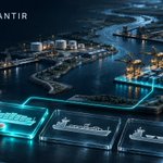
ALT Conceptual close-up harbor research worktable with container cranes, tank storage and bulk cargo piles. A hand selects a cyan container-ship tile beside tanker and dry-bulk tiles, highlighting a container terminal. Illustrative ship-category workflow, not measured traffic or a product screenshot. Official TERRANTIR orbital logo and wordmark at upper left.

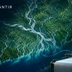
ALT Conceptual satellite-inspired regional view of Bangladesh’s braided rivers and green delta opening onto the Bay of Bengal, with eastern hills and a textile loom in the foreground. Illustrates manufacturing geography, not measured factory locations or a product screenshot. Official TERRANTIR orbital logo and wordmark at upper left.

ALT Conceptual banking-research console over a relief map of western Europe. Two glass selector tiles show stacked slabs and up/down arrows; lavender dashed relationships link map anchors, beside a teal-and-rose inset. Illustrates stock versus change, not measured data, payment routes or a product screenshot. Official TERRANTIR orbital logo and wordmark at upper left.

ALT Conceptual southern Vietnam-inspired river port at dusk, with a container ship, gold-lit cranes, warehouses and cyan-highlighted inland roads. Illustrates trade geography, not a real port photograph or measured traffic. Official TERRANTIR orbital logo and wordmark at upper left.

ALT Conceptual estuary town and countryside at sunrise, with bridges over winding water. A broad cyan disc suggests approximate regional location while a hand presses a location-symbol control on a laptop. Not a product screenshot or measured location. Official TERRANTIR orbital logo and wordmark at upper left.

ALT Conceptual editing display showing a Norwegian-style mountain fjord and three saved-view thumbnails. A gold arrow points from the main view to the cyan-selected middle thumbnail; a hand rests on a desk dial. Illustrates updating a saved shot, not a product screenshot. Official TERRANTIR orbital logo and wordmark at upper left.

ALT Conceptual Kenyan highland landscape at sunset: a road passes small town buildings toward rural homesteads, green hills and a telecom mast. A subtle cyan road contour suggests geographic research, not measured internet coverage. Official TERRANTIR orbital logo and wordmark at upper left.

ALT Conceptual alpine terrain worktable with a lake, river and village. An amber polygon outlines a lakeside area, a cyan line traces a separate valley route and a green pin marks the village. A hand holds a stylus beside three color swatches. Illustrative research annotations, not measured data or a product screenshot. Official TERRANTIR orbital logo and wordmark at upper left.

ALT Conceptual oblique relief map of Mexico, with Baja California, the Gulf of Mexico and Yucatan visible. Gold nodes and cyan threads suggest industrial and port research, not measured trade flows. Shipping containers frame the lower right; the official TERRANTIR orbital logo and wordmark sit at upper left.

ALT Conceptual research monitor showing a Kyoto-inspired street with wooden houses, a bicycle and wooded ridge. The main view preserves the whole wide photograph with dark bars; an inset shows a closer crop. Illustrative framing workflow, not a product screenshot or current imagery. Official TERRANTIR orbital logo and wordmark at upper left.

ALT Conceptual Chilean Pacific energy-import terminal at blue hour: an LNG carrier alongside a jetty leading to two storage tanks beneath dry coastal hills. A cyan pipeline highlight illustrates supply-chain context, not measured flows or an exact facility. Official TERRANTIR orbital logo and wordmark at upper left.

ALT Conceptual tabletop geographic briefing: a Pacific Northwest-inspired port terrain model with wooded hills and an estuary, three storyboard views linked by movement and pause symbols, a stylus and blank notes card. Not a product screenshot or current observations. Official TERRANTIR orbital logo and wordmark at upper left.

ALT Conceptual oblique regional view north along Egypt’s Nile corridor toward Cairo, the widening green Nile Delta and Mediterranean coast at dusk. Gold settlement lights and cyan river highlights illustrate geographic context, not measured population density or current imagery. Official TERRANTIR orbital logo and wordmark at upper left.

ALT Conceptual close-up of a monitor showing a Lisbon-inspired hillside street, tram tracks, tiled buildings and distant estuary at dusk. A small map inset with camera pins and previous/next icons illustrates expanded camera inspection, not live footage or a product screenshot. Official TERRANTIR orbital logo and wordmark at upper left.

ALT Conceptual water-level view toward a Norwegian-inspired hydroelectric dam and illuminated powerhouse, surrounded by steep rocky slopes, sparse conifers and snow-patched mountains at dusk. Illustrative energy infrastructure, not an exact installation or current conditions. Official TERRANTIR orbital logo and wordmark at upper left.

ALT Conceptual Alpine lake terrain model with mountains, villages and a river. A glass search panel shows icon-only layer rows, two glowing cyan, linked to an illustrative overlay above the lake. Not a product screenshot or measured data. Official TERRANTIR orbital logo and wordmark at upper left.