
Built a Long Barrow, Wiltshire Farmer, worked at Stonehenge.
Devizes Wiltshire
Joined June 2010
- Tweets9.1K
- Following1.5K
- Followers3.2K
- Likes28.9K


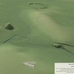




sarsen.org/assize-courts an interactive 3D model of the planned new @wiltshiremuseum in Devizes. (Unofficial - by me)

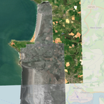
timdaw37.github.io/devon-coa… Visualising the sea level rise by matching the beach at the same part of the tide cycle as photographed in 1940 - more info at sarsen.org/2026/10/rising-se…

Tim Daw retweeted

I thought I'd found a remarkable prehistoric alignment. Then LiDAR changed my mind.
Nine Ladies, Andle Stone and Doll Tor lie on an almost exact 240° line across Stanton Moor.
But what if the most important feature isn't a monument at all?
I built a LiDAR Lens to investigate. What emerged changed the hypothesis.
Read the story and explore the map 👇
stonetemplegardening.com/pos…


Mae LiDAR Lens Ynys Môn yn dangos Môn gyfan mewn LiDAR 1 m, mewn gwyliwr cyflym am ddim sy'n gweithio cystal ar ffôn mewn cae ag ar gyfrifiadur. lidar-lens-anglesey.tim-daw.…

Tim Daw retweeted

Great excitement chez moi. h/t @Timdaw, LIDAR.
Walking to Weybourne, our WW2 tank ditch has to sit in the imagination - it was largely filled in by 1952. But lo! The invsibilitymagickthing reveals works and wotnots everywhere. Thank me later.
Example: shorturl.at/NlF6X


lidarlens.sarsen.org - the comprehensive free LiDAR viewer for England and Wales - No ads, no app, phone or laptop.
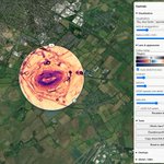
LiDAR Lens lidarlens.sarsen.org/ is, I think, the best and most complete free LiDAR tool there is for England and Wales. Every square metre of both countries' 1 m LiDAR is there, live, in a lens you drag across the map. You can light it from any angle, exaggerate it, and switch between hillshade, multi-direction hillshade, slope, local relief, sky-view factor, aspect and red relief, until faint banks, ditches, barrows and lost field systems jump out. Click any spot and it tells you the ground's measurements and the recorded sites nearby, with links straight to the records. Old OS maps, aerial photos and modern maps sit underneath for comparison. It works on a phone in the field as well as on a desktop. It costs nothing, there is no login, no account, and no adverts. sarsen.org/2026/10/lidar-len…

The other great henge landscape, in North Yorkshire. A LiDAR Lens for the Ure henges. sarsen.org/2026/10/a-lidar-l…

Tim Daw retweeted

✨ NEW VIDEO - OUT NOW! 💫
Discussing upcoming survey work from the Thornborough Archaeology Group! And plugging their fundraiser.
They've already been bumped almost £2000 since the video landed... which is wild.
Link: youtu.be/D_R0bgNgY2o?si=42aU…

Tim Daw retweeted
A fantastic LiDAR tool from the great @Timdaw!
Explore the Vale of Mowbray in Local Relief, like I do on my YouTube channel 😵💫 Go and discover some henges!
#archaeology
Link here: lidar-lens-ure.tim-daw.worke…


Historic Wales Beta is now live! Explore historic environment data from RCAHMW, Cadw and Heneb over newly-digitised historic maps including early Ordnance Survey and Enclosure maps, and maritime navigation charts: zurl.co/T5NQI #HistoricWales #WelshHeritage