

Youtube channel on a journey back through time on Ireland's southeast. Subscribe to get updated on my newest content: https://teapawt.org/t.co/fMsO9IJnDm
Waterford, Ireland
Joined April 2019
- Tweets1K
- Following40
- Followers920
- Likes1K
The LIDAR scans on ARCGIS are interesting. Quite a few ráthanna clearly visible on there that aren't documented on any OSI surveys or the HEV. Makes you wonder how many are lost to time.


My great-grandfather James Cuddihy, with his grandparents John Russell and Honoria Quinlan. Taken by AH Poole c. 1925 in Gorrue, County Kilkenny.

3
123
The Cross (#1) Waterford. Named for the historic market cross that once stood at the end of Patrick Street. It was demolished in 1750, but is still named the cross by the older generation in Waterford to this day.

2
119

I was interested in confirming this local story about the origins of the name of Paddy Browne's road. I discovered it was indeed true. Paddy Browne's road ran through the land of a Patrick Browne, who had a 30 acre lease from Thomas Wyse, Esq.


@tidesntales Do you know if there are records of harbour masters and deputy harbour masters for Waterford? My 4th great-grandfather Patrick Lawlor (also spelled Lalor) was listed as the deputy harbour master, I'm wondering if there are any records on him.

1
1

Turgesius Tower, shown here on a 1673 map stood at the end of what is now Barronstand St. by the AIB bank. The Tower was part of the original Viking walls, built circa 1000 AD and marked the perimeter of the city walls. The tower was demolished at the start of the 18th century.

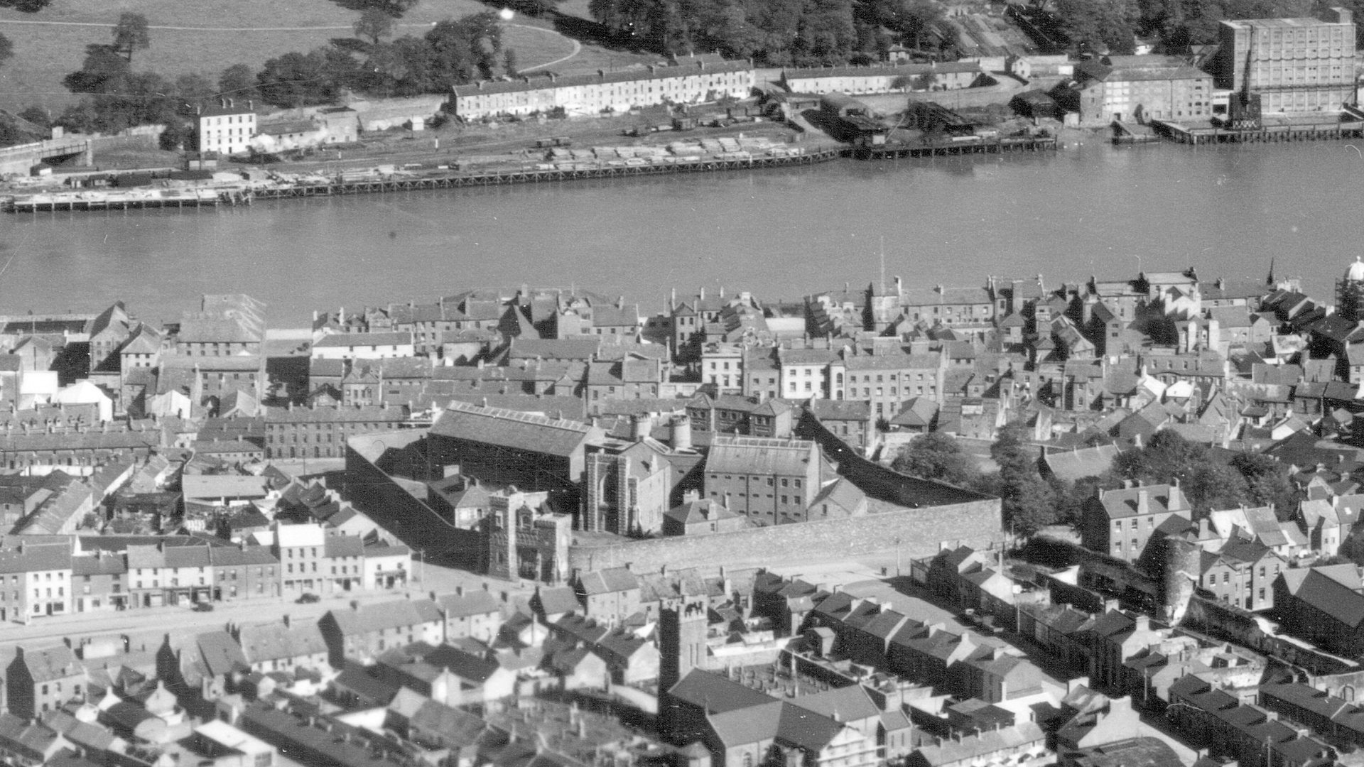
Ballybricken Gaol (1948). Originally built in 1727 on the site of a military barracks.
On the 4th March 1943, a section of the gaol wall collapsed on top of homes adjacent to it, killing nine people. It was knocked a year later in 1949.
Colourised with @DeOldify & photoshop.

6

New ancestry.com update - My Irish went from 93% to 97% and they threw in a cheeky bit of Norwegian. Well, I guess I'm a viking now.

2

On the 1837 6 inch OSI map, it's referred to as Fish Cove, but on the historic 25" map - it's referred to as the Guillameen for the first time:


1
4
A 1737 harbour chart labels the area as Lady Mary's Cove, but unsure if that's a reference to Newtown Cove or the Guillameen (or both). Same with another harbour chart from 1787


2

