

Meteorologist @NMasUnivision in Miami @UnivMiami Grad @AMetSoc CBM & CDM @nwas Certified @AMS_SSC 2025 Chair AMS CDM Board & CBM Board 2024 Chair @AMSCerts
- Tweets55.3K
- Following2.8K
- Followers4.4K
- Likes45.1K


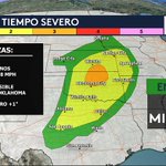
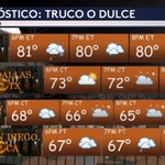


ALT Flood Watch in effect for southeast Florida beginning this afternoon and running through Thursday evening. Periods of heavy rainfall may lead to urban and poor drainage flooding.



ALT Excessive rainfall outlook graphic


ALT Winter Storm Warning for forecast area mountains above 4000 feet for 1-3 feet of snow above 5000 feet, up to 12 inches between 4-5000 feet and dusting as low as 3500 feet. Road closures, chain controls and snow rates of up to 1-2 inches per hour at times.


ALT Weather forecast graphic for Tuesday night, November 17, 2026, issued by the National Weather Service Houston/Galveston, Texas. The graphic outlines tonight's outlook as cool and dry with clouds building overnight, decreasing wind speeds, and forecasted overnight lows ranging from 44 to 53 degrees Fahrenheit inland and 48 to 60 degrees Fahrenheit at the beaches. The graphic also mentions a 20% chance of rain offshore late tonight.

ALT National Weather Service graphic for weather conditions on Wednesday, November 18, 2026. The graphic details that Wednesday will be partly cloudy and a touch warmer than Tuesday, with high temperatures between 68 to 73 degrees Fahrenheit.

ALT Small Craft Advisory in effect for the offshore Gulf waters through Wednesday at 6 PM. Small craft should exercise caution in the nearshore waters until Wednesday at 6 PM.

ALT Extended Outlook graphic from the National Weather Service Houston/Galveston office. Graphic illustrates that the weather will be dry with a slow warming trend for the next several days. Slight rain chances return later this weekend.




ALT This is a multiday forecast graphic for northern Illinois and northwest Indiana. Headline: Five Day Outlook. Sub Headline: Dry with above-average warmth into Saturday. Shower Chances return late Sat into early Sun. Visit weather.gov/Chicago for more forecast details for your location. Graphic Created: Tuesday, November 17, 2026 1:36 PM CST


ALT Weather map of the United States showing forecast precipitation amounts from Tuesday, November 17, 2026, to Sunday, November 22, 2026. Colors indicate amounts, with reds and purples showing heavier rain.

ALT Winter Storm Severity Index valid through Thursday evening.

ALT A storm system is on its way to Southwest California, bringing moderate to heavy rain with totals of 1-3 inches across the region and 3-6 inches across the mountains and foothills. There is a 10-20% chance of thunderstorms, with the threat of locally heavy downpours and downburst winds. Additionally, snow levels will gradually drop to 5,000 ft through the storm. There is a high risk for significant roadway flooding, a high risk for strong creek flows, and moderate risk for rockslides and mudslides.

ALT Timing: Coast Range/Shasta Mountains: 7 PM Tuesday - 4 AM Thursday, Nov 17-19, 2026 N. Sierra/ S. Cascades: 10 PM Tuesday - 4 AM Friday, Nov 17-20, 2026 Forecast: 4-8 inches of snow between 4000-5000 ft Up to 1 ft at 5000 ft Between 1-2 ft above 5000 feet Up to 3 ft at the highest peaks Snow rates of up to 1-2+ inches per hour at times Impacts: Significant reductions in visibilities at times Major travel delays likely Chain controls likely Potential for road closures Travel is highly discouraged


ALT On the left, a map of the weather prediction center 8 to 14 day precipitation outlook. On the right, forecast details.