

WTUS Southeast is a sub-account of @weathertrackus We cover the Southeastern region of the US. #WTUS
HQ - Birmingham, AL
Joined August 2021
- Tweets754
- Following33
- Followers189
- Likes493





WTUS Southeast retweeted

Traffic is heavy at I-20 & MS-35 as folks are trying to get off as I-20 & MS-481 is closed Southwest of Forest, MS due to flooding.
If you're out and about, please avoid flooded areas and do not attempt to enter them!
#mswx #mstraffic #flood


WTUS Southeast retweeted
On This Day, 30 Years Ago, Hurricane Andrew was on it’s approach to South Florida where it would make landfall just south of Miami, FL at around 5am, Aug 24.
These are probably one of the most memorable images taken of this devastating feat of nature.
#flwx #wxhistory #weather


WTUS Southeast retweeted
1/2
Life-threatening flash flooding continues until 10:30pm for areas north of Charleston, SC.
Several inches of rain have fallen and some more is on the way.
NEVER attempt to cross flooded roadways!
#scwx #weather #wxtwitter
WTUS Southeast retweeted
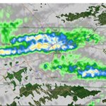
Today’s storms in parts of #Mississippi & #Alabama will be random and scattered in nature…
Y’all can expect thunderstorms in which a couple may be severe from this afternoon into this evening and maybe tonight.
The primary threat will be damaging winds.
#mswx #alwx #weather
WTUS Southeast retweeted
#Charleston, SC continues getting soaked by Invest #96L just skimming the South Carolina coast tonight.
Rain will persist for a little longer as this tropical wave slowly moves eastward.
If you encounter flooded areas, do NOT attempt to cross!
#scwx #weather #wxtwitter
WTUS Southeast retweeted
Oop. Got a little swirl east of #Savannah, GA, but this does not mean it is currently tropical. Sure could be mistaken for a tropical storm right now, though.
#scwx #gawx #weather #wxtwitter
WTUS Southeast retweeted
#OTD: 10 Years Ago - June 29, 2012 Derecho
From Southeast of Chicago to past Washington, DC;
A large, powerful and destructive derecho occurred.
Unfortunately, 22 were killed as a result.
Wind gusts peaked at 91 in Fort Wayne. IN.
#wxhistory #wxtwitter #weather


WTUS Southeast retweeted
Towering convection building up on these pulse storms with an overshooting top. One of the most impressive structures I’ve seen in a while. @NWSAtlanta @GlennBurnsWSB @BradNitzWSB @spann @Northeast_GA_WX


WTUS Southeast retweeted
Our focus for the next little while will be tied to these storms in North Central TN...
This cell has some work to do to organize after merging and competing...
It's still an IF this cell will reorganize and attempt another circulation.
But as always, watch, not fear.
#tnwx


WTUS Southeast retweeted
Great video from Morgan showing waves in Eastern NC!
Yes, even tropical storms can cause minor storm surge well outside of the main impact area.*
As #Alex moves ENE, waves will likely persist for at least for the next 24 hours and then diminish after that.
#ncwx #weather

Tropical Storm Alex is making big waves at Union Point in New Bern, NC. Even though it’s far off the coast, we’re feeling it here! #wxtwitter #ncwx