

Weather Enthusiast | NOT a Meteorologist | Located in South-Central PA | Focus on Severe, Tropics, and Winter
Joined November 2024
- Tweets9K
- Following759
- Followers2.3K
- Likes146K





a multi-day what now

Could Germany experience a multi-day Dunkelflaute period beginning October 29?
Today's 00Z AIFS-ENS and ECMWF forecasts indicate a more persistent low Dunkelflaute Risk Index (DRI) signal than GEFS.
The percentage of ensemble members forecasting at least 3 consecutive days below the historical 10th-percentile DRI threshold is:
• AIFS-ENS: 49%
• ECMWF: 37%
• GEFS: 13%
These percentages cover each model's forecast horizon and represent ensemble-member fractions, not calibrated event probabilities.
Explore the Point-in-Time Weather Forecast API: worldclimateservice.com/pit-…
#Dunkelflaute #EnergyMeteorology #Germany


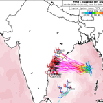
Storm in the Bay of Bengal (named Arnab) is now likely rapidly intensifying as it closes in on India's eastern coast. May weaken just before landfall tomorrow, but with a core this small, anything is possible.


Weather Sphere retweeted

A look at the damage from Saturday's tornado in Santa Fe.
The tornado has been rated a high-end EF-1, with 110 mph winds. It traveled 1.4 miles, damaging 10 homes, power poles, and trees.
This was Santa Fe's first documented tornado in 55 years.
📸 PNM, City of Santa Fe #NMwx


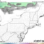
This winter looks to repeat our pattern of warm, relatively snowless Decembers.
Might as well just make it an autumn month at this point 🗿


3 years ago, early in the morning...
Still crazy to think that we watched Otis go from 50mph to 165mph in a span of 24 hours.

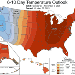
The ridge of heat that just keeps on giving.
The Northeast, namely coastal regions, will escape much of the well above temps for now.


Substantial mountain snow and coastal rain will be coming to the PNW, northern Rockies, and Sierra Nevada this week. Hopefully a sign of things to come, as drought conditions have worsened in the area the past few months.


Still looking at a potentially historic tropical cyclone impacting eastern India early next week.
Models have backed off a bit in strength, but AI guidance continues to rapidly strengthen anything that forms.
A second cyclone may form just south of the first a couple days later.

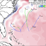
Low chance of some tropical/sub-tropical development in the SW Atlantic in early November. Likely the last chance of anything tropical in the Atlantic this year.

Weather Sphere retweeted

Polar Vortex update: the 12z suite of models is slowly pulling towards agreement, with the 12z ECMWF now pulling back the reversal and showing good agreement with GFS in terms of #polarvortex strength. Heighy anomaly wise, GFS and AIFS are in good agreement.
But make no mistake, even without a reversal all main 3 models agree on reaching the weakest Polar Vortex on record for this time of year. Tho its still too early in the season and this event, to talk any long-term impacts, especially since a rebound is expected for the Polar Vortex, and the Super El Niño is ramping up for the season.
But overall, this is still a significant event in the making for this time of year.
All the plots (and more) are available in my Polar Vortex monitor hub, link in the comments. 👇


No early winter in sight for the eastern US unfortunately... average to above average temps look to hold strong through most if not all of November.
Weather Sphere retweeted

Kind of a low probability event at this point, but there's a slight chance we could see some tropical or subtropical development in the SW Atlantic on the north side of the jet in a week or so. GFS is probably being a little silly, but there is some ensemble support from Google DeepMind WNV3 as well. Something to keep an eye on.

