
Weather in the Philippines. Ph.D. in atmospheric physics. Prof. of Meteorology - University of the Philippines Diliman.
Philippines
Joined December 2011
- Tweets1.6K
- Following906
- Followers5.7K
- Likes2.6K


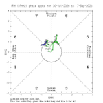




Our newest study on what extreme heat and heavy rainfall will be in NCR by 2070. Considering more built-up areas and more land reclamation, max temps estimated to rise by 2.4°C (and that's a conservative estimate) & habagat rains/heavy thunderstorms may be suppressed

ALT doi.org/10.1007/s00704-026-06677-y


rains projected today for NCR/W.Luzon a bit less than the previous projection, but rains nonetheless that may continue until tomorrow/Thursday-ish


looks like smoke from the Indonesian fire covers a large part of southern South China Sea this morning, most likely will affect Palawan, and perhaps some other parts of Visayas today


WeatherManila retweeted

Our crews are currently flying Hurricane Lowell in the Pacific, gathering data real-time and sending to the NOAA NWS National Hurricane Center. The crews have seen a max wind speed at 150 knots and 927 milibars for barometric pressure and it shows strengthening.
Video and photos by pilot Maj. Forrest Heintz below shows what the eye of Hurricane Lowell looks like right now.
Stay #WeatherReady


looks like a bit more rain in the next couple of days for Central and SW Luzon (esp. NCR), Occidental Mindoro


some rains projected for tomorrow in NCR, hopefully will clear up some of the long-range transported haze (but not for the rest of the country, unfortunately)


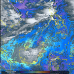
20260901 830pst visible (left) and aerosol optical depth (right; aod ~1 is more or less polluted), difficult to see because of the clouds but those w/ aod values, ~>1.5


Ang El Niño ay nagpapalakas ng Habagat (mas maulan) at nagpapahina naman ng Amihan(dry winter conditions),bakit?
Kapag uminit ang karagatan sa silangan ng Pacific (depinisyon ng El Niño), napapaakyat nito ang hangin, and anything that goes up must come down, bumababa itong (1/4)

(mas nagiging maulan ang mga panahong Jul-Aug-Sept). Pagdating ng Amihan, mapapansin na magkasalungat ang direksyon ng anticyclone at hanging Amihan, kaya humihina ang Amihan at nababawasan ang ulan mula Nov-Feb.