

Keep web maps open for a better world. Test new technologies for future geospatial operations. / Lead, UN Smart Maps Group, UN Open GIS Initiative.
Japan
Joined June 2008
- Tweets16.1K
- Following786
- Followers776
- Likes9.7K






hfu retweeted

Excited to share a new open-source project for the web-mapping and LiDAR community: maplibre-gl-lidar 🚀
With maplibre-gl-lidar, you can visualize large-scale LiDAR point clouds (LAS/LAZ, including COPC) directly in the browser using MapLibre GL JS. It supports point-cloud data stored locally or hosted on the web, and comes with an interactive GUI featuring customizable color schemes, classification legends, and point picking. It even works seamlessly inside Jupyter Notebooks.
Visualizing tens of millions of LiDAR points has never been this simple or fast, making it easy to build modern, lightweight, and fully interactive web-based LiDAR viewers.
Try it out:
Live Demo Viewer: lidar-viewer.gishub.org
GitHub Repository: github.com/opengeos/maplibre…
Full Video Tutorial: youtu.be/lV3oKk2WTEo
#MapLibre #LiDAR #WebGIS #OpenSource #PointCloud #3DMapping
hfu retweeted

🎉 Our Mapper of the Month for June is Paolo Frizzera from Italy.
🗺️ Paolo is celebrating his 10th year in #OpenStreetMap. We asked about his journey and to share any advice to new mappers. ✨
Read his interview 👉 tinyurl.com/MOTM0625
#UNMappers #UNMaps #OpenStreetMap




hfu retweeted

【リリース】
「点群タイル閲覧サイト」を試験公開
地表面に建物や植生等を加えた表層面の状況を臨場感のある立体的な表現で見ることができます。
点群タイル閲覧サイト:
gsi-cyberjapan.github.io/3dp…
※メニューの「点群>表示」をチェックしてください。
▼詳しくはこちら
gsi.go.jp/johofukyu/johofuky…

With just a single line of code, the MapLibre GL JS v5.0.0 globe feature comes to life—instantly! Huge thanks to the brilliant minds in the MapLibre community for making this possible! observablehq.com/@hfu/layer-…
hfu retweeted

Finally here! Explore Korea's visionary 6 new towns in stunning @opengeospatial 3D Tiles? Visit dtinfo.lh.or.kr/ and choose one to begin virtual tour. All data has been converted into 3D Tiles using mago3DTiler(github.com/Gaia3D/mago-3d-ti…), an open-source 3D Tiles converter.


hfu retweeted

We released the maplibre-cog-protocol to display @cogeotiff (RGB images, DEMs for terrain or hillshading, rasters colored with ColorBrewer) in @maplibre
npmjs.com/package/@geomatico…
github.com/geomatico/maplibr…
Feedback is welcome!

hfu retweeted
🗺️State of the Map 2024
Diego Gonzalez presented how #UNMaps has been both using and contributing to #OpenStreetMap #opendata and #community through mapping for #peacekeeping and capacity building activities.
Join us! 🙌

hfu retweeted

built pmtiles-styling.pages.dev to make it easier to style protomaps basemaps
this is me using it (alongside chatgpt) to create a fall-themed basemap

hfu retweeted
🌟 Congrats to our Mapper of the Month: Taichi Furuhashi - @mapconcierge, professor at Aoyama Gakuin University in Japan 🇯🇵
🎓Driven by a passion for empowering communities, Taichi enrolled his students in our #OSM validation course.
Read the interview➡️tinyurl.com/MOTM0824

hfu retweeted
📢 On the occasion of the Paris 2024 Olympic Games, we are offering our volunteers a truly exceptional competition: the UN Mappers #MappingChampionship!
🗺️ Test your mapping skills, map with us, and climb to the podium! 🏅
Ready, set, map!👉tinyurl.com/MapChamp

hfu retweeted

Country-Wide Terrain Tiles on Demand. From Cloud Optimized GeoTIFFs (COG) to quantized-mesh terrain format research.geodan.nl/country-w…


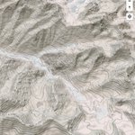
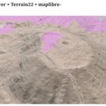
#Terrain22 is now available in South and East Asia. optgeo.github.io/terrain22/#… #PMTiles through @source_coop. Added #maplibre-contour.
#栃木県 w/ #林野庁森林整備部 #森林資源データ #樹種ポリゴン & 0.5m #デジタル標高データ with Maplibre GL JS and Observable observablehq.com/d/127ac70c1…
Added global contour line support to #Terrain22 using @maplibre-contour (thx to @smellman). observablehq.com/d/15509f3ef… DYK how to use WEBP terrain tiles in (@source_coop-hosted) @protomaps #PMTiles with maplibre-contour? This version uses terrarium instead.

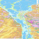
Global landform classification #Terrain22 #PMTiles now covers Cairo, Egypt. optgeo.github.io/terrain22/#…
