

Hi, I'm Paxton!! I'm a storm photographer in Ontario!🌪 Count: 5 (and 4 spouts) Links: https://xitter.cf/t.co/tDuWuM22Ud
Hamilton, ON / Caledon, ON
Joined September 2020
- Tweets133K
- Following2.5K
- Followers3.4K
- Likes392K





Pinned Tweet
Just realized I haven't posted my other decent shot of the Bergen, AB EF2 Tornado from July 7th, 2022! This was after it came out from inside those rain curtains of the first photo I had posted. Personally, it's my favourite shot of that day! 😳
#StormHour #ABwx #ThePhotoHour

ALT Bergen, AB EF2 Tornado - 07/07/2022



alluringstorms 🇨🇦 retweeted
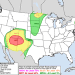
7:46pm CDT #SPC Day1 Outlook Marginal Risk: across portions of eastern New Mexico and Far West Texas spc.noaa.gov/products/outloo…


alluringstorms 🇨🇦 retweeted

Hey folks.
The Twistex memorial on google maps has been completed overrun with AI slop, Roblox videos, random memes, and fancams(?).
Please do me a favor and report any photos that aren't actually of the memorial.
Thank y'all ❤️
maps.app.goo.gl/eJ8UibPcmwvX…

alluringstorms 🇨🇦 retweeted

Pretty high values for being so far out.. though with it being >7 days out, lots will likely change. Something to continue to monitor!


alluringstorms 🇨🇦 retweeted

this will be bjorn’s account now. here is a small introduction: he is a 4 year old cymric who was adopted from a local rescue group. he has a very goofy personality, he likes to lick your fingers and is curious about water. he says it’s nice to meet you all🫶

alluringstorms 🇨🇦 retweeted

5:25a FROST ADVISORY (YELLOW LEVEL) UPDATED by Environment Canada
(Locations listed below description)
Patchy frost is expected early this morning, particularly for inland areas.
Take preventative measures to protect cold-sensitive plants, trees, and crops. Cover up plants, especially those in frost-prone areas.
Please continue to monitor alerts and forecasts issued by Environment Canada. To report severe weather, send an email to [email protected] or post reports on social media using #ONStorm.
UPDATED:
- Brampton
- Grimsby
- Mississauga
- Niagara Falls
- Northern Niagara Region
- Southern Niagara Region
- St. Catharines
- Welland

alluringstorms 🇨🇦 retweeted

Might need a damage survey near Lynx Lake #azwx @NWSFlagstaff


alluringstorms 🇨🇦 retweeted

Avoiding 1.5 C of warming above pre-industrial levels is now impossible, and a new pathway to limit peak warming and then bring temperatures back down will be needed, according to an annual UN report on global climate action.
ow.ly/ULkC50ZZVqL

alluringstorms 🇨🇦 retweeted

TikTok finally let us have our account back! Apparently, we weren’t in the forecast. 😂
We’re back with regular WeatherWise content - quick tutorials, useful app features, and weather education that helps you understand what you’re seeing on the map.
New to WeatherWise or ready to learn a few more tricks? We’ve got you covered.
Follow WeatherWise on TikTok. We’ve got some catching up to do! ♥️

alluringstorms 🇨🇦 retweeted

Good example of MESH peaking when hail is aloft. The severe hail reports follow shortly after as the stones fall out. #azwx
alluringstorms 🇨🇦 retweeted

Sub-tropical storm Josephine will be beneath us this weekend with CAT1 strength winds offshore 👀 @ThatMetGirl

alluringstorms 🇨🇦 retweeted

Oct 21 Wed afternoon: NHC is monitoring 2 systems over the central and NW Atlantic Ocean. The westernmost one (Invest #AL93) has a 50% chance to become a subtropical storm, with low chances for the system well E-SE of Bermuda. More: hurricanes.gov


alluringstorms 🇨🇦 retweeted

this will be the first tornado watch in the western US all together since october 6th, 2010


alluringstorms 🇨🇦 retweeted

Wow! Amazing sky at sunset this evening. A marvellous view from my patio.
Bonavista, NL
#ShareYourWeather #Newfoundland
alluringstorms 🇨🇦 retweeted

Potentially strong tornado moving into the town of Overgaard, Arizona in Navajo County. Tornadic debris signature on the KFSX radar!

alluringstorms 🇨🇦 retweeted

Whoa. A milestone reached. Final edits on the book are done. Just some cleanups and an acknowledgment section and it all goes to my publisher. Whoooooo! April 20 is the launch date! Eeeeeeep. @ecwpress @weathernetwork

alluringstorms 🇨🇦 retweeted
⚠️ Monitoring Ongoing Chemical Leak in Toledo, Ohio for Potential Impacts in Southwestern Ontario
We are closely monitoring an ongoing hazardous chemical leak in Toledo, Ohio, just across the border from Southwestern Ontario, for any potential impacts on our side of the border.
The incident began late Tuesday evening, prompting officials to order evacuations and shelter-in-place measures in parts of North Toledo. Officials have also expressed concerns about a potential explosion as crews work to contain the leak.
The chemical involved has been identified as glycidyl methacrylate, an industrial chemical that can pose health risks if inhaled or through direct exposure.
Given Toledo’s proximity to Windsor and Essex County, we are keeping a close eye on the situation, particularly the potential for airborne chemicals to travel across the border.
The good news is that current wind patterns are carrying the air away from Southwestern Ontario. However, wind direction can change, so we will continue monitoring conditions closely.
At this point, there is no indication of a threat to communities on the Canadian side of the border. We want to emphasize that we are monitoring this out of an abundance of caution.
We will provide further updates if there is any indication of a potential impact on our region.
- Brennen
