

Serving beef producers in the Nebraska counties of Blaine, Cherry, Grant, Hooker, Thomas and beyond.
- Tweets3K
- Following2.1K
- Followers1.6K
- Likes24.4K






ALT A two-panel forecast graphic titled "Cooler Monday with Rain for Most/Snow for Some" created by NWS North Platte on Monday, October 26, 2026. The left panel, "Potential for Snow (late AM/early PM)," shows a dividing line running west of Mullen and Valentine, indicating snow potential confined north of Highway 2 and west of a Hyannis to Nenzel line. Ellsworth shows a 14% chance (low potential) and Gordon shows a 47% chance (medium potential), with 0% snow potential across the rest of the region. Callout text notes that accumulations are not expected, though brief reductions in visibility are possible. The right panel, "Monday's Afternoon Highs," shows widespread rain chances (over 90%) across the coverage area, transitioning to a rain/snow mix icon near Gordon and Ellsworth. High temperatures range from 39°F in Gordon to 54°F in Curtis. Winds shift north to northeast at 10-20 mph with gusts up to 25 mph.


ALT Cattle grazing in pasture. "Fundamentals of Feeding the Cow November 9th, 12th, 16th, and 19th |. 7:30-8:45 pm CT." is written at the top. The CAP logo is in the bottom right corner.


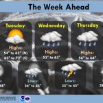
ALT A National Weather Service weather forecast graphic titled "The Week Ahead" for North Platte, Nebraska, issued on October 12, 2026. Daytime Forecast (Highs):Monday: Sunny; Highs 68° to 78° (North), 79° to 89° (South). Tuesday: Partly cloudy; Highs 54° to 62° (North), 63° to 72° (South). Wednesday: Rain showers; Highs 53° to 63°. Thursday: Rain showers; Highs 56° to 64°. Friday: Sunny with morning frost; Highs 54° to 60°. Nighttime Forecast (Lows):Monday Night: Clear sky; Lows 36° to 48°. Tuesday Night: Rain showers; Lows 34° to 45°. Wednesday Night: Rain and thunderstorms; Lows 35° to 45°. Thursday Night: Partly cloudy; Lows 28° to 39°.

ALT Old farmers lean up against truck and talk to younger farmer. The words "Ideas for Estate and Transition Planning GIft Leaseback" are written at the bottom.

ALT Cows standing in pasture. "Fundamentals of Feeding the Cow" is written at the top. "Nebraska Extension Webianr Series" is written at the bottom. The CAP logo is in the bottom right corner.


ALT Cedar Workshop flyer Oct 14 in Halsey 1:30-4 CT

ALT aerial photo of rangeland recovered from wildfire

ALT Five-day forecast for western and north-central Nebraska from Tuesday through Saturday. Highs today reach the mid to upper 80s, followed by cooler temperatures Wednesday and Thursday. Thursday highs range from around 70 to 80 degrees. Temperatures warm again Friday and Saturday, with highs reaching the upper 70s to upper 80s. Dry conditions are expected throughout the period.

ALT Lady looking out the window of truck. The words "Setting Expectations for Land Link Relationships" are on the right side.

ALT Graphic depicting forecast highs and weather conditions for select cities across western and north central Nebraska for Saturday October 3rd through Wednesday October 7th.

ALT Monthly outlook for October.

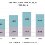
ALT Bar graph depicting Nebraska Hay Production in 2022, 2023, 2024, 2025, and forecast hay production in 2026.

ALT Hay bales in meadow at UNL Gudmundsen Sandhills Laboratory.

ALT 2 black cows in grass

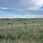
ALT Cows grazing pasture.

ALT A graphic showing that rain chances will be on the increase this week across western and north central Nebraska.