

Data Science, geography, earth observation/remote sensing. MA/PhD @ucsbgeog & @COFOregonState
San Francisco, CA
Joined October 2017
- Tweets525
- Following534
- Followers229
- Likes1K







Burke Greer retweeted

Curve-Fitting. If you ever worked with a quantitative dataset in academia or in the world of business you might feel personally attacked. I for one sure like clicking "smooth lines" in Excel 😬 Source: buff.ly/3OtTgKv

Watching Triston Casa on @RedSox give a live interview during actual play and what the heck is happening? How are they still talking?
1
2
287
See you there. And please let me know if you’re attending and you want to meet up.

Edgybees SKY is now native to GXP!
Come see our demonstration of our imagery georegistration tools integrated with BAE products at GXP360 at booth #1.
See you there!
1
141
Anyone else seeing @SlackHQ stripping location data out of geotiff headers in shared files on slack? What a rabbit hole.
2
2
243
Burke Greer retweeted

.@Synthetaic's imagery analysis platform RAIC unearthed a dozen photos of the balloon from millions of square miles of satellite imagery based on a sketch drawn by the company's founder @CoreyJaskolski. nytimes.com/interactive/2023…

My weather station here in Pacifica just hit 29.4 and it’s still dropping!


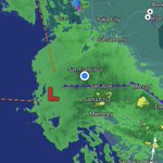
Models are starting to converge on a bomb cyclone making landfall near the Bay Area tomorrow as California gets hit by yet another significant storm.
Widespread heavy rain, flooding, damaging winds, and heavy mountain snowfall is likely, especially for Central CA/SoCal.
1
1
288



We're kicking off 2023 by hiring a Technical Product Manager to the Edgybees team. Interested? Come join us (and please share with anyone you think might be interested)! lnkd.in/dQv-HUwA
87
👎
You’re unable to view this Post because this account owner limits who can view their Posts. Learn more
2
76
We're hiring a technical product manager here at Edgybees to build products that help users fully leverage data from space. Interested? Please apply! lnkd.in/eRtUvwXb
3
fwiw, I presented to rooms of people in California circa 2006 whose communities were presented two choices: 1) pay for better maps, 2) keep existing maps and also their property values. Guess what they chose?

Why?
1) FEMA maps are not designed to capture certain types of flooding, esp. "pluvial" flooding (due to surface runoff from intense precip)
2) Modeling based too strongly on observed historical events
3) Climate change is increasing intensity of extreme precipitation events
1