

Intelligence for the physical world
Joined November 2021
- Tweets87
- Following1
- Followers79
- Likes30





Pinned Tweet
In a world where knowledge is power, @getlayerxyz is empowering citizens, governments & businesses with accurate spatial data from 120+ public & private datasets sourced from leading space agencies & commercial providers, enabling teams to work together in shaping our cities.🌐💡
Layer retweeted

Introducing @getlayerxyz to the readers of #thinkthinkthink. An old aspiration to organize knowledge and data in better understanding and thinking about cities.
thinkthinkthink.substack.com…

Layer retweeted
Merry Christmas and Happy Holidays with some inquisitive maps from Rovaniemi - the capital of Lapland in northern Finland - but most importantly the "official" home-town of Santa Claus!
Quite a bit of forest loss in the past twenty years demonstrating increased activity in the elven toy factories. The city was actually designed by Alvar Aalto after being largely destroyed during the second World War: the historical settlement footprint map illustrates the touch of the architect with the city being designed in the shape of a reindeer's head. The rugged terrain probably accounts for the need of magic reindeer to get around.


Layer retweeted

In this podcast, we dived into the shift towards a more decentralized and organic approach to city planning with Joni Baboci, an architect, planner, and urban enthusiast. @getlayerxyz
#CityPlanning #FromSeries4 #Podcast
buff.ly/44TZgBG
Beyond Layer's extensive globally available data catalogue (beta.getlayer.xyz/catalogue) we also offer customized data and spatial analytics tailored to the needs of a diverse set of clients.

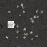
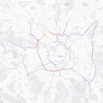
Researchers, professionals, & planners can use @getlayerxyz to study & compare the density/accessibility of a city's public transportation network. Here's an example from @ComuneMI with data from @openstreetmap, @WorldPopProject and custom analytics from @getlayerxyz.
4. Out Multiple Accessibility Index overlaying 19 indicators in providing a comprehensive view of service accessibility coverage at 10/15/30min walking distance intervals + overlaid with population density closest to each public transportation station.

Check out your own city for free at beta.getlayer.xyz/signup or get more information on each of our available layers at beta.getlayer.xyz/catalogue
#publictransportation #mobility #transportation #spatialdatascience #globalcoverage


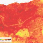
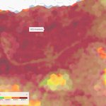
Examples from Cape Town, Tirana, Rome and Montevideo. Sign-up and check out more cities for free at beta.getlayer.xyz/signup!
#global #environmental #carbonaccounting #geospatialdata #spatialdatascience