

Physical volcanology research at @Haskoli_Islands 🌋- fieldwork, labwork, hazard monitoring and remote sensing - we do it all! ⚒️🔬
Reykjavík, Iceland
Joined August 2022
- Tweets114
- Following69
- Followers356
- Likes32




Yet another eruption on the Sundhnúkur volcanic lineament - started at 21:25:50 on 22 August 2024. (1/3)

The start of eruption appeared to be indicating that this event would be a repeat of the last 2 eruptions on the lineament, but in early morning the fissure lengthened significantly to the north, reaching much farther in that direction than the fissures of earlier events. (2/3)
As of 19/12/23, 11:45, the #eruption at Sundhnúkar has slowed down significantly and bulk of the activity was confined to 300-500 m long segment near the middle of the original vent system from the previous night. (1/2)

An #eruption began on the Sundhnúkar volcanic lineament at ~22:17 in the evening of 18th December with a curtain of fire along a 4 km-long volcanic fissure, extending from north side of Hagafell in the south and just past Stóra Skógfell in the north. (1/5)

Sulfur dioxide reacts with atmospheric vapour to produce sulfuric aerosols (sulfuric acid droplets) and at this level in the atmosphere it takes about a day to convert half of the SO2 mass into sulfuric aerosols, which are far more toxic than sulfur dioxide. (4/5)
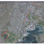
The image is an aerial photograph from the year 1954 and shows that the faults that delineate the graben extending through the town of Grindavík existed back then. (1/4)

The area between the western and eastern margins (indicated by the red broken lines) of the graben was dropped down by the activity 2000 year ago and again by the recent unrest. (3/4)

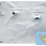
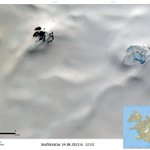
The #Skaftár cauldrons on satellite images before and after the jökulhlaup from the Eastern cauldron. SENTINEL-2 image from Copernicus EU on 27/08/ 2023 (at the beginning of the flood) and LANDSAT-8 image from USGS & NASA (after the flood).


Changes in the #Skaftárkatlar cauldrons from August 24th to 27th 2023. The surface water decreased in the eastern cauldron between those dates, suggesting that the current flood stems from there.
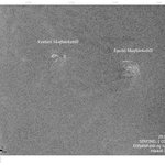
SENTINEL-2 images from COPERNICUS EU


A look at the radar image from 29/8/2023 at 18:43 also indicates that it’s the eastern boiler.
Water from a geothermal area under the glacier (which accumulates steadily as the geothermal heat melts the glacier above) has started to flow south through a tunnel under the glacier.

