

Husband, Father, Fire/medical, Meteorologist by practice. To license content please contact [email protected]
NE Arkansas
Joined May 2009
- Tweets2.7K
- Following81
- Followers557
- Likes835


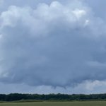


Our view of the tornado warned cell coming out of Arkansas into Missouri, about one mile north of Cardwell @ryanvaughan @MicahStevensWx #arwx

Structure fire in Brookland on @IDriveArkansas cameras. This looks very close to where there was a lightning strike in the earlier storms but not positive that was the cause #arwx


Possible tropical funnels from this storm near Lake Frierson. Looking northwest from Brookland. Notice the little helical funnel near the bottom of the one to the right. I’ll let the station meteorologists verify if this is a tropical funnel or cold air funnel @ryanvaughan @MicahStevensWx #arwx

Textbook SLC (scary looking cloud) looking north west from Kirk Field in Paragould. No worries though, so far today all storms have been sub-severe, and the atmosphere isn’t conducive for tornadoes. #arwx @ryanvaughan @MicahStevensWx


Excuse my dirty dash but the lines for fuel at the Walmart market on Linwood in Paragould are crazy. Unleaded is 3.89

Possible landspout from Arkansas 139 and county road 535 in Clay county. Big visibility issues. Getting approx 40mph wind gusts. Motorcyclists having a hard time staying upright. #arwx

Looking north toward Marmaduke from Greene 823 road @ryanvaughan @MicahStevensWx

Storms moving into Paragould as of 3:15 pm. They may be loud and look ominous, but so far below severe limits. @ryanvaughan @MicahStevensWx


One odd thing about the Runaway Bay #tornado is that by looking at the damage footage it appears to have been moving due west-deviant from the storm motion.
michael david retweeted

It’s always “you’re autistic” and never “thank you for telling me that there’s a tornado in progress in Oklahoma”


The shortwave is going to do what? 🫠

I am watching Friday, April 3rd as a potential significant severe weather day, with all hazards in play including tornadoes. There is now growing agreement amongst models on a shortwave ejaculating into the Plains. However, there is still considerable uncertainty in the evolution of the trough, specifically its placement, and timing, leading to lower confidence at this time.
Multiple additional severe weather days will likely occur both before and after the 3rd, but as of now, Friday appears to be the most favorable setup!

Home that burned in the 2000 block of Highway 135 in Craighead County. Social media video appeared to show a transformer arcing prior to the fire, and debris was strewn around nearby, but it is unclear if this was weather related @NWSMemphis @Region8News

A home damaged along Craighead County Road 905 from yesterday’s storm near the intersection of 905 and 910. Also, more damage along 910 to the east. @NWSMemphis @Region8News @ryanvaughan


