

Prof. of Atmos Sci. @unevadareno. Mountain WX, Wildfire Plumes, Backcountry Skiing, Frontcountry Dadding. Formerly:@SJSUmeteorology @UUtah @Livermore_Lab @MWObs
Truckee, CA
Joined December 2009
- Tweets5K
- Following321
- Followers6.7K
- Likes20.5K

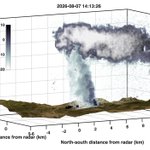

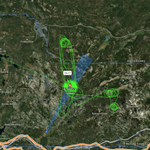


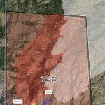
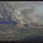

Playing around with some visualizations: Here is a volume rendering of one of the plumes we measured this summer with the @wildfirecenter's Ka-Band Doppler radar during @NASA's #INSPYRE. This was the McCully Fire in Oregon.


Numerous new lightning starts in the Sierra... some of which can be inferred from the AA plane's recon paths. Hope they can hit these before the get established.

Fair bit of lightning on dry Sierra fuels. Not a situation I'm wild about. #CAfire
The junction between the #BullFire and the earlier (8/22-23) #HawkFire has now mostly been made, substantially reducing growth potential.


#Pileus clouds forming atop #pyrocumulus were observed during #INSPYRE. These clouds are indicative of rapidly growing convection linked to intense fire. Co-located radar observations reveal the powerful updrafts (~20 m/s) driving their formation. science.nasa.gov/?p=1422768 via @NASA


Stunning pyro-convective development from the new #FlintFire in SW ID. share.watchduty.org/i/117156…
Radar reconstruction of today's (8/22) plume development from the #HawkFire in Reno, NV. Notable transition to a hydraulic like flow late in the day (~00 UTC) linked to dangerous run into town. We were conducting on-site lidar scans during the transition.
Part of our NASA #INSPYRE program is aimed at measuring plume rise processes triggering pyroCu/Cb. Here are some data from the @wildfirecenter scanning Ka-Band radar during the Widemouth fire showing upright plume development with vigorous updrafts transitioning to ice/cloud aloft.


Here is the corresponding visible imagery, which shows the #pyrocumulus cloud in exquisite detail.
Our NASA #INSPYRE project captured extreme fire spread and pyroCu development on the #SandCreekFire in #MT on 8/11. MASTER imagery from the #ER2 blends IR and other channels to reveal the rapidly evolving fire front, smoke plume, and developing pyrocloud. Data processed by Roseanne Dominguez.
Our NASA #INSPYRE project captured extreme fire spread and pyroCu development on the #SandCreekFire in #MT on 8/11. MASTER imagery from the #ER2 blends IR and other channels to reveal the rapidly evolving fire front, smoke plume, and developing pyrocloud. Data processed by Roseanne Dominguez.
Neil Lareau retweeted

[23/July/2026] Current #Wildfires in #France/#Bordeaux as seen by our 3D weather radar product, viewed from North to south.
Aktuelle #Waldbrände in #Frankreich in unserem 3D Wetterradar, von Nord nach Süd betrachtet.
meteopool.org
#wildfire #smoke #rauch #waldbrand
Terrain-wind alignment yields explosive fire growth. From the bottom to the top in <15 minutes. Can't outrun that. #OhioFire near Ketchum, ID.