

under construction: the world's best digital map
Joined June 2024
- Tweets337
- Following141
- Followers2K
- Likes699






Parchment retweeted

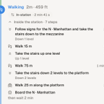
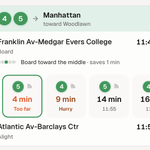
Deleting Instagram did NOTHING to improve my productivity. I now doomscroll on Google Maps.

Parchment retweeted

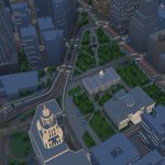
I'm building New York City, with Unreal Engine 5 and Blender and three.js as renderer options, open source! Ready for building games, visualization, simulations or reinforcement learning!

Parchment retweeted

GeoRetina Atlas is the most comprehensive digital twin of the entire planet ever built based on OpenStreetMaps (OSM).
Any cities/place that has OSM data is available to explore for free without any limits.
It's built using @threejs and a custom WebGL pipeline.
It's not just built for visualizations, but also for physical simulations like flood scenario modeling.
We already have our own high-resolution 5m flood maps for 139 cities and plan to expand it to 1000 cities across the world in the next few days.
You can find the link in the comments 👇


Parchment retweeted

Built an interactive 3D of Shibuya crossing
Try it here:
3dscenes.qualityf2p.workers.…


Parchment retweeted
Fog of War effect on Apple Maps - 120fps. Seamless between zooms, animated uncover, custom shader on discovered areas!


Parchment retweeted

Mapillary Update: Captures Nearby 📍
Powered by our radius API, a new counter on mapillary.com opens a carousel of surrounding imagery.
Easily find alternative views, track historical changes & discover new coverage.
Try: mapillary.com/app


Parchment retweeted

Imagine @googlemaps of the future built on 3D Gaussian Splatting. Where you can visit any place indistinguishable from reality. 🗺️
Splat linked 👇