

PIX11 Meteorologist // AMS CBM #871 // Pilot // Former NYS EMT // Occasional Storm Chaser ☈
New York, NY
Joined July 2013
- Tweets32.6K
- Following1.5K
- Followers10.8K
- Likes72.9K
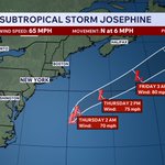


There she is and there she goes... #Josephine will continue out to sea tomorrow into the weekend
@PIX11News

Pat Cavlin retweeted

This was not about harvesting olives.
It was about harvesting headlines.
Brad Lander’s latest stunt is nothing more than a calculated political provocation.
Lander traveled to a foreign country, deliberately entered a restricted security area, and participated in an unauthorized activity without the required coordination.
What makes this stunt even more outrageous is that his own team contacted Israeli representatives in the United States ahead of his visit and was explicitly informed that proper coordination with the relevant authorities was required.
He chose to ignore those instructions.
At a time of heightened security tensions, Israeli security forces have a responsibility to protect lives, prevent dangerous incidents, and maintain public order.
Had anyone been injured as a result of his reckless political theater, Lander would undoubtedly have been among the first to demand that Israeli authorities intervene and provide protection.
Brad Lander came looking for a confrontation. Now he is pretending to be its victim.


Pat Cavlin retweeted

8pm EDT Sun 18th Oct: NHC is monitoring a non-tropical low pressure area developing off the SE U.S. coast. This system now has a medium chance (🟠40%) of becoming a subtropical cyclone, primarily during the 2nd half of this week.
Regardless of development, the system will cause high winds, coastal flooding, & dangerous surf along portions of the U.S. East Coast. Please see warnings from your local @NWS offices & @NWSWPC.
hurricanes.gov/gtwo.php?basi…

ALT 7 day Tropical Weather Outlook Graphic depicting the the system off the SE U.S. coastline.


Meanwhile today is my pick day of the week…
Immaculate fall vibes today. Perfectly comfortable in the sun


Pat Cavlin retweeted

We're getting a lot of photos of this cloud asking what it is.
It's called a fallstreak cloud. They form when a plane or something else goes through a cloud deck (made of water), disturbs it, and it's cold enough that the supercooled water particles freeze and then fall down.


The hurricane has highlighted an area off the East Coast for potential development this week
A coastal storm is expected to develop, & it may gain tropical characteristics. Regardless, the storm is expected to stay offshore, bringing breezy conditions and high surf to the coast


A severe thunderstorm watch is now in effect for the entire area (except for Suffolk Co)
Damaging wind gusts of 60-70 mph are possible with any storms that become severe this evening
@PIX11News

Skies are very gradually clearing across NY and NJ ahead of the developing squall line in PA
If we can get enough sunshine beforehand, the chances for severe weather in the city will become much more pronounced
@PIX11News


