

Exploring the rails, roads, and trails of California and the Lincoln Highway, "Coast to Coast". VP / historian/editor, Lincoln Highway Association, California.
Sierra Nevada, California
Joined November 2007
- Tweets15.7K
- Following457
- Followers13K
- Likes23.1K



Pinned Tweet
A mule team works its way up towards Donner Summit, c.1862. This colorized photo shows a couple of wagons, one covered and one not, filled with goods. This is the Dutch Flat Donner Lake Wagon Road, and the team is taking supplies up to the summit for the transcontinental railroad construction. I included the original black-and-white photo in the comments.

It's rare to see a photo of an actual mule team at work. These mules are helping in the construction of the Cool Mountain Quarry Bridge just outside Auburn, CA, in 1912. The flat area is the bed for the Cool Mountain Quarry Railroad, which is what the construction was for.

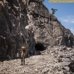
We're on Donner Summit, and the Transcontinental Railroad is under construction in 1868. That's Tunnel #8 being dug out for the laying of the rails. You might think the man in the photo is carrying buckets of gravel out of the tunnel, but he is actually carrying buckets of tea for the workers inside. All the work on the railroad was done by hand and with nitroglycerin.

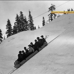
Back in the 1930s, before ski lifts, you got to the top of the hill using the "up ski". This is the Auburn Ski Club up-ski being used at their hill near Cisco Grove. Just about 100 years later, the old up-ski still sits on the side of the mountain, waiting for skiers who will never arrive, with Interstate 80 far below.


Just off Highway 89 at Luther Pass, we took a short walk to the historic summit, which, if followed all the way, leads to the beautiful Hope Valley far below. Here, we checked out a Trails West T Post describing the history of this famous pass. Just across from that is Grass Lake. In the fall, it's a brown sea of grass, while at other times, it's snowbound or green, with a beautiful creek running through it. Many a Pioneer stopped and took in this sight before continuing their journey into the new land of California. Map coordinates: 38°47'15.01"N 119°56'47.32"W
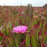
Ice plant use to be all over freeways in California. Great for erosion control it unfortunately can spread where it shouldn't. It's no longer used for roads. Along the coast it's quite pervasive. The local native plant societies try removing it, but it is a herculean task. It's quite beautiful in bloom.


Adventures in California History retweeted

1956-June-04 - Newly opened Harbor Fwy (then US-6/CA-11, now I-110) in Wilmington, approaching Anaheim St near Pacific Coast Hwy (then US-101 Alt, now CA-1). New ice plant seedlings in median (DOH D7 Archives photo).

Along the Pioneer Luther Pass Trail (1854)is this enormous Jeffrey Pine. Up here, 6500- 7000 ', Jeffrey Pines and Ponderosa Pines intermingle. Monica demonstrates one good way to tell them apart. Smell the bark! If it has a vanilla/butterscotch smell, it's a Jeffrey Pine. Check out Monica walking next to the tree in the first photo to get an idea of the size.


We stopped at the southern end of Hope Valley for some fantastic fall color provided by the Quaking Aspens. Most turn yellow, but some get an orange cast. The peak of the color will be this coming week if the warm temperatures forecast arrive. This spot with the cabin in the forgrond is very popular for just this kind of photo. After this, we headed up and over Carson Pass. Coordinates: 38°43'44.58"N 119°57'15.61"W

Yesterday was a beautiful Fall day in the high country of the Sierra. We wanted to catch some of the fall color and found ourselves on the Luther Pass Trail headed from the pass towards Hope Valley, Alpine County.
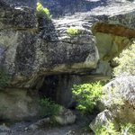
We found some great "rust-stained rocks" formed by the metal rims of the wagons rubbing against the rock surface. It's really something to stand in that spot, realizing that many of the gold-and-silver-rush legends passed through this very gap. The pass is named after Ira M. Luther, one of the "Irish Brigade" described by Mark Twain in Roughing It. Luther traversed the pass by covered wagon in 1854.
In April 1860, early Pony Express riders utilized the Luther Pass Trail between Hope Valley and Lake Tahoe for about five weeks before the route was shifted to the more direct Kingsbury Grade. During the 1860s, the path served as an important route moving freight, wagons, and prospectors from California over to the booming Comstock silver mines in Nevada.
Coordinates: 38°47'14.75"N 119°56'48.02"W
Looking east at Old Hangtown (Placerville), California, at the height of the Gold Rush, 1849. The tree that helped earn this town its nickname is visible at the left center of the photo. Three men were convicted of robbing a local successful miner in his hotel room in 1849. When caught, they were charged with another robbery and murder and sentenced to death by hanging. A large oak tree in Elstner's Hay Yard on Main Street was chosen for the triple hanging. In the center, we can see the Empire Theatre, which lasted into the 20th Century. We watched movies there before it became an antique store, which it still is today.

Same spot on Donner Summit over 100 years later. On the left, we have autos approaching the Lincoln Highway underpass, which allowed vehicles to pass beneath the Transcontental Railroad. On the right, I'm standing in roughly the same spot while pointing to the underpass. The black-and-white photo shows deep snow and black soot placed on top by City of Truckee merchants in an attempt to get the snow to melt more quickly. This is before the State of California plowed the mountain passes, so the sooner the snow melted, the sooner tourists could make their way to the mountain playground. You will also notice that 100 years ago, the wooden snow tunnels still covered the tracks. You can still walk in the footsteps of history here and walk through the underpass.
Coordinates: 39°18'55.53"N 120°19'15.47"W


At Donner Pass the Lincoln Highway (1913-1927) did not cross the railroad at grade for long. In 1914 an auto subway opened under the Southern Pacific snowsheds so cars could pass under the rails instead of through them.
This walk reaches that underpass, often called California's first railroad underpass built for automobiles. It carried the road until the 1926 bridge moved traffic onto a new alignment. Same rocks. Same pass. Old emigrant trail still underfoot.
Would you have driven under those trains in 1914?
This is the Berkeley Pier.
Lincoln Highway (1913-1927) motorists, and later US-40, drove an amazing three miles out over the bay on this concrete pier, then ferried to Hyde Street Pier in San Francisco. It was built for the Golden Gate Ferry Company, with service beginning in 1927 and ending after the Bay Bridge opened. It was closed for safety in 2015.

ALT Dec. 1927 cars on Berkeley Pier (San Francisco Newsletter)

ALT Golden Bear ferry 1927 (San Francisco Public Library)

ALT Berkeley Pier today (Trey Pitsenberger)
Where am I? What am I?
This one should be fairly easy to guess the location, as there is a huge clue, but what was it? Another clue: it was part of the great Lincoln Highway (1913-1927) for a while. Any guesses?

Here is a cool photo showing the construction of the Transcontinental Railroad in 1868. The central shaft was located under that building, with the tracks going into it in the photo on the right. Today that same spot is shown with the white arrow in the photo on the right. We don't know what happened to the pond. How many of you have stood at Donner Summit, or traveled through the tunnels? Original 1868 photo in comments.


Join Monica and me as we explore the most famous railroad tunnel in the world, Tunnel #6 of the Transcontinental Railroad, 1868. About halfway through, we will look up inside Tunnel #6 at the Central Shaft. That vertical hole let crews work four faces at once: inward from both portals, and left and right from the bottom of the shaft, while a donkey engine on top hauled men, tools, and blasted rock.
The tunnel runs 1,659 feet. The first train passed through on December 4, 1867. The metal cover on the shaft has been up there since about 1868. Stand under that opening today, and the mountain still feels like a job site that never finished explaining itself.
Some people don't like the dark and cold of he tunnel, but if you have a flashlight and it's summer, it's very refreshing. Have you walked through the tunnel, or do you wish you could?
"Stay in your lane!" Not hard to do when your wheels are knee-deep in mud in 1919.
As California Lincoln Highway Association archivist, I recently got a treasure trove of Lincoln Highway (1913-1927) material from our former archivist, Gary Kinst. A lot of it is California. Plenty of it covers the whole road, New York to California.
Starting here: Tama County, Iowa, infamous on the original Lincoln Highway (1913-1927). After rain, that rich Iowa soil turned to "gumbo" that packed wheels and threw mud "higher than the telephone poles," Henry Joy of the Lincoln Highway Association wrote after getting stuck near Tama. The 1924 Official Road Guide even warned that trying Iowa dirt roads right after a rain was "folly."
Imagine leaving New York for California and having to time your trip around avoiding this. That is why the Lincoln Highway (1913-1927) was built: a paved coast-to-coast highway.
