

PhD-astrophysics. Was XMM-Newton and Gaia (2006) project scientist (PS) . Was XMM, MEX , VEX, Rosetta, Gaia Mission manager (11,10,7,2,5 yr). ESA (retired).
Leiderdorp, The Netherlands
Joined January 2011
- Tweets5.7K
- Following162
- Followers2.1K
- Likes48.3K



Fred Jansen retweeted

After more than 15 years in orbit, @NOAA will be deorbiting the Suomi NPP satellite starting on Dec. 1, 2026. This will be done by gradually lowering its orbit before it reenters Earth’s atmosphere over the South Pacific Ocean.
Suomi NPP was a pathfinding mission to demonstrate the capabilities of NOAA's JPSS constellation. The data provided by Suomi NPP are now operationally delivered by NOAA-20 and NOAA-21.
Learn more: bit.ly/3VQ4YoM

ALT Visualization of the Suomi NPP in orbit with Earth in the background. (Credit: NOAA)
Fred Jansen retweeted

New #GaiaDR4 story on Gaia Cosmos: "Gaia Data Release 4: from acquisition to archive" 👉cosmos.esa.int/web/gaia/iow_…

Fred Jansen retweeted

This is a huge thing for space transparency! Historical records do inform space policy and understanding.
Jonathan needs your support please consider contributing so the library can be completed and made operational for the benefit of all. gofundme.com/f/fund-jonathan…


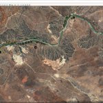
After being away for a few days, went back to geo-locating KANOPUS-V X-band data: V 4 18-Aug @ 09:52 UTC - Mzimvubu river near Port St Johns, South Africa. V 3 19-Aug @ 10:21 UTC - Ghadamis, Lybia. V 5 today @ 10:23 UTC - Arba Minch, Ethiopia and a crop of the airport


SUOMI NPP @ 11:50 UTC - another one (almost) bites the dust ..... as a farewell gift I got a few of its infamous antenna dips

Geo-locating the X-band imageres received from KANOPUS-V is challenging: V-IK yesterday @ 09:48 UTC. Two distinct areas in 1 pass: 1- Russia near the Kara Sea, some 100 km to the NNE of Kharasavey, Yamalia. 2- Gereshk, Afghanistan on the Helmand river.


Two hobby items. Received on X-band from ELEKTRO-L 2 Wed this week @ 17:30 UTC (very (!!) weak signal at that time of day) - mid-top eclipse shadow over Greenland. Next, using a S50 (EQ mode) - 5900 sec on NGC 6992 processed with Siril/Gimp. Amazing what such a telescope can do.


From a KANOPUS-V 3 pass last Wednesday - using the MSS channels 3, 2 and 1 and the advanced align option in the great #SatDump (by @aang254 , @original_lego11 et al) - the French mediterranean coastline near Beziers. Post-processing in GIMP.

Slowly getting better at recognising the geo-location of home received X-band KANOPUS-V imagery, using cloud shadows to estimate latitude - 30/6 V 5: Witbank/Emalahleni, South Africa - 3/7 V 4: Al Theniah, Saudi Arabia - 8/7 V 4: Al Hazm, Yemen and Khbash, Saudi Arabia


Today METEOR-M2 4 KMSS @ 14:10 UTC - a few nice looking crops of Cornwall/Devon, Dundee, S-W Holland/Belgium and a significantly cooler Ireland


Yesterday - 2 KANOPUS-V passes: V 4 Russian-Finnish border area @ Vuoksenniska and a crop of the true border @ Svetogorsk/Imatra. V 5 - Samara on the Volga river and a crop of it's football stadium - highlighting the PSS resolution.


Part of todays X-band harvest from global overview to small scale: ELEKTRO-L 2 Europe crop, FENGYUN 3F crop and two KANOPUS-V 5 crops (1: Lypchany, Ukraine, hydroelectric power plant near Dnister river and 2: Lacul Ceamurlia, Romania)


From a KANOPUS-V-IK pass yesterday @ 09:45Z. Took some time to identify the location, but found it: NW-Spitsbergen taken 2 orbits earlier. MSS ch 3 low res crop, side by side comparison of MSS with Google Earth and a full res PSS crop (about 2.5 m/pix).


Fred Jansen retweeted

@NASA's founding visionary behind @chandraxray and a titan of high energy physics has left us. We'll miss you, friend.
Ad astra to Dr. Martin C. Weisskopf 1942-2026.

Looking down - looking up. FY3F weather satellite image received on X-band (crop of the Netherlands) looking down at Earth from LEO; and looking up at the cosmos using my SeeStar S50 - some 1800 seconds on M51 "the Whirlpool Galaxy". Amazing, given the city lights and full moon.


