

Natural Disaster Cartography, Maps
Deutschland
Joined June 2017
- Tweets9.1K
- Following120
- Followers2.3K
- Likes911





Risklayer Maps retweeted

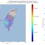
#CATDAT @Risklayer @CEDIM_KIT #Japan #Earthquake Damage Estimate using JMA/RL intensity data & Shakemap: $4.9 billion (Range: $2.3-$11.1 billion).
Estimate does not include significant indirect losses, however includes direct building, infrastructure & production damage.
Risklayer Maps retweeted
Day 2 of #COP28UAE . A decent start for the Loss and Damage Fund but need more - $ Umbrellas, Engineering and more needed to help the V20 nations. Ana from @cisl_cambridge will be presenting @risklayer, @CEDIM_KIT risk results today at COP28 Financial Future Climate Forum. ☔️🌏
Risklayer Maps retweeted

After further analysis, Geoscience Australia can confirm that the shaking reports received from the Melbourne area at around 12:00am (AEST) 8/8/23, are not related to a seismic event. This is likely associated to space debris re-entry as determined by The Australian Space Agency.


Risklayer Maps retweeted

1. Halbjahresbilanz der Erdbebenschäden 2023, #EarthquakeImpactDatabase:
- 161 Schadenserdbeben
- 59.333 Todesopfer
- 125.914 Verletzte
- 5,1 Millionen Obdachlose
- 2,1 Millionen beschädigte Gebäude
- 59 Länder betroffen
@risklayer @risklayer_maps

Risklayer Maps retweeted

Incorporating GPS and near-field remote sensing data illuminates the spatial distribution of fault slip, largest between 2 and 6 km depth. The rupture stopped some 30 km south of the 2020 Elazig rupture, potentially leaving behind a seismic gap ripe for another Mw 6.8 earthquake.

Risklayer Maps retweeted
#EarthquakeImpactDatabase 2022, preliminary summary:
319 damaging earthquakes, 66 affected countries. 1954 fatalities, 18,096 injuries, 357,836 affected buildings, 466,086 people homeless. Earthquake losses were 48% lower than 2021. @risklayer @LastQuake @CATnewsDE


Risklayer Maps retweeted
Für August schrieb ich, der Monat sei einer der ruhigsten seit Aufzeichnungsbeginn gewesen. Der September wurde quasi zum kompletten Gegenteil. Ein Rückblick auf einen Monat mit sehr vielen großen und auch zerstörenden #Erdbeben risklayer-explorer.com/repor… @risklayer

Risklayer Maps retweeted
Zwei Drittel des Jahres sind um und die Karte der Schadenserdbeben ist entsprechend gefüllt. 204 Mal haben Erdbeben 2022 bisher Schäden verursacht, 23 Mal endete dies tödlich. 56 Länder waren betroffen. Eine kurze Zwischenübersicht. @risklayer #EarthquakeImpactDatabase

Risklayer Maps retweeted
Multiple earthquake sequences, destructive shaking and volcanic effects led to more than 30.000 damaged buildings and several casualties.
Our monthy #earthquake & #disaster report:
risklayer-explorer.com/repor…
Risklayer Maps retweeted
21 damaging earthquakes, four casualties, 20 injuries and approx. 2700 damaged buildings in May 2022. 13 countries were affected. It's the month with the least #earthquake losses since November 2020. More details: risklayer-explorer.com/repor…
@risklayer @CATnewsDE @LastQuake

Risklayer Maps retweeted
There are unknown risks in the world (Black Swan events).
But there are more known, but not acknowledged risks (Black Elephant events). We can mitigate these.
Black Elephants are not Black Swans: 2021 Ahr Valley floods, 2011 Japan Tsunami, Climate Change.
nature.com/articles/s43247-0…

Risklayer Maps retweeted

Offset tracking from #Sentinel1 offers a clear view of the main fault rupture from the Mw7.4 #earthquake in Southern Qinghai, China. Offsets along the fault trace are >1-2m. Below is a simplified trace from the autoRIFT range offset results. Total length is 178 km.

Risklayer Maps retweeted

78 damaging #earthquakes in the first 100 days of 2021
@CATnewsDE @risklayer
#EarthquakeImpactDatabase


Risklayer Maps retweeted
A newly discovered fault could provide the answer to a decade-old riddle in seismology: The origin of the Great Lisbon earthquake 1755. But this finding defies all previous rules of geology and leaves many questions unanswered. Read: risklayer-explorer.com/repor… @risklayer @CATnewsDE
Risklayer Maps retweeted
Two #earthquakes with similar magnitude and epicenter off the east coast of Honshu, #Japan. But with completely different effects. Earthquakes are more complex, it's not only the magnitude.
Event pages:
risklayer-explorer.com/event…
risklayer-explorer.com/event…
@CATnewsDE @risklayer

Risklayer Maps retweeted
Wenn wir "OFFIZIELL" immer 12-48 Std. mit den #Coronazahlen Inland & 5-10 Tage Ausland hinterher liegen, dann wird es nichts mit funktionierenden Massnahmen in Risikogebieten und #NoCovid.
Wir verfolgen seit 383 Tage 21/7 die Zahlen und dieses Problem führt zu vielen Ausbrüchen.
Risklayer Maps retweeted

Wave heights of about 0.5 m at Norfolk Island continued for more than an hour and significant waves are still arriving

Risklayer Maps retweeted

Neue Daten zum #Fukushima-#Erdbeben (M7.1) vor zwei Wochen: Leider doch ein Todesopfer durch umgestürzte Möbel. Dazu 186 Verletzte und mehr als 4500 beschädigte Gebäude. Immer noch (für ein Beben dieser Intensität) ziemlich geringe Auswirkungen. @risklayer @CATnewsDE


Risklayer Maps retweeted
One large #earthquake can cause other large earthquakes. Over the past few days we have seen several examples of triggered seismicity and sequences. But how does triggering work and how can we identify possible relations between earthquakes? risklayer-explorer.com/repor… via @risklayer
Risklayer Maps retweeted
#Turkey, #Croatia and #Iran are the countries with the most #earthquake losses in 2020. This map shows the Impact Value of all losses in each of the 59 eq-affected countries. More details for the "Top 20" in the table. #EarthquakeImpactDatabase
@risklayer @LastQuake @CATnewsDE
