

A trusted source for forecasts, long-range trends, and in-depth analysis of extreme weather worldwide.
World
Joined July 2013
- Tweets35K
- Following831
- Followers98.1K
- Likes551


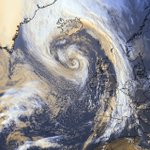
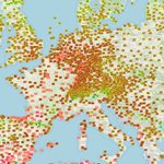
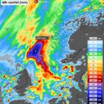




The Polar Vortex is already under pressure, with forecasts showing record-weak winds for early November.
To track every twist this winter, we launched a new Polar Vortex page with live ECMWF and GFS maps, updated twice a day. It also includes the latest commentary on development, the long-range Polar Vortex outlook for Winter, and what a mid-winter Sudden Stratospheric Warming could mean for the United States, Canada, and Europe.
Check it out and monitor the Polar Vortex with us. 👇
severe-weather.eu/polar-vort…


A split Polar Vortex in early November? 👀
The latest ECMWF 00z shows two vortex cores/lobes at 10mb, over northern Eurasia and Canada, with a wave-2 ridge cutting in-between. The same pattern reaches down to 50mb, so it’s not just an upper-level feature, but it is actually an upward-propagating event from the lower levels.
Both ECMWF and GFS push 60°N/10mb winds below the historical minimum (5–11 m/s by Nov 4-5). Even the GEFS extended mean, with its usual strong-SPV bias, is trending weaker in the latest available data.
Images by our author @Recretos
#PolarVortex #Winter2026


SWE | severe-weather.eu retweeted

Polar vortex outlook for winter 2026/27: El Niño analogs vs ECMWF SEAS5 🌀
Polar cap (60-90°N) temperature anomaly, Oct-Apr, from the surface to the stratosphere.
📊 Analogs (strong East-Pacific El Niño years 1997, 2015, 1982, 1957; NOAA CORe):
A cold, strong polar vortex from November through most of January. Then a sharp stratospheric warming in late January / early February that works its way down towards the lower stratosphere by March.
ECMWF SEAS5 (October run, 51 members):
The same overall story: a cold vortex in November and December, then a strong warming signal that arrives earlier, from late December, peaking in January and reaching below 100mb by February.
The takeaway: both point to a strong vortex in early winter, followed by a vortex disruption in mid-to-late winter. The main difference is timing: SEAS5 brings the warming about a month earlier than the analogs.
A weaker vortex in late winter raises the odds of a negative AO / NAO pattern and cold outbreaks into mid-latitudes, but the timing is uncertain at this range.
Also, the analogs are only 4 years, with high variance.
@judah47 @webberweather @RyanWeather


❄️ The latest seasonal forecasts for winter 2026/2027 are in, and six models now agree on the snow pattern for the season ahead.
The Super El Niño is driving a strong winter pattern that shows less snow over Europe, the northern United States, and southern Canada. But it brings more snow across the southern and central United States. Most of the snow is expected in the second half of winter, after a typical slow Super El Niño December.
In the article, I present the full set of maps, including the visual change from the previous month's snow forecast, the snow spatial distribution, the forecast for ski areas, and a Snowfall Explorer where you can check the snow forecast for your own state, province, or country.
severe-weather.eu/long-range…


SWE | severe-weather.eu retweeted

TLE / red sprite — Mediterranean Sea
Event: 2026-10-06 21:01:09Z 0.25x speed
Observer: Christophe Suarez
POV 43.455470, 6.567903
#redsprites #farfadets #orage #orages #TLE #suarezphoto
SWE | severe-weather.eu retweeted

🌌 Wát een kleurrijke verrassing! Gisteravond kwam het #noorderlicht prachtig tevoorschijn: ik kon de kleuren vastleggen samen met een onweersbui aan de horizon, zie het weerlicht rechts in de buienwolk. Dit is een foto met 10 seconden belichtingstijd. Magische avond...

Can rapid October snow advance in Siberia predict your winter? This is a famous forecast signal for cold winters in the U.S. and Europe, so we tested it across 47 winters of data and 4 different datasets.
The results were surprising, and they change how we should read this October’s snow surge as we head into Winter 2026/2027.
severe-weather.eu/long-range…

SWE | severe-weather.eu retweeted

#Hurricane #Isaias is now a Category 2 hurricane with max winds of 100 mph. The last Atlantic hurricane season with no Category 2+ hurricanes was 2013.
SWE | severe-weather.eu retweeted

🚀 After its recent launch, #CopernicusEU Sentinel-3C has delivered its 1st images capture Italy 🇮🇹 from the Alps to Sicily, showcasing the satellite’s capabilities.
🌍 A major step towards full operational service for monitoring changing Earth.
🔗 eu-space.europa.eu/news/cope…


SWE | severe-weather.eu retweeted

Can't stop watching the lightning within Hurricane Isaias.
Just a phenomenal view from space.
The new October forecast for Winter 2026/2027 is in, keeping the Super El Niño on pace to reach record strength.
In the latest long-range data, much of the United States is trending colder and snowier, while Canada and the northern U.S. stay on the mild side. Europe looks mild and wetter overall, with the best snow chances in the north and at higher elevations.
There's also an interesting Polar Vortex signal pointing to a potentially more active second half of winter. You can also check the latest month-by-month outlook maps for your own region in the new Winter Explorer.
severe-weather.eu/long-range…

SWE | severe-weather.eu retweeted
Red sprites (farfadets) au dessus d'un système orageux très développé, situé en Méditerranée, entre les Baléares et Barcelone, dans la nuit du 03 au 04 octobre 2026.
#orages orages #redsprites #lightning @PlanetarioMad
SWE | severe-weather.eu retweeted

⚠️🔴 AVISOS ROJOS | Lluvias torrenciales en zonas de Barcelona y Girona.
➡️ Se podrán superar 90 l/m² en una hora y 200 l/m² en menos de 6 horas.
➡️ Situación muy adversa la noche del sábado y primera mitad del domingo. Posibles inundaciones y crecidas. ¡Peligro extraordinario!


SWE | severe-weather.eu retweeted

Localidades como Madrigueras y Mahora han registrado una tromba de agua que ha hecho saltar una alerta en toda La Manchuela. Los videos del momento se han hecho virales
SWE | severe-weather.eu retweeted

¡Brutal! Sonido ON. Rondando los 100 litros por metro cuadrado en puntos del Campo de Cartagena. Esta tarde (02/10/2036), así llueve en #LosAlcázares (#Murcia). Otra vez vuelve a ser castigada la misma zona, en el entorno del #MarMenor. Vídeo: @JoselitoCn.
SWE | severe-weather.eu retweeted
¡Qué peligro! No es solo lo que llueve, sino donde construimos. El agua siempre vuelve a su cauce. Esta mañana (02/10/2026), situación en Les Cases d'Alcanar, barrio del municipio de #Alcanar (#Tarragona). Vídeo: @cutxamande.

SWE | severe-weather.eu retweeted


