


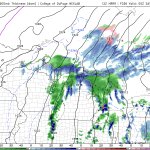






Lake effect season has arrived as the coldest air of the year pushes over the Great Lakes the next couple days. Still should be warm enough for rain along the shorelines but a couple areas of accumulations possible particularly S/E of Sarnia & higher elevations S of Georgian Bay.

2
26
1,709

System will bring heavy rain/isolated thunder to the region tonight into early Fri AM. Brief warm up/humid Fri AM. Cold front pushes through late Fri into Sat with gusty N winds. Lake effect FLURRIES off Georgian Bay & Huron early Sat AM with first flakes possible even in GTA. 😳


Guess it’s a good weekend to be heading to NYC…

Stormwx1 retweeted

Category 5 Polo is now the second strongest hurricane on record in the eastern Pacific with a pressure down to 892mb. What's even more remarkable is that Polo was just a tropical storm yesterday.


