


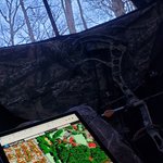
Another screenshot--this time #forest management and time black bear #habitat in southern Georgia, USA.
The terraPulse map layers show percent tree cover (2020) in shades of green and forest-establishment year (1984 to 2020) from blue to yellow. Okefonok…lnkd.in/guqdkrWi
Every once in a while I just have to share my screen.
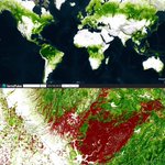
The pair of terraPulse screenshots shows Mule Deer summer (left) and winter (right) habitat suitability over the Book Cliffs region of Utah (2020). This dataset has a spatio-temporal resolution of 10…lnkd.in/gKkZhZ9Y
How does #biodiversity make ecosystems #resilient to climate change?
Each species--and by extension, community--responds uniquely to seasonal cycles of temperature, sunlight, snow, and other factors. While these differences make the total ecosystem less…lnkd.in/gQ6Z5mTv

It's amazing for #NASA to focus on terraPulse's vision and our work. Thanks especially to @WordProvocateur for the spotlight.
While any story needs a single persona to quote, the article is really about Min Feng, Panshi Wang, @johnnybirder, Giuseppe Berl…lnkd.in/dRu_RUeX


From the atmosphere to the biosphere, @NASA's Earth-observing satellites have produced terabytes of data on our home planet. Now, a company is pairing this data with an AI algorithm to create maps used to examine and prepare for climate-driven changes. go.nasa.gov/3Ai2qS4

ALT This map of the northern part of New Mexico created by terraPulse shows the tree loss (red) that occurred between from 2010 to 2015 against the remaining tree canopy (green)
terraPulse retweeted

From the atmosphere to the biosphere, @NASA's Earth-observing satellites have produced terabytes of data on our home planet. Now, a company is pairing this data with an AI algorithm to create maps used to examine and prepare for climate-driven changes. go.nasa.gov/3Ai2qS4
ALT This map of the northern part of New Mexico created by terraPulse shows the tree loss (red) that occurred between from 2010 to 2015 against the remaining tree canopy (green)
While AI might get the headlines, the reality remains that conscientious, educated, and knowledgeable human beings still drive the whole thing.
Nice work @johnnybirder. lnkd.in/eneAMVzY

Comparing terraPulse’s boreal-calibrated tree cover findings to previous work, and ran into this gem.
“We need more ecologists in canoes.” —Kevin Timoney & Steven Mamet (2020)
(And it looks like we’re on the same page about calibration too.) lnkd.in/guKr9JHQ

It’s been a big year for terraPulse.
We produced the world’s first global maps of tree cover and forest loss based on #Sentinel data; we developed #biomass and #wildfire risk mapping algorithms using the full #Landsat archive; and we produced another wor…lnkd.in/gsjXPgJi

terraPulse Forest Age data predicting site index across the boreal #forest. lnkd.in/giKX2b46

#ecology job in the land #carbon sector with a team that has been doing great things with terraPulse #forest activity data lnkd.in/dhTrJKnR
terraPulse retweeted

Miss 10 thinks @terraPulse needs new branding. She shall submit the following new “Hugs and Kisses” logo for board review. #ecology #biodiversity #climatechange #seedround @GretaThunberg

Fact: Environmental change is accelerating.
Land cover change detection is powerful—it does just what it says on the label.
But full time-series of urban, water, and other land cover maps let you get acceleration into your models.
terraPulse is unlock…lnkd.in/d28SwCy5

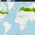
The boreal #forest is getting denser and moving north: @terraPulse scientists interviewed by @FT on highest-resolution, longest-term mapping of the region’s change ft.com/content/e59c800f-3704…

The algorithm is simple: do good, work hard, and surround yourself with geniuses.
Welcome to the adventure, Giuseppe Berlanda, PhD! lnkd.in/ejcvDCwm