
Keynote speaker on risk, money & uncertainty 9/11 survivor | Financial strategist | Storm chaser Helping leaders turn uncertainty into clarity & decisive action
- Tweets40.1K
- Following920
- Followers2.4K
- Likes88K








ALT Time series plot showing water levels in Lake Powell. A precipitous multiyear decline is visible, followed by a sharp increase in recent days (the magnitude of which still pales in comparison, however, to the multiyear decline).


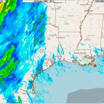
ALT Current snapshot of flood watches/warning and forecasts from NOAA's Water Prediction Center. It depicts numerous locations at or above predicted flood stage, with more than a few at or predicted to se "major" flooding.


ALT National Weather Service Houston/Galveston graphic displaying a High Risk of Rip Currents in effect through 7 AM Sunday for Gulf-facing beaches across the region. The graphic includes safety instructions warning that rip currents can sweep swimmers away from shore, advising against swimming directly against the current, and recommending swimming parallel to the shoreline to escape or drawing attention if unable to reach shore.

ALT National Weather Service Houston/Galveston safety graphic titled Rip Current Safety, updated October 17, 2026. It advises beachgoers to watch for channels of different water colors or choppy and foamy water, and to stay away from rocks due to dangerous rip currents.


ALT National Weather Service Houston/Galveston graphic detailing a cold front expected on Friday, bringing cooler and breezy weather, a wind shift to north/northeast, possible rain ahead of the front, and weekend temperatures with highs in the 70s to 80s and lows in the 50s to 60s.

ALT National Weather Service Houston/Galveston graphic detailing late-week hazardous marine conditions behind the first fall front, featuring strong winds and hazardous seas, Small Craft Advisory conditions Friday night into Saturday, an increasing chance of gale conditions, and seas of 5 to 8 feet with potential for over 10 feet.

ALT National Weather Service Houston/Galveston probability map graphic showing the chance of temperatures falling below 60°F during the weekend, featuring high probabilities (>80% chance) north of I-10 and medium probabilities (50-60% chance) south of I-10 following the season's first real fall front.


ALT A map of the Houston-Galveston region displaying precipitable water values exceeding 2 inches, illustrating above-normal atmospheric moisture levels originating from the Gulf of America.

