
Dad, Son of a Farmer | Research Scientist https://teapawt.org/t.co/OeRjNNxprO | Alabama Associate State Climatologist https://teapawt.org/t.co/emaPnmNpbr
- Tweets70
- Following74
- Followers231
- Likes183


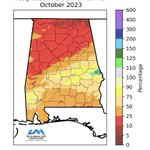






ALT On average, October is Alabama’s driest of all the months. This October was no exception. The state received a mere 1.40 inches of rainfall, which is 1.43 inches less than the 20th century normal of 2.83 inches. With such little rainfall in October, drought conditions continue to degrade throughout the month. A drier than average October translates to a very dry month. Of the 231 stations with rain gauges and no missing days of recorded observations, 133 stations reported less than 1 inch of rainfall. The driest location for this October was the Harvest 3.9 SE station recording a measly 0.19 inch of rainfall. Drier than average conditions also contributed to almost 96% of the state being placed in some level of drought by the end of October. There were, however, a few stations that reported adequate rainfall amounts. The Auburn No.2 station had the highest rainfall total reported for the month at 4.07 inches, most of which occurred between the 11th and 12th of October.

ALT Looking ahead into winter (December, January, February), the Climate Prediction Center (CPC) forecasts the entire state is likely to experience equal chances of below, near, and above-normal seasonal average temperatures. For precipitation, there is a sharp gradient from equal chances of below, near, and above-normal precipitation in the counties that border Tennessee to 60-70% chance of above-normal precipitation to the South. The CPC forecast is strongly influenced by the ongoing El Niño (the warm phase of the El Niño/Southern Oscillation mode) in the central Pacific Ocean. However, we examined past El Niños (1957-58,1972-73,1965-66, and 1997-98) that initiated around the same time as the current El Niño to serve as analogs for predicting how this winter may unfold. This analysis depicts a drier northern half of Alabama and a wetter southern half. It’s important to note that while these analogs provide valuable insights, they represent averages, week-to-week weather can be variable

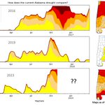
ALT This time of year Alabama and the Southeast US are susceptible to rapid intensification of dry conditions. September and October are normally our dryer months of the year, especially is we miss out on any tropical moisture. This year we rolled into our dry season already hot and dry, setting up the rapid degradation of conditions. This figure shows how the current (2023) drought compares with recent notable fall "flash droughts" of 2016 and 2019.