

VP Weather Communications & Strategy @_FNNINC Former @weatherchannel -- Opinions are my own #FSU #UHawaii #UWisc
Atlanta, GA
Joined January 2013
- Tweets3.5K
- Following1.8K
- Followers2.9K
- Likes4.2K




Matthew Sitkowski retweeted

16,000 linemen ready to roll.
Thank you to every crew preparing to restore power after Isaias, and to @FLSERT for keeping Florida ready.
Stay safe, and follow official guidance as Isaias approaches. 🌀

🚨 The State Emergency Response Team is hard at work making final preparations ahead of Hurricane #Isaias.
Our teams continue coordinating with state & local partners, staging critical resources & positioning personnel to support impacted communities.
▪️ 3 million shelf-stable meals
▪️ 1.1 million bottles of water
▪️ 30 Points of Distribution
▪️ 16,000 linemen ready to restore power to Florida communities
Florida is prepared & our teams stand ready to respond! 💪


Matthew Sitkowski retweeted

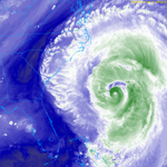
@53rdWRS Hurricane Hunters currently flying into Hurricane Lowell at 8AM HST Friday. They are getting valuable data to go into computer models and to use for the 11AM HST NHC update. Look at this track and loop right through the eye!
@weatherchannel @HurricaneLowell #Hawaii
Matthew Sitkowski retweeted

“It’s Summer, it’s Hot.” We hear ya, but this is no ordinary heat. Several all-time heat records are likely to be broken across the Eastern U.S. this weekend, with triple-digit heat up and down the East Coast. Stay hydrated, have a cooling plan and #StayCoolforthe4th

ALT A significant Heat Wave will impact the Eastern U.S. this July 4th weekend with Major-to-Extreme HeatRisk for much of the population.
Matthew Sitkowski retweeted

Director of the National Weather Service @wx4keg visited the @weatherchannel for a wide-ranging conversation with @JimCantore about the future of weather forecasting and public safety!
LISTEN to the full interview on the Weather Geeks podcast: linktr.ee/WeatherGeeks

Matthew Sitkowski retweeted

It's a bird...It's a plane...It's the Artemis II crew on their way to the moon! #ArtemisII
Matthew Sitkowski retweeted

Since January 14, 2026, total snow cover in Colorado has been at a record low in the 26-year-satellite record. Stay current on snow conditions with NSIDC's Snow Today. nsidc.org/snow-today/snow-vi…

Matthew Sitkowski retweeted

California’s snowpack is melting fast. Here’s why that matters for fire risk.
An early-season heat wave is rapidly melting snow across the Sierra Nevada weeks ahead of normal.
Right now, that snowmelt is helping keep vegetation moist. But less snow = earlier drying. Snowpack acts as a natural reservoir, slowly releasing water into spring and early summer. When it melts too quickly, grasses and brush dry out sooner.
Experts warn that early snow loss increases the chance of earlier and longer periods of fire activity, especially if warm, dry conditions continue.
What to watch for:
➤ Rapid snow loss in the Sierra
➤ Warming temperatures and wind
➤ Grasses curing earlier than normal
California sees fire year-round, but these conditions can bring peak fire activity sooner. Now is the time to get ready:
➡ Clear defensible space
➡ Harden your home
➡ Make a wildfire action plan
➡ Pack a go-bag
#CALFIRE #FireSafety #ReadySetGo #SierraNevada #Snowpack @CA_DWR
Matthew Sitkowski retweeted

Our Trenton snow observer photographed these yesterday... inverse snow tracks! The snow was walked in when it was changing to sleet (ice pellets) back on January 25th, then the footprints filled up with sleet, and now the softer snow around them is melting faster than the sleet.


Matthew Sitkowski retweeted

We're monitoring all things #Fern tonight on @weatherchannel with @mikebettes & @DrRickKnabb.
Here's a look at the last forecast state by state:


Matthew Sitkowski retweeted

This was Cornwall Regional (the hospital I was born at) in Montego Bay Jamaica earlier today
Matthew Sitkowski retweeted

Sangster International Airport, Montego Bay. Melissa was no joke. Prayers. 🙏❤️🇯🇲 #HurricaneMelissa
Matthew Sitkowski retweeted

A major hurricane is expected to form this weekend, bringing catastrophic impacts to Hispaniola and Jamaica.
@DrRickKnabb shares an urgent message for those in the path of Melissa:
Matthew Sitkowski retweeted

We are thrilled to announce that our beta experience is now available to everyone! Redesigned for every screen. The new responsive layout delivers a smooth, native-like experience—whether you’re on desktop or mobile.
beta.pivotalweather.com/


Matthew Sitkowski retweeted

The deadline to apply to our Local Science Partners is being extended! Anyone looking to develop relationships with their members of Congress in DC and help bring science policy to the forefront of policymakers' agendas, submit your application by 22 Oct: lite.spr.ly/6002zyjG

Matthew Sitkowski retweeted

2 pm EDT Wed, Sep. 24 Key Messages for disturbances (AL93 and AL94) over the western Atlantic.
Continue to monitor hurricanes.gov for the latest information on these systems.

Matthew Sitkowski retweeted

One week left to register for the 2025 Climate Policy Colloquium!
This year's CPC will be held 8–12 Dec. in Washington, D.C., and will cover a range of topics—from the CHIPS and Science Act to international science diplomacy, and more.
Apply by 15 Sept.: bit.ly/3K0cwPA

ALT Photo of 2024 CPC participants.
Matthew Sitkowski retweeted

This is it! Closest approach from #HurricaneErin to the OBX. About 200 mi offshore. NC 12 closed south of Pea Island. Waves at Oregon Inlet 15 ft. No rain here, just tropical storm force wind!
Matthew Sitkowski retweeted

Last night, the 53rd Weather Reconnaissance Squadron flew into the eye of Hurricane Erin—and captured imagery of the breathtaking stadium effect.
These missions provide critical data to the NHC to improve forecasts, helping keep communities safe before the storm makes landfall.#readynow #weatherready
Matthew Sitkowski retweeted
Hurricane Erin's Rapid Intensification of 70mph in only 15 hours!!! The definition for rapid intensification is a 35 mph increase in 24 hours. The 70 mph increase is double the MPH and in only 15 hours! If you go back to 8am Friday the increase in winds is 75 mph.
@weatherchannel #HurricaneErin