Katy Demers (@Met_katykramer) header
Katy Demers (@Met_katykramer) profile picture
Joined August 2013
Photo by Katy Demers (@Met_katykramer)Photo by Katy Demers (@Met_katykramer)Photo by Katy Demers (@Met_katykramer)Photo by Katy Demers (@Met_katykramer)Photo by Katy Demers (@Met_katykramer)Photo by Katy Demers (@Met_katykramer)Photo by Katy Demers (@Met_katykramer)Photo by Katy Demers (@Met_katykramer)Photo by Katy Demers (@Met_katykramer)Photo by Katy Demers (@Met_katykramer)
No Billy, I鈥檓 not 馃槙. My last day was two weeks ago.
Replying to @Met_katykramer
Why are you not on the morning cast anymore? We miss you.
5
1
3
.@SequoyahKTUL8 you are wonderful SQ! Thank you! It was a pleasure working with you during those very early mornings and very late nights. All the best!
3
1
6
Well this is a glorious sight! No more 1 AM alarm! #lastday
8
2
1
24
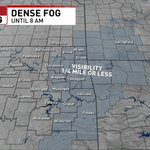
HEADS UP...looks like fog will join many for the morning commute. The advisory is in effect until 8 AM for areas east of HWY 75 but that doesn't mean fog won't develop elsewhere. Drive safely! #okwx #fog @KTULNews
1
2
1
5
Thank you Paula!!
You鈥檙e unable to view this Post because this account owner limits who can view their Posts. Learn more
2
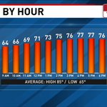
Good news is, we're warming up today! Still, a little cool for early June but with some sun today will be fairly nice. A few scat'd storms are possible. #okwx @KTULNews
1
1
3
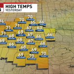
Well, the first day of Meteorological Summer certainly didn't feel like it. We officially tied the record cool high for June 1st with a high of just 69掳 in Tulsa. #okwx #recordtemps @KTULNews
1
3
Rain is on the move and beginning to fall in some of our far western counties. Expect rain to fill in over all of Green Country this #MemorialDay ...umbrellas will be needed! #okwx #kswx @KTULNews
1
1
3
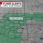
A Flood Watch is in effect for most of Green Country until Tuesday morning. Widespread 1-2" of rain are expected, with locally higher totals of 3-4" possible. #TurnAroundDontDrown
1
6
Despite the cool down, most of the weekend looks great! Lots of sun and DRY TIME!!! Don't forget the sunscreen if you heading out to Southern Hills or if you plan to be outside the next few days. A small rain chance returns Sunday. #okwx @KTULNews
1
2
That cooler trend hangs around through the holiday weekend and extends into next week! Most will run 10-15掳 below normal for late May/early June. #okwx @KTULNews
1
3
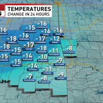
The cooler air has arrived! Big temp swing for most this Friday morning. #okwx #kswx @KTULNews
1
4
Stay weather aware and tuned into @KTULNews @DanThrelkeld & @ChrisNestmanWX for updates throughout the evenings events. #okwx
[2:29 pm - 5/27/21] Severe potential continues across NE OK with enhanced tornado potential in some areas. #okwx #arwx
1
Flash Flood Warning for Ottawa county until 5:30pm. Here's a shot taken by News Channel 8 Storm Chaser Nacoma Hutchison. Street flooding in Afton at the intersection of Walnut Ave. and 1st Street. #okwx
4
8
A Tornado Watch has been issued for much of Green Country until 7:00 PM. Stay weather aware and have ways to get weather alerts! #okwx #ktulwx
1
3
Here's a break down of how this afternoon/evening may play out. Any of these storms may produce damaging winds (60-70 mph), large hail (up to baseball size), and a few tornadoes. Stay aware of the changing conditions today! #okwx #kswx @KTULNews
2
1
3
A few storms may fire up around lunch time but the main event looks to hold off until late afternoon/evening. #okwx @KTULNews
1
3
Don't be Scared, Be Prepared!! Severe weather appears likely this afternoon/evening. Have your action plan ready to implement. #okwx #kswx @KTULNews
1
1
SEVERE WEATHER OUTLOOK: NewsChannel 8's Meteorologist @Met_katykramer has your Wednesday forecast and details on possible severe weather moving into Green Country. #okwx
1
4